![](/images/other/stat-length.png)
![Tour Wandern Plougoumelen - N.D. de Béquerel - Plougoumelen - Anse de Lann Vihan - Le Bono - Photo](https://media.geolcdn.com/t/1900/400/ext.pjpeg?maxdim=2&url=https%3A%2F%2Fstatic1.geolcdn.com%2Fsiteimages%2Fupload%2Ffiles%2F1553511878bg_sport_marche.png)
N.D. de Béquerel - Plougoumelen - Anse de Lann Vihan - Le Bono
PAM2235
Benutzer
![Länge](/images/other/stat-length.png)
Länge
10,6 km
![Maximale Höhe](https://static1.geolcdn.com/siteimages/upload/files/1508320355ic_sort_altitude_max_24dp.png)
Maximale Höhe
31 m
![Positive Höhendifferenz](https://static1.geolcdn.com/siteimages/upload/files/1508320355ic_sort_den_pos_24dp.png)
Positive Höhendifferenz
122 m
![Km-Effort](/images/other/stat-length.png)
Km-Effort
12,2 km
![Min. Höhe](https://static1.geolcdn.com/siteimages/upload/files/1508320355ic_sort_altitude_min_24dp.png)
Min. Höhe
-1 m
![Negative Höhendifferenz](https://static1.geolcdn.com/siteimages/upload/files/1508320355ic_sort_den_neg_24dp.png)
Negative Höhendifferenz
121 m
![Boucle](https://static1.geolcdn.com/siteimages/upload/files/16400158638029165_repeat_loop_refresh_sync_direction_icon.png)
Boucle
Ja
Erstellungsdatum :
2020-06-30 16:59:54.013
Letzte Änderung :
2021-10-01 17:21:34.285
![Wandern](https://static1.geolcdn.com/sitytour/trail-icons/101.png)
2h35
Schwierigkeit : Medium
![Scannen Sie diesen QR-Code, um die Tour in der SityTrail-Anwendung zu öffnen](https://capi.geolives.com/qq0zvz2zws4bq2lad0pu/sitytour/trails/2456654/qr.png?size=200)
Kostenlosegpshiking-Anwendung
Über SityTrail
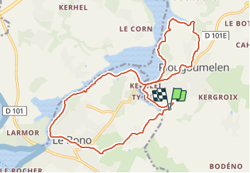
Tour Wandern von 10,6 km verfügbar auf Bretagne, Morbihan, Plougoumelen. Diese Tour wird von PAM2235 vorgeschlagen.
Beschreibung
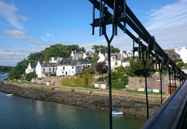
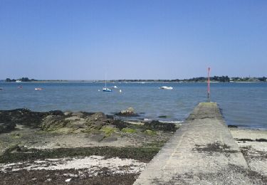
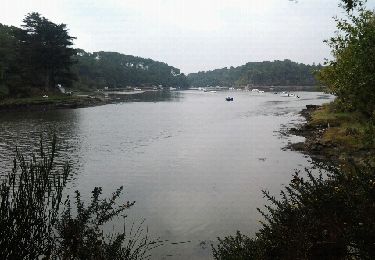
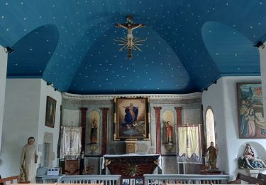
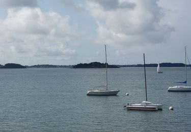
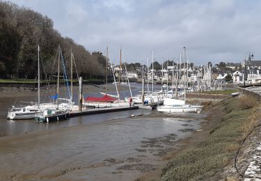
Circuit de 10,5 km au départ du parking de la chapelle Notre-Dame de Béquerel. Ce circuit permet de suivre la rive gauche de la rivière du Bono de l'anse de Lann Vihan au port du Bono et de découvrir les bourgs de Plougoumelen et du Bono.
Ort
Land:
France
Region :
Bretagne
Abteilung/Provinz :
Morbihan
Kommune :
Plougoumelen
Standort:
Unknown
Gehen Sie:(Dec)
Gehen Sie:(UTM)
505740 ; 5276866 (30T) N.
Kommentare
Touren in der Umgebung
![Tour Wandern Le Bono - Du Bono à la Chapelle de Saint-Avoye - Photo](https://media.geolcdn.com/t/375/260/ext.jpg?maxdim=2&url=https%3A%2F%2Fservices.sitytrail.com%2FGeolivesWS%2FDownloadMedia.ashx%3FTrailID%3D455675%26Media%3Dfix__20150807180035.jpg)
![Wandern Wandern](https://static1.geolcdn.com/sitytour/trail-icons/101.png)
Du Bono à la Chapelle de Saint-Avoye
Wandern
Einfach
(1)
Le Bono,
Bretagne,
Morbihan,
France
![](/images/other/stat-length.png)
8 km | 9,3 km-effort
2h 47min
![](https://static1.geolcdn.com/siteimages/upload/files/16400158638029165_repeat_loop_refresh_sync_direction_icon.png)
Ja
![Tour Wandern Baden - Ile aux Moines - Photo](https://media.geolcdn.com/t/375/260/ext.jpg?maxdim=2&url=https%3A%2F%2Fservices.sitytrail.com%2FGeolivesWS%2FDownloadMedia.ashx%3FTrailID%3D204495%26Media%3Dfix__20130708163141.jpg)
![Wandern Wandern](https://static1.geolcdn.com/sitytour/trail-icons/101.png)
Ile aux Moines
Wandern
Einfach
(1)
Baden,
Bretagne,
Morbihan,
France
![](/images/other/stat-length.png)
19,8 km | 22 km-effort
4h 53min
![](https://static1.geolcdn.com/siteimages/upload/files/16400158638029165_repeat_loop_refresh_sync_direction_icon.png)
Nein
![Tour Wandern Pluneret - st Avoye - Photo](https://media.geolcdn.com/t/375/260/ext.jpg?maxdim=2&url=https%3A%2F%2Fservices.sitytrail.com%2FGeolivesWS%2FDownloadMedia.ashx%3FTrailID%3D159588%26Media%3D20121024110349.jpeg)
![Wandern Wandern](https://static1.geolcdn.com/sitytour/trail-icons/101.png)
![Tour Wandern Ploeren - Ploeren - Photo](https://media.geolcdn.com/t/375/260/ext.jpg?maxdim=2&url=https%3A%2F%2Fstatic1.geolcdn.com%2Fsiteimages%2Fupload%2Ffiles%2F1553511878bg_sport_marche.png)
![Wandern Wandern](https://static1.geolcdn.com/sitytour/trail-icons/101.png)
Ploeren
Wandern
Sehr leicht
(1)
Ploeren,
Bretagne,
Morbihan,
France
![](/images/other/stat-length.png)
5,4 km | 6,1 km-effort
1h 27min
![](https://static1.geolcdn.com/siteimages/upload/files/16400158638029165_repeat_loop_refresh_sync_direction_icon.png)
Ja
![Tour Wandern Baden - PR_56_Baden_AB_05_Circuit4a_Anse-Du-Moustran_20240908 - Photo](https://media.geolcdn.com/t/375/260/a2cc3589-c64a-4b8b-8252-b3acfcad70d8.jpg&format=jpg&maxdim=2)
![Wandern Wandern](https://static1.geolcdn.com/sitytour/trail-icons/101.png)
PR_56_Baden_AB_05_Circuit4a_Anse-Du-Moustran_20240908
Wandern
Einfach
Baden,
Bretagne,
Morbihan,
France
![](/images/other/stat-length.png)
8,1 km | 9,3 km-effort
1h 43min
![](https://static1.geolcdn.com/siteimages/upload/files/16400158638029165_repeat_loop_refresh_sync_direction_icon.png)
Ja
![Tour Wandern Pluneret - PR_56_Pluneret_EA_06_Circuit1b_Tro-Ar-Vourch_20240227 - Photo](https://media.geolcdn.com/t/375/260/5d6bdb50-6a7c-4d72-8e80-1296b3e69841.jpg&format=jpg&maxdim=2)
![Wandern Wandern](https://static1.geolcdn.com/sitytour/trail-icons/101.png)
PR_56_Pluneret_EA_06_Circuit1b_Tro-Ar-Vourch_20240227
Wandern
Sehr leicht
Pluneret,
Bretagne,
Morbihan,
France
![](/images/other/stat-length.png)
7,3 km | 8,2 km-effort
1h 51min
![](https://static1.geolcdn.com/siteimages/upload/files/16400158638029165_repeat_loop_refresh_sync_direction_icon.png)
Ja
![Tour Wandern Plougoumelen - PR_56_Plougoumelen_CA_03_Circuit4a_Du-Boterff_20231011 - Photo](https://media.geolcdn.com/t/375/260/d3c418c5-7ec8-4dd5-81ed-a4f492fa39d3.jpg&format=jpg&maxdim=2)
![Wandern Wandern](https://static1.geolcdn.com/sitytour/trail-icons/101.png)
PR_56_Plougoumelen_CA_03_Circuit4a_Du-Boterff_20231011
Wandern
Einfach
Plougoumelen,
Bretagne,
Morbihan,
France
![](/images/other/stat-length.png)
10 km | 11,8 km-effort
2h 40min
![](https://static1.geolcdn.com/siteimages/upload/files/16400158638029165_repeat_loop_refresh_sync_direction_icon.png)
Ja
![Tour Wandern Baden - PR_56_Baden_CA_03_Circuit4a_Bois-Bourgerel_20230826 - Photo](https://media.geolcdn.com/t/375/260/de3b635d-62db-43c4-97a4-c6a0e3f84db8.jpg&format=jpg&maxdim=2)
![Wandern Wandern](https://static1.geolcdn.com/sitytour/trail-icons/101.png)
PR_56_Baden_CA_03_Circuit4a_Bois-Bourgerel_20230826
Wandern
Einfach
Baden,
Bretagne,
Morbihan,
France
![](/images/other/stat-length.png)
10,3 km | 11,8 km-effort
2h 1min
![](https://static1.geolcdn.com/siteimages/upload/files/16400158638029165_repeat_loop_refresh_sync_direction_icon.png)
Ja
![Tour Wandern Auray - port saint goustan,port bono - Photo](https://media.geolcdn.com/t/375/260/12116764-6d8c-4e87-8742-90bc6f2c0827.jpg&format=jpg&maxdim=2)
![Wandern Wandern](https://static1.geolcdn.com/sitytour/trail-icons/101.png)
port saint goustan,port bono
Wandern
Einfach
Auray,
Bretagne,
Morbihan,
France
![](/images/other/stat-length.png)
14,3 km | 16,5 km-effort
3h 17min
![](https://static1.geolcdn.com/siteimages/upload/files/16400158638029165_repeat_loop_refresh_sync_direction_icon.png)
Ja