![](/images/other/stat-length.png)
![Tour Reiten Cherier - le point du jour-la gilbernie 1 - Photo](https://media.geolcdn.com/t/1900/400/ext.pjpeg?maxdim=2&url=https%3A%2F%2Fstatic1.geolcdn.com%2Fsiteimages%2Fupload%2Ffiles%2F1524743154cheval.jpg)
le point du jour-la gilbernie 1
leoutre
Benutzer
![Länge](/images/other/stat-length.png)
Länge
29 km
![Maximale Höhe](https://static1.geolcdn.com/siteimages/upload/files/1508320355ic_sort_altitude_max_24dp.png)
Maximale Höhe
1077 m
![Positive Höhendifferenz](https://static1.geolcdn.com/siteimages/upload/files/1508320355ic_sort_den_pos_24dp.png)
Positive Höhendifferenz
860 m
![Km-Effort](/images/other/stat-length.png)
Km-Effort
41 km
![Min. Höhe](https://static1.geolcdn.com/siteimages/upload/files/1508320355ic_sort_altitude_min_24dp.png)
Min. Höhe
593 m
![Negative Höhendifferenz](https://static1.geolcdn.com/siteimages/upload/files/1508320355ic_sort_den_neg_24dp.png)
Negative Höhendifferenz
997 m
![Boucle](https://static1.geolcdn.com/siteimages/upload/files/16400158638029165_repeat_loop_refresh_sync_direction_icon.png)
Boucle
Nein
Erstellungsdatum :
2020-06-25 15:15:29.448
Letzte Änderung :
2020-06-25 15:18:25.646
![Reiten](https://static1.geolcdn.com/sitytour/trail-icons/301.png)
5h00
Schwierigkeit : Medium
![Scannen Sie diesen QR-Code, um die Tour in der SityTrail-Anwendung zu öffnen](https://capi.geolives.com/qq0zvz2zws4bq2lad0pu/sitytour/trails/2450271/qr.png?size=200)
Kostenlosegpshiking-Anwendung
Über SityTrail
Tour Reiten von 29 km verfügbar auf Auvergne-Rhone-Alpen, Loire, Cherier. Diese Tour wird von leoutre vorgeschlagen.
Beschreibung
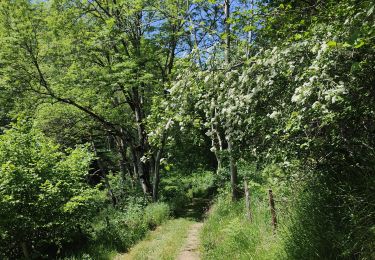
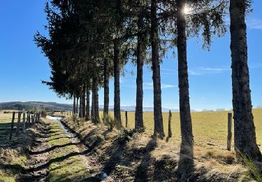
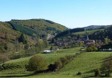
des belles perspectives.... Attention, avant la ferme de Dolle, passage embroussaillé! Je suis passée en septembre 2019, j'ai dû couper quelques branches et descendre.
Ort
Land:
France
Region :
Auvergne-Rhone-Alpen
Abteilung/Provinz :
Loire
Kommune :
Cherier
Standort:
Unknown
Gehen Sie:(Dec)
Gehen Sie:(UTM)
567872 ; 5092069 (31T) N.
Kommentare
Touren in der Umgebung
![Tour Wandern - Randonnée sur les plateaux au dessus du village de Moulins -Chérier - Photo](https://media.geolcdn.com/t/375/260/328a50ea-b5e1-4410-88c7-07bd0b3b435c.jpg&format=jpg&maxdim=2)
![Wandern Wandern](https://static1.geolcdn.com/sitytour/trail-icons/101.png)
Randonnée sur les plateaux au dessus du village de Moulins -Chérier
Wandern
Medium
,
Auvergne-Rhone-Alpen,
Loire,
France
![](/images/other/stat-length.png)
17,7 km | 25 km-effort
4h 18min
![](https://static1.geolcdn.com/siteimages/upload/files/16400158638029165_repeat_loop_refresh_sync_direction_icon.png)
Ja
![Tour Wandern Cherier - rocher de rochefort depuis la croix Trévingt - Photo](https://media.geolcdn.com/t/375/260/dcc1659c-efdc-4c94-9e85-a848a823e0bd.jpg&format=jpg&maxdim=2)
![Wandern Wandern](https://static1.geolcdn.com/sitytour/trail-icons/101.png)
rocher de rochefort depuis la croix Trévingt
Wandern
Einfach
Cherier,
Auvergne-Rhone-Alpen,
Loire,
France
![](/images/other/stat-length.png)
9,3 km | 13,4 km-effort
3h 10min
![](https://static1.geolcdn.com/siteimages/upload/files/16400158638029165_repeat_loop_refresh_sync_direction_icon.png)
Ja
![Tour Wandern Arcon - Arcon: Roche Corbière-Quatre Murs - Photo](https://media.geolcdn.com/t/375/260/f084a593-c8ab-4485-bad9-4355d9e9f1a8.jpg&format=jpg&maxdim=2)
![Wandern Wandern](https://static1.geolcdn.com/sitytour/trail-icons/101.png)
Arcon: Roche Corbière-Quatre Murs
Wandern
Schwierig
Arcon,
Auvergne-Rhone-Alpen,
Loire,
France
![](/images/other/stat-length.png)
18,2 km | 29 km-effort
6h 32min
![](https://static1.geolcdn.com/siteimages/upload/files/16400158638029165_repeat_loop_refresh_sync_direction_icon.png)
Ja
![Tour Wandern Cherier - rando à Moulin Charier - Photo](https://media.geolcdn.com/t/375/260/3886ddf7-94b0-4692-af5c-3d0753f12223.jpg&format=jpg&maxdim=2)
![Wandern Wandern](https://static1.geolcdn.com/sitytour/trail-icons/101.png)
rando à Moulin Charier
Wandern
Medium
Cherier,
Auvergne-Rhone-Alpen,
Loire,
France
![](/images/other/stat-length.png)
13,3 km | 18,6 km-effort
3h 29min
![](https://static1.geolcdn.com/siteimages/upload/files/16400158638029165_repeat_loop_refresh_sync_direction_icon.png)
Nein
![Tour Wandern Cherier - Les Moulins Chérier : entre Les Faux et Montloup - Photo](https://media.geolcdn.com/t/375/260/35e95e0f-9bf0-4632-a277-b5de924d69b4.jpg&format=jpg&maxdim=2)
![Wandern Wandern](https://static1.geolcdn.com/sitytour/trail-icons/101.png)
Les Moulins Chérier : entre Les Faux et Montloup
Wandern
Medium
Cherier,
Auvergne-Rhone-Alpen,
Loire,
France
![](/images/other/stat-length.png)
8,5 km | 10,9 km-effort
2h 30min
![](https://static1.geolcdn.com/siteimages/upload/files/16400158638029165_repeat_loop_refresh_sync_direction_icon.png)
Ja
![Tour Zu Fuß Cherier - Les Moulins Chérier - boucles autour du vieux bourg - Photo](https://media.geolcdn.com/t/375/260/02a5a11d-56eb-4a94-af63-ae9a9466184f.jpg&format=jpg&maxdim=2)
![Zu Fuß Zu Fuß](https://static1.geolcdn.com/sitytour/trail-icons/100.png)
Les Moulins Chérier - boucles autour du vieux bourg
Zu Fuß
Einfach
Cherier,
Auvergne-Rhone-Alpen,
Loire,
France
![](/images/other/stat-length.png)
8,6 km | 12,5 km-effort
2h 50min
![](https://static1.geolcdn.com/siteimages/upload/files/16400158638029165_repeat_loop_refresh_sync_direction_icon.png)
Ja
![Wandern Wandern](https://static1.geolcdn.com/sitytour/trail-icons/101.png)
Saint Alban les Eaux
Wandern
Medium
Saint-Alban-les-Eaux,
Auvergne-Rhone-Alpen,
Loire,
France
![](/images/other/stat-length.png)
13,1 km | 19,5 km-effort
3h 10min
![](https://static1.geolcdn.com/siteimages/upload/files/16400158638029165_repeat_loop_refresh_sync_direction_icon.png)
Ja
![Tour Mountainbike - VTT sportif à Moulins-Chérier - Photo](https://media.geolcdn.com/t/375/260/ext.jpg?maxdim=2&url=https%3A%2F%2Fservices.sitytrail.com%2FGeolivesWS%2FDownloadMedia.ashx%3FTrailID%3D105815%26Media%3D9743_6.jpg)
![Mountainbike Mountainbike](https://static1.geolcdn.com/sitytour/trail-icons/202.png)
VTT sportif à Moulins-Chérier
Mountainbike
Schwierig
,
Auvergne-Rhone-Alpen,
Loire,
France
![](/images/other/stat-length.png)
32 km | 46 km-effort
3h 30min
![](https://static1.geolcdn.com/siteimages/upload/files/16400158638029165_repeat_loop_refresh_sync_direction_icon.png)
Ja
![Tour Wandern - Marche des Pentes & Côtes à Moulins Cherier - Photo](https://media.geolcdn.com/t/375/260/ext.jpg?maxdim=2&url=https%3A%2F%2Fservices.sitytrail.com%2FGeolivesWS%2FDownloadMedia.ashx%3FTrailID%3D105063%26Media%3D8644_6.jpg)
![Wandern Wandern](https://static1.geolcdn.com/sitytour/trail-icons/101.png)
Marche des Pentes & Côtes à Moulins Cherier
Wandern
Schwierig
,
Auvergne-Rhone-Alpen,
Loire,
France
![](/images/other/stat-length.png)
16,6 km | 24 km-effort
4h 30min
![](https://static1.geolcdn.com/siteimages/upload/files/16400158638029165_repeat_loop_refresh_sync_direction_icon.png)
Ja