![](/images/other/stat-length.png)
![Tour Wandern Saint-Maurice-Navacelles - NAVACELLES - CIRQUE DE NAVACELLES VERSION LONGUE - 14.6Km - 05h00 - Dénivelé 400 m - Photo](https://media.geolcdn.com/t/1900/400/ext.pjpeg?maxdim=2&url=https%3A%2F%2Fstatic1.geolcdn.com%2Fsiteimages%2Fupload%2Ffiles%2F1553511878bg_sport_marche.png)
NAVACELLES - CIRQUE DE NAVACELLES VERSION LONGUE - 14.6Km - 05h00 - Dénivelé 400 m
dansmabulle
Benutzer
![Länge](/images/other/stat-length.png)
![Maximale Höhe](https://static1.geolcdn.com/siteimages/upload/files/1508320355ic_sort_altitude_max_24dp.png)
![Positive Höhendifferenz](https://static1.geolcdn.com/siteimages/upload/files/1508320355ic_sort_den_pos_24dp.png)
![Km-Effort](/images/other/stat-length.png)
![Min. Höhe](https://static1.geolcdn.com/siteimages/upload/files/1508320355ic_sort_altitude_min_24dp.png)
![Negative Höhendifferenz](https://static1.geolcdn.com/siteimages/upload/files/1508320355ic_sort_den_neg_24dp.png)
![Boucle](https://static1.geolcdn.com/siteimages/upload/files/16400158638029165_repeat_loop_refresh_sync_direction_icon.png)
![Wandern](https://static1.geolcdn.com/sitytour/trail-icons/101.png)
4h28
Schwierigkeit : Schwierig
![Scannen Sie diesen QR-Code, um die Tour in der SityTrail-Anwendung zu öffnen](https://capi.geolives.com/qq0zvz2zws4bq2lad0pu/sitytour/trails/244612/qr.png?size=200)
Kostenlosegpshiking-Anwendung
Über SityTrail
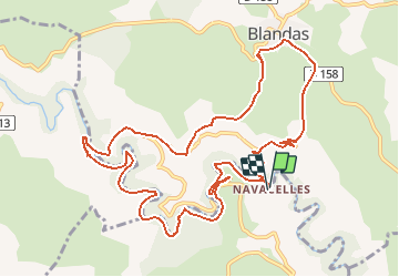
Tour Wandern von 14,6 km verfügbar auf Okzitanien, Hérault, Saint-Maurice-Navacelles. Diese Tour wird von dansmabulle vorgeschlagen.
Beschreibung
14.6Km - 05h00
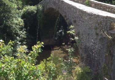
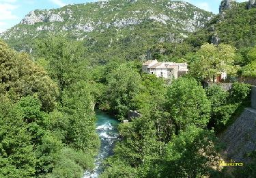
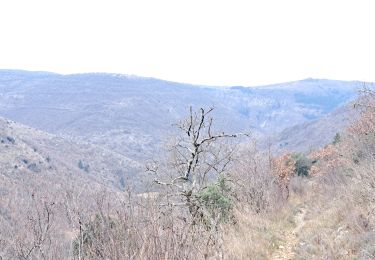
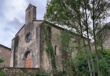
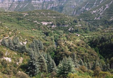
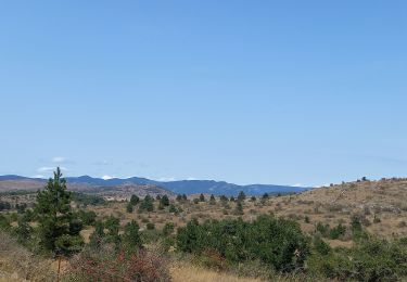
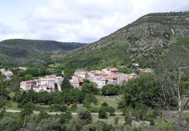
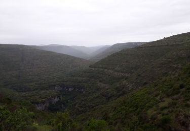
Départ randonnée : Village de Navacelles (gard) Nous aurons visité au préalable ce magnifique village avec son histoire géologique étonnante. Ce site fut crée par l'abandon d'un des méandres de la Vis qui avait creusé son lit de plus de 250 mètres dans le calcaire.Nous monterons sur le causse du Blandas par le GR 7 d'où nous aurons de magnifiques points de vue.En fonction du temps nous poursuivrons jusqu'au cromlech de Perrarinnes dont l'utilité de ces petits menhirs disposés en rond autour d'une pierre centrale il y a des milliers d'années n'est toujours pas expliquée d'aujourd'hui.Un site semblable se trouve en Irlande.Nous retournerons par les gorges de la Vis jusqu'à une de ses résurgences qui peut y être bouillonnante. Un superbe moulin hydraulique vient d'y être restauré, il fera l'émerveillement des amoureux de vieilles pierres, d'énergie gratuite, de belle architecture et d'un compagnonnage très présent à cette époque.Nous suivrons la rivière jusqu'à Navacelles. Bonne randonnée.
Ort
Kommentare
Touren in der Umgebung
![Tour Wandern Saint-Maurice-Navacelles - cirque de Navacelles - Photo](https://media.geolcdn.com/t/375/260/ext.jpg?maxdim=2&url=https%3A%2F%2Fservices.sitytrail.com%2FGeolivesWS%2FDownloadMedia.ashx%3FTrailID%3D331316%26Media%3D20140805152414.jpg)
![Wandern Wandern](https://static1.geolcdn.com/sitytour/trail-icons/101.png)
Wandern
![](/images/other/stat-length.png)
![](https://static1.geolcdn.com/siteimages/upload/files/16400158638029165_repeat_loop_refresh_sync_direction_icon.png)
![Tour Wandern Rogues - Madières - La Sauvie - Photo](https://media.geolcdn.com/t/375/260/ext.jpg?maxdim=2&url=https%3A%2F%2Fservices.sitytrail.com%2FGeolivesWS%2FDownloadMedia.ashx%3FTrailID%3D214916%26Media%3D15483_6.jpg)
![Wandern Wandern](https://static1.geolcdn.com/sitytour/trail-icons/101.png)
Wandern
![](/images/other/stat-length.png)
![](https://static1.geolcdn.com/siteimages/upload/files/16400158638029165_repeat_loop_refresh_sync_direction_icon.png)
![Tour Wandern Vissec - sentier du Regagnas - Photo](https://media.geolcdn.com/t/375/260/da6617d7-2a0d-4d03-9eaa-131f37014f58.jpg&format=jpg&maxdim=2)
![Wandern Wandern](https://static1.geolcdn.com/sitytour/trail-icons/101.png)
Wandern
![](/images/other/stat-length.png)
![](https://static1.geolcdn.com/siteimages/upload/files/16400158638029165_repeat_loop_refresh_sync_direction_icon.png)
![Tour Zu Fuß Saint-Maurice-Navacelles - Navacelles Vissec par le chemin du facteur - Photo](https://media.geolcdn.com/t/375/260/5eb51299-e303-4e2d-9d78-ac9fc254c62c.jpeg&format=jpg&maxdim=2)
![Zu Fuß Zu Fuß](https://static1.geolcdn.com/sitytour/trail-icons/100.png)
Zu Fuß
![](/images/other/stat-length.png)
![](https://static1.geolcdn.com/siteimages/upload/files/16400158638029165_repeat_loop_refresh_sync_direction_icon.png)
![Tour Zu Fuß Blandas - Randonnée Cirque de Navacelles - Causse de Blandas - Vissec - Moulin de la Foux - Photo](https://media.geolcdn.com/t/375/260/8ddb3d2c-f886-47a1-a994-79ae500f0ce8.jpeg&format=jpg&maxdim=2)
![Zu Fuß Zu Fuß](https://static1.geolcdn.com/sitytour/trail-icons/100.png)
Zu Fuß
![](/images/other/stat-length.png)
![](https://static1.geolcdn.com/siteimages/upload/files/16400158638029165_repeat_loop_refresh_sync_direction_icon.png)
![Tour Wandern Blandas - Causse de Blandas et Vallée de la Vis - Photo](https://media.geolcdn.com/t/375/260/63d6e02c-c419-4b36-9d67-d9ec414c30bc.jpg&format=jpg&maxdim=2)
![Wandern Wandern](https://static1.geolcdn.com/sitytour/trail-icons/101.png)
Wandern
![](/images/other/stat-length.png)
![](https://static1.geolcdn.com/siteimages/upload/files/16400158638029165_repeat_loop_refresh_sync_direction_icon.png)
![Tour Wandern Blandas - Vissec / Moulin de la Foux - Photo](https://media.geolcdn.com/t/375/260/10a13c13-90e1-488e-8e53-bc3d65b1bc36.jpg&format=jpg&maxdim=2)
![Wandern Wandern](https://static1.geolcdn.com/sitytour/trail-icons/101.png)
Wandern
![](/images/other/stat-length.png)
![](https://static1.geolcdn.com/siteimages/upload/files/16400158638029165_repeat_loop_refresh_sync_direction_icon.png)
![Tour Wandern Blandas - Bois de calot rouge - Photo](https://media.geolcdn.com/t/375/260/a9a713a3-ac0f-45b3-9482-9c5a24bfa783.jpg&format=jpg&maxdim=2)
![Wandern Wandern](https://static1.geolcdn.com/sitytour/trail-icons/101.png)
Wandern
![](/images/other/stat-length.png)
![](https://static1.geolcdn.com/siteimages/upload/files/16400158638029165_repeat_loop_refresh_sync_direction_icon.png)
![Tour Wandern Blandas - Sentier du Belvédère de Blandas 2 - Photo](https://media.geolcdn.com/t/375/260/ext.jpg?maxdim=2&url=https%3A%2F%2Fstatic1.geolcdn.com%2Fsiteimages%2Fupload%2Ffiles%2F1553511878bg_sport_marche.png)
![Wandern Wandern](https://static1.geolcdn.com/sitytour/trail-icons/101.png)
Wandern
![](/images/other/stat-length.png)
![](https://static1.geolcdn.com/siteimages/upload/files/16400158638029165_repeat_loop_refresh_sync_direction_icon.png)