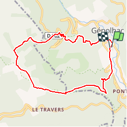
![](/images/other/stat-length.png)
![Tour Wandern Génolhac - GENOLHAC - 9.2 Km - 03h30 Heures - Dénivelé 500 m - Photo](https://media.geolcdn.com/t/1900/400/ext.pjpeg?maxdim=2&url=https%3A%2F%2Fstatic1.geolcdn.com%2Fsiteimages%2Fupload%2Ffiles%2F1553511878bg_sport_marche.png)
GENOLHAC - 9.2 Km - 03h30 Heures - Dénivelé 500 m
dansmabulle
Benutzer
![Länge](/images/other/stat-length.png)
![Maximale Höhe](https://static1.geolcdn.com/siteimages/upload/files/1508320355ic_sort_altitude_max_24dp.png)
![Positive Höhendifferenz](https://static1.geolcdn.com/siteimages/upload/files/1508320355ic_sort_den_pos_24dp.png)
![Km-Effort](/images/other/stat-length.png)
![Min. Höhe](https://static1.geolcdn.com/siteimages/upload/files/1508320355ic_sort_altitude_min_24dp.png)
![Negative Höhendifferenz](https://static1.geolcdn.com/siteimages/upload/files/1508320355ic_sort_den_neg_24dp.png)
![Boucle](https://static1.geolcdn.com/siteimages/upload/files/16400158638029165_repeat_loop_refresh_sync_direction_icon.png)
![Wandern](https://static1.geolcdn.com/sitytour/trail-icons/101.png)
3h12
Schwierigkeit : Schwierig
![Scannen Sie diesen QR-Code, um die Tour in der SityTrail-Anwendung zu öffnen](https://capi.geolives.com/qq0zvz2zws4bq2lad0pu/sitytour/trails/244398/qr.png?size=200)
Kostenlosegpshiking-Anwendung
Über SityTrail
Tour Wandern von 9,3 km verfügbar auf Okzitanien, Gard, Génolhac. Diese Tour wird von dansmabulle vorgeschlagen.
Beschreibung
GENOLHAC
9.2 Km - 03h30 Heures - Dénivelé 500 mètres
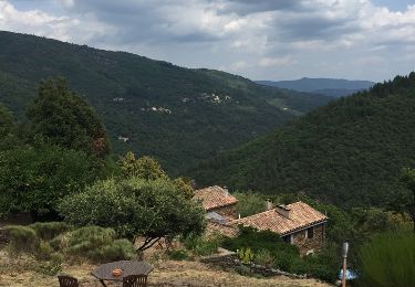
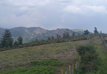
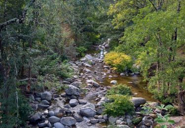
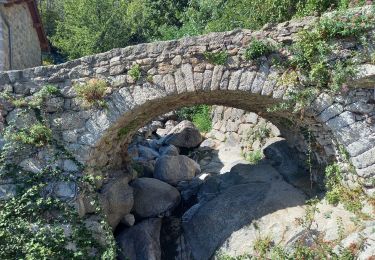
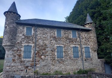
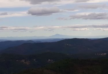
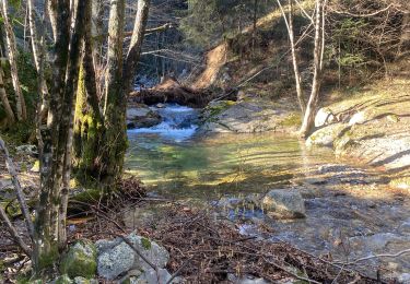
Départ randonnée : Village de Génolhac (Gard 30) Randonnée de 10km à la limite des départements du Gard et de la Lozère en partant de Génolhac par l'entrée du Parc National des Cévennes côté Est du Mont-Lozère.Bonne randonnée.
Ort
Kommentare
Touren in der Umgebung
![Tour Wandern Vialas - Sentier de l'Avès depuis le Coupétadou - Photo](https://media.geolcdn.com/t/375/260/ext.jpg?maxdim=2&url=https%3A%2F%2Fservices.sitytrail.com%2FGeolivesWS%2FDownloadMedia.ashx%3FTrailID%3D616629%26Media%3D20160818152623.jpg)
![Wandern Wandern](https://static1.geolcdn.com/sitytour/trail-icons/101.png)
Wandern
![](/images/other/stat-length.png)
![](https://static1.geolcdn.com/siteimages/upload/files/16400158638029165_repeat_loop_refresh_sync_direction_icon.png)
![Tour Wandern Aujac - GRP Haute Vallée de la Cèze - Photo](https://media.geolcdn.com/t/375/260/e3906bcb-beec-4b57-9fb9-5e3785ceb834.jpg&format=jpg&maxdim=2)
![Wandern Wandern](https://static1.geolcdn.com/sitytour/trail-icons/101.png)
Wandern
![](/images/other/stat-length.png)
![](https://static1.geolcdn.com/siteimages/upload/files/16400158638029165_repeat_loop_refresh_sync_direction_icon.png)
![Tour Wandern Ventalon en Cévennes - Sentier de l'Avès - Photo](https://media.geolcdn.com/t/375/260/bb007248-100a-4dc9-b839-07facd88bc96.jpg&format=jpg&maxdim=2)
![Wandern Wandern](https://static1.geolcdn.com/sitytour/trail-icons/101.png)
Wandern
![](/images/other/stat-length.png)
![](https://static1.geolcdn.com/siteimages/upload/files/16400158638029165_repeat_loop_refresh_sync_direction_icon.png)
![Tour Wandern Concoules - 2023-01-22_15h09m14_Cirkwi-La_Virado_del_Ronc - Photo](https://media.geolcdn.com/t/375/260/ext.jpg?maxdim=2&url=https%3A%2F%2Fstatic1.geolcdn.com%2Fsiteimages%2Fupload%2Ffiles%2F1553511878bg_sport_marche.png)
![Wandern Wandern](https://static1.geolcdn.com/sitytour/trail-icons/101.png)
Wandern
![](/images/other/stat-length.png)
![](https://static1.geolcdn.com/siteimages/upload/files/16400158638029165_repeat_loop_refresh_sync_direction_icon.png)
![Tour Wandern Génolhac - Vallée de l'Homol - Photo](https://media.geolcdn.com/t/375/260/6da51f23-b6c0-4f07-88d5-b7f87324ef05.jpg&format=jpg&maxdim=2)
![Wandern Wandern](https://static1.geolcdn.com/sitytour/trail-icons/101.png)
Wandern
![](/images/other/stat-length.png)
![](https://static1.geolcdn.com/siteimages/upload/files/16400158638029165_repeat_loop_refresh_sync_direction_icon.png)
![Tour Wandern Vialas - sud Mont Lozère de Vialas - Photo](https://media.geolcdn.com/t/375/260/f84d4d4c-c02a-465e-803e-7fcc56bba63b.jpg&format=jpg&maxdim=2)
![Wandern Wandern](https://static1.geolcdn.com/sitytour/trail-icons/101.png)
Wandern
![](/images/other/stat-length.png)
![](https://static1.geolcdn.com/siteimages/upload/files/16400158638029165_repeat_loop_refresh_sync_direction_icon.png)
![Tour Wandern Sénéchas - sentier du Quinsonnet - Photo](https://media.geolcdn.com/t/375/260/855022e7-fcee-4cf7-b53f-5174e0f3a0b4.jpg&format=jpg&maxdim=2)
![Wandern Wandern](https://static1.geolcdn.com/sitytour/trail-icons/101.png)
Wandern
![](/images/other/stat-length.png)
![](https://static1.geolcdn.com/siteimages/upload/files/16400158638029165_repeat_loop_refresh_sync_direction_icon.png)
![Tour Wandern Chamborigaud - Ronde des crêtes - Photo](https://media.geolcdn.com/t/375/260/9bff9be7-0886-4652-9ad5-0d332f7fb419.jpg&format=jpg&maxdim=2)
![Wandern Wandern](https://static1.geolcdn.com/sitytour/trail-icons/101.png)
Wandern
![](/images/other/stat-length.png)
![](https://static1.geolcdn.com/siteimages/upload/files/16400158638029165_repeat_loop_refresh_sync_direction_icon.png)
![Tour Wandern Concoules - Conclûmes - Photo](https://media.geolcdn.com/t/375/260/b2b6c430-1ec3-4149-a53f-95b8b18f710b.jpg&format=jpg&maxdim=2)
![Wandern Wandern](https://static1.geolcdn.com/sitytour/trail-icons/101.png)
Wandern
![](/images/other/stat-length.png)
![](https://static1.geolcdn.com/siteimages/upload/files/16400158638029165_repeat_loop_refresh_sync_direction_icon.png)
Rando sympa mais la trace n'est pas fidèle à la réalité du terrain.