![](/images/other/stat-length.png)
![Tour Vienne-en-Bessin - Les balcons de la Seulles - Photo](https://media.geolcdn.com/t/1900/400/ext.pjpeg?maxdim=2&url=https%3A%2F%2Fsecurestorage.geolives.com%2Fsitytour%2Ftrail-bg%2Fdefault.jpg)
Les balcons de la Seulles
aubinjoel
Benutzer
![Länge](/images/other/stat-length.png)
Länge
10,9 km
![Maximale Höhe](https://static1.geolcdn.com/siteimages/upload/files/1508320355ic_sort_altitude_max_24dp.png)
Maximale Höhe
68 m
![Positive Höhendifferenz](https://static1.geolcdn.com/siteimages/upload/files/1508320355ic_sort_den_pos_24dp.png)
Positive Höhendifferenz
76 m
![Km-Effort](/images/other/stat-length.png)
Km-Effort
11,9 km
![Min. Höhe](https://static1.geolcdn.com/siteimages/upload/files/1508320355ic_sort_altitude_min_24dp.png)
Min. Höhe
18 m
![Negative Höhendifferenz](https://static1.geolcdn.com/siteimages/upload/files/1508320355ic_sort_den_neg_24dp.png)
Negative Höhendifferenz
77 m
![Boucle](https://static1.geolcdn.com/siteimages/upload/files/16400158638029165_repeat_loop_refresh_sync_direction_icon.png)
Boucle
Ja
Erstellungsdatum :
2020-06-09 08:58:32.737
Letzte Änderung :
2020-06-09 08:59:48.416
![Scannen Sie diesen QR-Code, um die Tour in der SityTrail-Anwendung zu öffnen](https://capi.geolives.com/qq0zvz2zws4bq2lad0pu/sitytour/trails/2429760/qr.png?size=200)
Kostenlosegpshiking-Anwendung
Über SityTrail
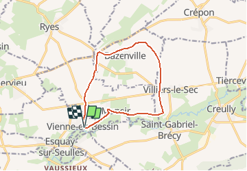
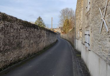
Tour von 10,9 km verfügbar auf Normandie, Calvados, Vienne-en-Bessin. Diese Tour wird von aubinjoel vorgeschlagen.
Beschreibung
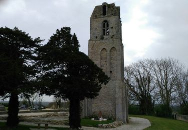
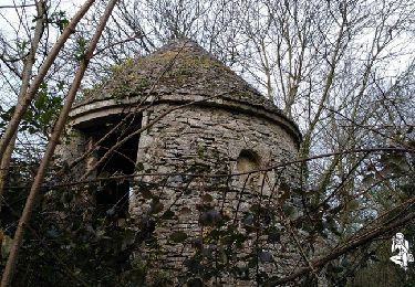
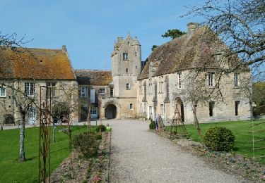
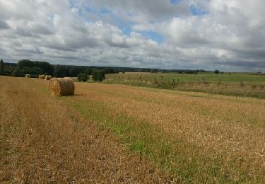
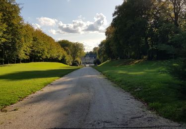
Depuis Vienne-en-Bessin, prenez de la hauteur et partez cheminer sur les chemins qui dominent la vallée de la Seulles. Vous découvrirez de beaux panoramas sur cette vallée verdoyante et de bels édifices bâtis dans les bourgs ou sur les bords de la Seulles.
Ort
Land:
France
Region :
Normandie
Abteilung/Provinz :
Calvados
Kommune :
Vienne-en-Bessin
Standort:
Unknown
Gehen Sie:(Dec)
Gehen Sie:(UTM)
673989 ; 5461189 (30U) N.
Kommentare
Touren in der Umgebung
![Tour Fahrrad Ryes - Petites routes du Bessin - Photo](https://media.geolcdn.com/t/375/260/ext.jpg?maxdim=2&url=https%3A%2F%2Fservices.sitytrail.com%2FGeolivesWS%2FDownloadMedia.ashx%3FTrailID%3D741984%26Media%3Dd424f3ff-7899-49e7-bff6-3ce0466f24fb.jpg)
![Fahrrad Fahrrad](https://static1.geolcdn.com/sitytour/trail-icons/200.png)
Petites routes du Bessin
Fahrrad
Medium
Ryes,
Normandie,
Calvados,
France
![](/images/other/stat-length.png)
64 km | 71 km-effort
4h 6min
![](https://static1.geolcdn.com/siteimages/upload/files/16400158638029165_repeat_loop_refresh_sync_direction_icon.png)
Ja
![Tour Wandern Ryes - Ryes-Bazenville-Ryes - Photo](https://media.geolcdn.com/t/375/260/ext.jpg?maxdim=2&url=https%3A%2F%2Fservices.sitytrail.com%2FGeolivesWS%2FDownloadMedia.ashx%3FTrailID%3D736315%26Media%3De11c7be8-a637-4828-bcc7-504555823948.jpg)
![Wandern Wandern](https://static1.geolcdn.com/sitytour/trail-icons/101.png)
Ryes-Bazenville-Ryes
Wandern
Einfach
Ryes,
Normandie,
Calvados,
France
![](/images/other/stat-length.png)
11,2 km | 12,6 km-effort
2h 47min
![](https://static1.geolcdn.com/siteimages/upload/files/16400158638029165_repeat_loop_refresh_sync_direction_icon.png)
Ja
![Tour Wandern Ryes - Ryes Arromanches Les Monts - Photo](https://media.geolcdn.com/t/375/260/ext.jpg?maxdim=2&url=https%3A%2F%2Fservices.sitytrail.com%2FGeolivesWS%2FDownloadMedia.ashx%3FTrailID%3D735954%26Media%3D7c0dec61-404a-4e9a-9583-28cafb5dcd89.jpg)
![Wandern Wandern](https://static1.geolcdn.com/sitytour/trail-icons/101.png)
Ryes Arromanches Les Monts
Wandern
Medium
Ryes,
Normandie,
Calvados,
France
![](/images/other/stat-length.png)
15,6 km | 18,1 km-effort
3h 58min
![](https://static1.geolcdn.com/siteimages/upload/files/16400158638029165_repeat_loop_refresh_sync_direction_icon.png)
Ja
![Tour Wandern Vienne-en-Bessin - Vienne en Bessin-St Gabriel A-R - Photo](https://media.geolcdn.com/t/375/260/ext.jpg?maxdim=2&url=https%3A%2F%2Fservices.sitytrail.com%2FGeolivesWS%2FDownloadMedia.ashx%3FTrailID%3D721258%26Media%3Dfix__20170326152950.jpg)
![Wandern Wandern](https://static1.geolcdn.com/sitytour/trail-icons/101.png)
Vienne en Bessin-St Gabriel A-R
Wandern
Sehr leicht
Vienne-en-Bessin,
Normandie,
Calvados,
France
![](/images/other/stat-length.png)
8,2 km | 9,3 km-effort
1h 48min
![](https://static1.geolcdn.com/siteimages/upload/files/16400158638029165_repeat_loop_refresh_sync_direction_icon.png)
Ja
![Tour Mountainbike Creully sur Seulles - creuilly- asnelles - Photo](https://media.geolcdn.com/t/375/260/ext.jpg?maxdim=2&url=https%3A%2F%2Fservices.sitytrail.com%2FGeolivesWS%2FDownloadMedia.ashx%3FTrailID%3D211399%26Media%3Dfix__20130809113151.jpg)
![Mountainbike Mountainbike](https://static1.geolcdn.com/sitytour/trail-icons/202.png)
creuilly- asnelles
Mountainbike
Medium
Creully sur Seulles,
Normandie,
Calvados,
France
![](/images/other/stat-length.png)
44 km | 49 km-effort
2h 42min
![](https://static1.geolcdn.com/siteimages/upload/files/16400158638029165_repeat_loop_refresh_sync_direction_icon.png)
Ja
![Tour Mountainbike Vienne-en-Bessin - Saint Gabriel /pierrepont /amblie - Photo](https://media.geolcdn.com/t/375/260/99d4d45e-373f-4d16-9281-98c4130c2152.jpg&format=jpg&maxdim=2)
![Mountainbike Mountainbike](https://static1.geolcdn.com/sitytour/trail-icons/202.png)
Saint Gabriel /pierrepont /amblie
Mountainbike
Sehr leicht
Vienne-en-Bessin,
Normandie,
Calvados,
France
![](/images/other/stat-length.png)
28 km | 31 km-effort
2h 17min
![](https://static1.geolcdn.com/siteimages/upload/files/16400158638029165_repeat_loop_refresh_sync_direction_icon.png)
Ja
![Tour Mountainbike Vienne-en-Bessin - Sainte croix, coulombs, Saint Gabriel - Photo](https://media.geolcdn.com/t/375/260/d31830e6-abfd-4312-9bd5-8385f7712b34.jpg&format=jpg&maxdim=2)
![Mountainbike Mountainbike](https://static1.geolcdn.com/sitytour/trail-icons/202.png)
Sainte croix, coulombs, Saint Gabriel
Mountainbike
Sehr leicht
Vienne-en-Bessin,
Normandie,
Calvados,
France
![](/images/other/stat-length.png)
24 km | 27 km-effort
1h 41min
![](https://static1.geolcdn.com/siteimages/upload/files/16400158638029165_repeat_loop_refresh_sync_direction_icon.png)
Ja
![Tour Fahrrad Ryes - Nord Ouest Ryes - Photo](https://media.geolcdn.com/t/375/260/ext.jpg?maxdim=2&url=https%3A%2F%2Fservices.sitytrail.com%2FGeolivesWS%2FDownloadMedia.ashx%3FTrailID%3D718019%26Media%3Dfix__20170321152201.jpg)
![Fahrrad Fahrrad](https://static1.geolcdn.com/sitytour/trail-icons/200.png)
![Tour Mountainbike Vienne-en-Bessin - balade ver sur mer - Photo](https://media.geolcdn.com/t/375/260/ad267704-0712-4bad-b90c-279d4da85a8b.jpg&format=jpg&maxdim=2)
![Mountainbike Mountainbike](https://static1.geolcdn.com/sitytour/trail-icons/202.png)
balade ver sur mer
Mountainbike
Medium
Vienne-en-Bessin,
Normandie,
Calvados,
France
![](/images/other/stat-length.png)
23 km | 25 km-effort
1h 44min
![](https://static1.geolcdn.com/siteimages/upload/files/16400158638029165_repeat_loop_refresh_sync_direction_icon.png)
Nein