![](/images/other/stat-length.png)
![Tour Wandern Baignes - « Les évêques » depuis baignes jusqu à mont le bernois - Photo](https://media.geolcdn.com/t/1900/400/9cb4026b-5e22-4065-b0b9-09a83fd6d98a.jpg&format=pjpeg&maxdim=2)
« Les évêques » depuis baignes jusqu à mont le bernois
nicolasdresse
Benutzer
![Länge](/images/other/stat-length.png)
Länge
9,7 km
![Maximale Höhe](https://static1.geolcdn.com/siteimages/upload/files/1508320355ic_sort_altitude_max_24dp.png)
Maximale Höhe
414 m
![Positive Höhendifferenz](https://static1.geolcdn.com/siteimages/upload/files/1508320355ic_sort_den_pos_24dp.png)
Positive Höhendifferenz
230 m
![Km-Effort](/images/other/stat-length.png)
Km-Effort
12,8 km
![Min. Höhe](https://static1.geolcdn.com/siteimages/upload/files/1508320355ic_sort_altitude_min_24dp.png)
Min. Höhe
219 m
![Negative Höhendifferenz](https://static1.geolcdn.com/siteimages/upload/files/1508320355ic_sort_den_neg_24dp.png)
Negative Höhendifferenz
227 m
![Boucle](https://static1.geolcdn.com/siteimages/upload/files/16400158638029165_repeat_loop_refresh_sync_direction_icon.png)
Boucle
Ja
Erstellungsdatum :
2020-06-07 14:24:00.0
Letzte Änderung :
2020-06-08 06:31:51.855
![Wandern](https://static1.geolcdn.com/sitytour/trail-icons/101.png)
3h07
Schwierigkeit : Unbekannt
![Scannen Sie diesen QR-Code, um die Tour in der SityTrail-Anwendung zu öffnen](https://capi.geolives.com/qq0zvz2zws4bq2lad0pu/sitytour/trails/2428220/qr.png?size=200)
Kostenlosegpshiking-Anwendung
Über SityTrail
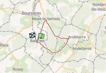
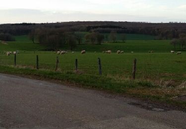
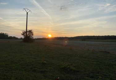
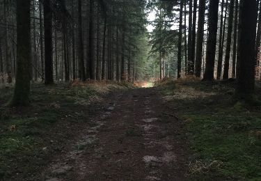
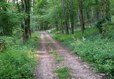
Tour Wandern von 9,7 km verfügbar auf Burgund und Freigrafschaft, Haute-Saône, Baignes. Diese Tour wird von nicolasdresse vorgeschlagen.
Beschreibung
Des forges de baignes jusqu à la superbe maison autonome des évêques ( coup de chapeau à son propriétaire) andelarre, mont le vernois et retour sur baignes.
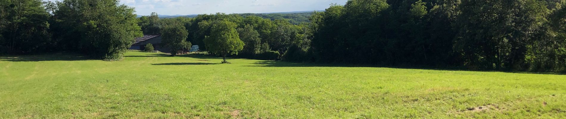
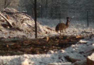
Belle randonnée en famille
Ort
Land:
France
Region :
Burgund und Freigrafschaft
Abteilung/Provinz :
Haute-Saône
Kommune :
Baignes
Standort:
Unknown
Gehen Sie:(Dec)
Gehen Sie:(UTM)
278206 ; 5274445 (32T) N.
Kommentare
Touren in der Umgebung
![Tour Wandern Rosey - Rosey Baigne 2020-01-04 CAF - Photo](https://media.geolcdn.com/t/375/260/46db9feb-593b-402b-8771-bfd7a10d57d1.jpg&format=jpg&maxdim=2)
![Wandern Wandern](https://static1.geolcdn.com/sitytour/trail-icons/101.png)
Rosey Baigne 2020-01-04 CAF
Wandern
Medium
Rosey,
Burgund und Freigrafschaft,
Haute-Saône,
France
![](/images/other/stat-length.png)
15,6 km | 21 km-effort
3h 26min
![](https://static1.geolcdn.com/siteimages/upload/files/16400158638029165_repeat_loop_refresh_sync_direction_icon.png)
Ja
![Tour Wandern Velleguindry-et-Levrecey - velguindry et levrecey - Photo](https://media.geolcdn.com/t/375/260/ext.jpg?maxdim=2&url=https%3A%2F%2Fservices.sitytrail.com%2FGeolivesWS%2FDownloadMedia.ashx%3FTrailID%3D259788%26Media%3Dfix__20140323182933.jpg)
![Wandern Wandern](https://static1.geolcdn.com/sitytour/trail-icons/101.png)
velguindry et levrecey
Wandern
Medium
Velleguindry-et-Levrecey,
Burgund und Freigrafschaft,
Haute-Saône,
France
![](/images/other/stat-length.png)
5,2 km | 6,5 km-effort
1h 25min
![](https://static1.geolcdn.com/siteimages/upload/files/16400158638029165_repeat_loop_refresh_sync_direction_icon.png)
Ja
![Tour Wandern Velleguindry-et-Levrecey - De velleguindry à levrecey - Photo](https://media.geolcdn.com/t/375/260/c2c324bd-877b-46a2-817b-43947960b4d3.jpg&format=jpg&maxdim=2)
![Wandern Wandern](https://static1.geolcdn.com/sitytour/trail-icons/101.png)
De velleguindry à levrecey
Wandern
Einfach
Velleguindry-et-Levrecey,
Burgund und Freigrafschaft,
Haute-Saône,
France
![](/images/other/stat-length.png)
4,9 km | 6,2 km-effort
1h 19min
![](https://static1.geolcdn.com/siteimages/upload/files/16400158638029165_repeat_loop_refresh_sync_direction_icon.png)
Ja
![Tour Andere Aktivitäten Andelarre - combe Sautot - Photo](https://media.geolcdn.com/t/375/260/ext.jpg?maxdim=2&url=https%3A%2F%2Fservices.sitytrail.com%2FGeolivesWS%2FDownloadMedia.ashx%3FTrailID%3D525588%26Media%3D20160214174712.jpg)
![Andere Aktivitäten Andere Aktivitäten](https://static1.geolcdn.com/sitytour/trail-icons/900.png)
combe Sautot
Andere Aktivitäten
Sehr leicht
Andelarre,
Burgund und Freigrafschaft,
Haute-Saône,
France
![](/images/other/stat-length.png)
4,8 km | 7,5 km-effort
1h 21min
![](https://static1.geolcdn.com/siteimages/upload/files/16400158638029165_repeat_loop_refresh_sync_direction_icon.png)
Nein
![Tour Wandern Andelarrot - la craye - Photo](https://media.geolcdn.com/t/375/260/ext.jpg?maxdim=2&url=https%3A%2F%2Fservices.sitytrail.com%2FGeolivesWS%2FDownloadMedia.ashx%3FTrailID%3D303008%26Media%3Dfix__20140518185033.jpg)
![Wandern Wandern](https://static1.geolcdn.com/sitytour/trail-icons/101.png)
la craye
Wandern
Einfach
Andelarrot,
Burgund und Freigrafschaft,
Haute-Saône,
France
![](/images/other/stat-length.png)
4,3 km | 6,8 km-effort
1h 16min
![](https://static1.geolcdn.com/siteimages/upload/files/16400158638029165_repeat_loop_refresh_sync_direction_icon.png)
Ja
![Tour Wandern Vaivre-et-Montoille - Vaivre Charrier - Photo](https://media.geolcdn.com/t/375/260/ext.jpg?maxdim=2&url=https%3A%2F%2Fstatic1.geolcdn.com%2Fsiteimages%2Fupload%2Ffiles%2F1553511878bg_sport_marche.png)
![Wandern Wandern](https://static1.geolcdn.com/sitytour/trail-icons/101.png)
Vaivre Charrier
Wandern
Schwierig
Vaivre-et-Montoille,
Burgund und Freigrafschaft,
Haute-Saône,
France
![](/images/other/stat-length.png)
9,7 km | 13,4 km-effort
5h 2min
![](https://static1.geolcdn.com/siteimages/upload/files/16400158638029165_repeat_loop_refresh_sync_direction_icon.png)
Ja
![Tour Wandern Mont-le-Vernois - Mont le Vernois-andelarre - Photo](https://media.geolcdn.com/t/375/260/ext.jpg?maxdim=2&url=https%3A%2F%2Fstatic1.geolcdn.com%2Fsiteimages%2Fupload%2Ffiles%2F1553511878bg_sport_marche.png)
![Wandern Wandern](https://static1.geolcdn.com/sitytour/trail-icons/101.png)
Mont le Vernois-andelarre
Wandern
Medium
Mont-le-Vernois,
Burgund und Freigrafschaft,
Haute-Saône,
France
![](/images/other/stat-length.png)
6 km | 8 km-effort
1h 58min
![](https://static1.geolcdn.com/siteimages/upload/files/16400158638029165_repeat_loop_refresh_sync_direction_icon.png)
Ja
![Tour Zu Fuß Boursières - boursiere - Photo](https://media.geolcdn.com/t/375/260/ext.jpg?maxdim=2&url=https%3A%2F%2Fstatic1.geolcdn.com%2Fsiteimages%2Fupload%2Ffiles%2F1545311037marcheuse_200dpi.jpg)
![Zu Fuß Zu Fuß](https://static1.geolcdn.com/sitytour/trail-icons/100.png)
boursiere
Zu Fuß
Einfach
Boursières,
Burgund und Freigrafschaft,
Haute-Saône,
France
![](/images/other/stat-length.png)
7,7 km | 9 km-effort
2h 3min
![](https://static1.geolcdn.com/siteimages/upload/files/16400158638029165_repeat_loop_refresh_sync_direction_icon.png)
Ja
![Tour Wandern Andelarre - ANDELARRE -Mont le vernois- Trou de Jean le fou - Photo](https://media.geolcdn.com/t/375/260/ext.jpg?maxdim=2&url=https%3A%2F%2Fstatic1.geolcdn.com%2Fsiteimages%2Fupload%2Ffiles%2F1553511878bg_sport_marche.png)
![Wandern Wandern](https://static1.geolcdn.com/sitytour/trail-icons/101.png)
ANDELARRE -Mont le vernois- Trou de Jean le fou
Wandern
Medium
Andelarre,
Burgund und Freigrafschaft,
Haute-Saône,
France
![](/images/other/stat-length.png)
5,5 km | 7,4 km-effort
1h 39min
![](https://static1.geolcdn.com/siteimages/upload/files/16400158638029165_repeat_loop_refresh_sync_direction_icon.png)
Ja