


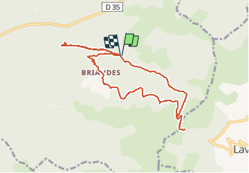

9,3 km | 12,4 km-effort


Benutzer


Kostenlosegpshiking-Anwendung
 SityTrail
IGN / Geografische Institute
SityTrail World
Die Welt öffnet sich für Sie
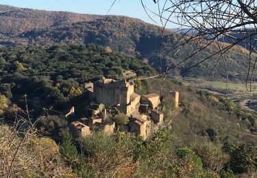
Tour Wandern von 10,8 km verfügbar auf Okzitanien, Hérault, Lunas. Diese Tour wird von coulombf vorgeschlagen.
06/06/2020 Reconnaissance avec Jacques et Nicole Brivet, Brigitte Fleury, Lyane Bergerioux.
Démarrer la marche devant l'église (possibilité de garer de nombreux véhicules)

Nordic Walking

Nordic Walking
Wandern

Wandern
Wandern
Wandern
Nordic Walking
Wandern