![](/images/other/stat-length.png)
![Tour Wandern Saint-Quentin-sur-Isère - st Quentin montaud boucle - Photo](https://media.geolcdn.com/t/1900/400/0aa42cac-7efa-41f8-ab64-12fb04627411.jpg&format=pjpeg&maxdim=2)
st Quentin montaud boucle
floup6138
Benutzer
![Länge](/images/other/stat-length.png)
![Maximale Höhe](https://static1.geolcdn.com/siteimages/upload/files/1508320355ic_sort_altitude_max_24dp.png)
![Positive Höhendifferenz](https://static1.geolcdn.com/siteimages/upload/files/1508320355ic_sort_den_pos_24dp.png)
![Km-Effort](/images/other/stat-length.png)
![Min. Höhe](https://static1.geolcdn.com/siteimages/upload/files/1508320355ic_sort_altitude_min_24dp.png)
![Negative Höhendifferenz](https://static1.geolcdn.com/siteimages/upload/files/1508320355ic_sort_den_neg_24dp.png)
![Boucle](https://static1.geolcdn.com/siteimages/upload/files/16400158638029165_repeat_loop_refresh_sync_direction_icon.png)
![Wandern](https://static1.geolcdn.com/sitytour/trail-icons/101.png)
2h58
Schwierigkeit : Medium
![Scannen Sie diesen QR-Code, um die Tour in der SityTrail-Anwendung zu öffnen](https://capi.geolives.com/qq0zvz2zws4bq2lad0pu/sitytour/trails/2417590/qr.png?size=200)
Kostenlosegpshiking-Anwendung
Über SityTrail
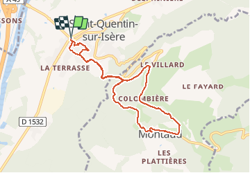
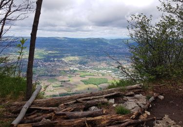
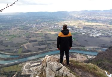
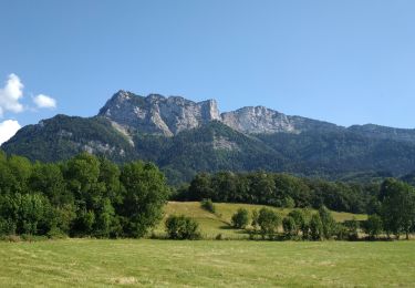
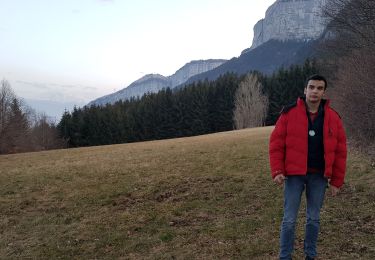
Tour Wandern von 8,9 km verfügbar auf Auvergne-Rhone-Alpen, Isère, Saint-Quentin-sur-Isère. Diese Tour wird von floup6138 vorgeschlagen.
Beschreibung
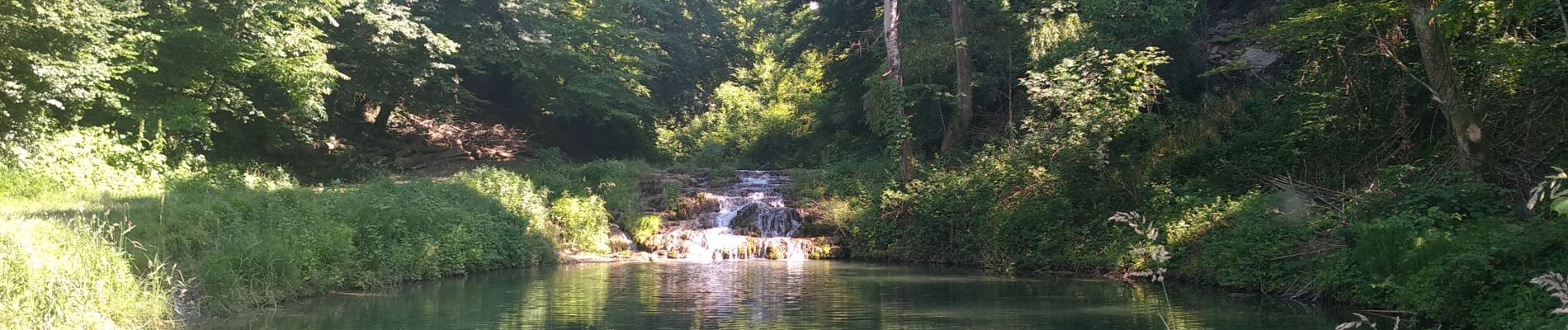
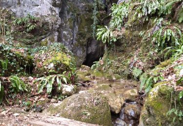
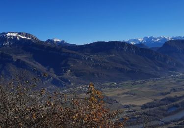
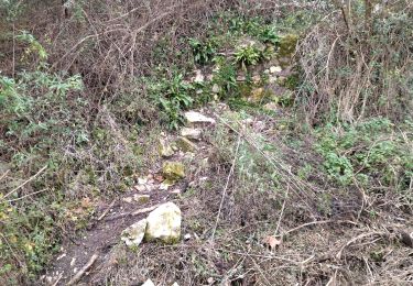
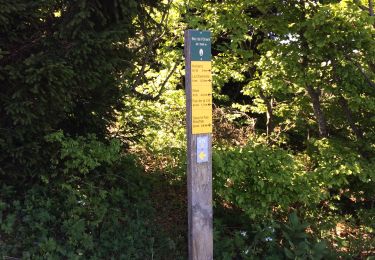
Circuit assez bien balisé en grande patie abrité du soleil. des fortes pentes à l'aller et retour, prudence à la descente, cailloux pouvant rouler sous les pieds. La première partie de la descente arrivé à MONTAUD se fait sur la route mais quelques beaux paysages.
Pas de danger mais pente moyenne importante
Ort
Kommentare
Touren in der Umgebung
![Tour Wandern Saint-Quentin-sur-Isère - 38 St Quentin sur isere - Photo](https://media.geolcdn.com/t/375/260/a8213203-4838-4b30-a9a1-6f63f9fa0c7f.jpg&format=jpg&maxdim=2)
![Wandern Wandern](https://static1.geolcdn.com/sitytour/trail-icons/101.png)
Wandern
![](/images/other/stat-length.png)
![](https://static1.geolcdn.com/siteimages/upload/files/16400158638029165_repeat_loop_refresh_sync_direction_icon.png)
![Tour Wandern Saint-Quentin-sur-Isère - Dent de Moirans - Photo](https://media.geolcdn.com/t/375/260/cc5b3296-26ad-4d08-b80e-e1eedf7283f6.jpg&format=jpg&maxdim=2)
![Wandern Wandern](https://static1.geolcdn.com/sitytour/trail-icons/101.png)
Wandern
![](/images/other/stat-length.png)
![](https://static1.geolcdn.com/siteimages/upload/files/16400158638029165_repeat_loop_refresh_sync_direction_icon.png)
![Tour Wandern Saint-Quentin-sur-Isère - 38 carrières echaillon - Photo](https://media.geolcdn.com/t/375/260/728d4589-2ee2-49ea-a83d-3257b1bf0904.jpg&format=jpg&maxdim=2)
![Wandern Wandern](https://static1.geolcdn.com/sitytour/trail-icons/101.png)
Wandern
![](/images/other/stat-length.png)
![](https://static1.geolcdn.com/siteimages/upload/files/16400158638029165_repeat_loop_refresh_sync_direction_icon.png)
![Tour Wandern Tullins - Clos des Chartreux Parmenie 2 - Photo](https://media.geolcdn.com/t/375/260/3e5993b5-a74b-4c7a-a6d9-a420eaf80d04.jpg&format=jpg&maxdim=2)
![Wandern Wandern](https://static1.geolcdn.com/sitytour/trail-icons/101.png)
Wandern
![](/images/other/stat-length.png)
![](https://static1.geolcdn.com/siteimages/upload/files/16400158638029165_repeat_loop_refresh_sync_direction_icon.png)
![Tour Wandern Montaud - La Dent de Moirans - Photo](https://media.geolcdn.com/t/375/260/42159542-0525-485e-906a-e99c0c2c152d.jpg&format=jpg&maxdim=2)
![Wandern Wandern](https://static1.geolcdn.com/sitytour/trail-icons/101.png)
Wandern
![](/images/other/stat-length.png)
![](https://static1.geolcdn.com/siteimages/upload/files/16400158638029165_repeat_loop_refresh_sync_direction_icon.png)
![Tour Wandern Montaud - La dent de Moirans - Photo](https://media.geolcdn.com/t/375/260/c31d5ba7-98c1-4d2c-8f51-1281362b0eb5.jpg&format=jpg&maxdim=2)
![Wandern Wandern](https://static1.geolcdn.com/sitytour/trail-icons/101.png)
Wandern
![](/images/other/stat-length.png)
![](https://static1.geolcdn.com/siteimages/upload/files/16400158638029165_repeat_loop_refresh_sync_direction_icon.png)
![Tour Wandern Montaud - BOUCLE MONTAUD DE T DE MOIRANS - Photo](https://media.geolcdn.com/t/375/260/e130ea2b-4587-4c00-ae7c-a57eb66385d6.jpg&format=jpg&maxdim=2)
![Wandern Wandern](https://static1.geolcdn.com/sitytour/trail-icons/101.png)
Wandern
![](/images/other/stat-length.png)
![](https://static1.geolcdn.com/siteimages/upload/files/16400158638029165_repeat_loop_refresh_sync_direction_icon.png)
![Tour Wandern Noyarey - Ezy Montaud par les chemins communaux - Photo](https://media.geolcdn.com/t/375/260/0cea62fe-ffe7-4b76-832e-d8e78db74c24.jpg&format=jpg&maxdim=2)
![Wandern Wandern](https://static1.geolcdn.com/sitytour/trail-icons/101.png)
Wandern
![](/images/other/stat-length.png)
![](https://static1.geolcdn.com/siteimages/upload/files/16400158638029165_repeat_loop_refresh_sync_direction_icon.png)
![Tour Wandern Montaud - Pas Brochier - Photo](https://media.geolcdn.com/t/375/260/4a42f92b-3781-4449-8214-42e3d818bec3.jpg&format=jpg&maxdim=2)
![Wandern Wandern](https://static1.geolcdn.com/sitytour/trail-icons/101.png)
Wandern
![](/images/other/stat-length.png)
![](https://static1.geolcdn.com/siteimages/upload/files/16400158638029165_repeat_loop_refresh_sync_direction_icon.png)