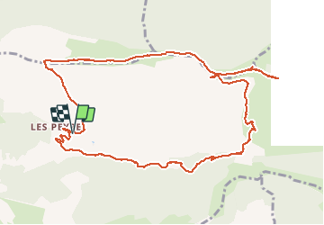
Tour Wandern Éourres - EOURRES , les Diamas , certes de Chanteduc , col de Branche , col de Garasse  , col  St Pierre o - Photo

EOURRES , les Diamas , certes de Chanteduc , col de Branche , col de Garasse , col St Pierre o

 RobinMicheline
RobinMicheline

Benutzer

© OpenStreetMap contributors
Länge
Länge
13,4 km
Maximale Höhe
Maximale Höhe
1548 m
Positive Höhendifferenz
624 m
Km-Effort
Km-Effort  
22 km
Min. Höhe
Min. Höhe
964 m
Negative Höhendifferenz
624 m
Boucle
Boucle
Ja
Erstellungsdatum :
2020-05-21 07:13:50.782
Letzte Änderung :
2020-05-21 18:11:07.275

(0 Nachricht)

Wandern
Wandern
4h13
Schwierigkeit : Medium

Scannen Sie diesen QR-Code, um die Tour in der SityTrail-Anwendung zu öffnen

Kostenlosegpshiking-Anwendung

Logo SityTrail SityTrail

IGN / Geografische Institute

SityTrail aus dem App Store herunterladen SityTrail von Google Play herunterladen

Logo SityTrail SityTrail World

Die Welt öffnet sich für Sie

SityTrail aus dem App Store herunterladen SityTrail von Google Play herunterladen SityTrail auf Huawei AppGallery herunterladen

Über SityTrail

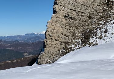
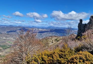
Tour Wandern von 13,4 km verfügbar auf Provence-Alpes-Côte d'Azur, Hochalpen, Éourres. Diese Tour wird von RobinMicheline vorgeschlagen.

Beschreibung

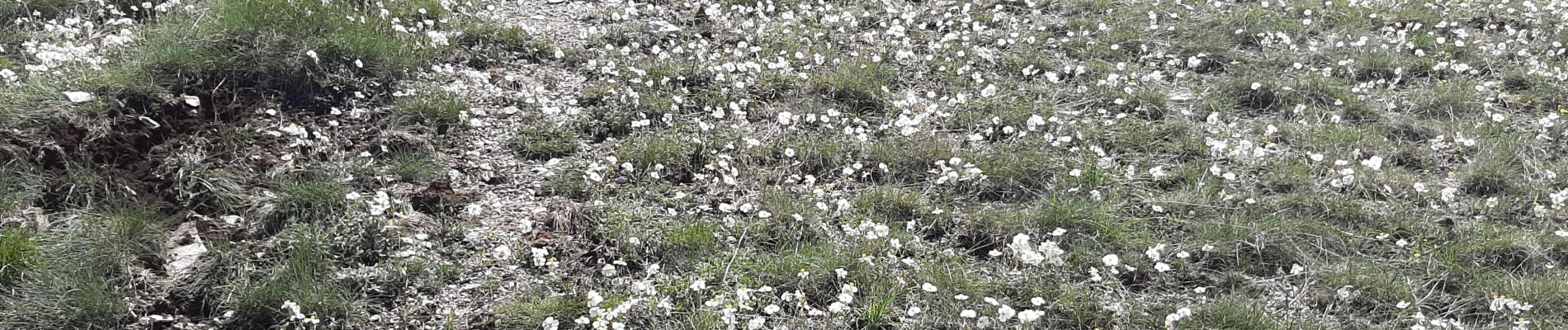
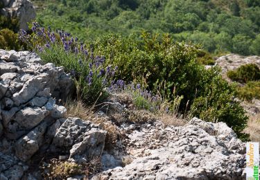
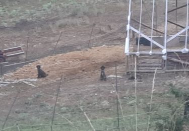
Belle rando , lauriges  , chamois , fleurs , GR sympa

Höhenprofil

Foto-Galerie

Ort

Land:
France
Region :
Provence-Alpes-Côte d'Azur
Abteilung/Provinz :
Hochalpen
Kommune :
Éourres
Standort:
Unknown
Gehen Sie:(UTM)
717217 ; 4899402 (31T) N.

Touren in der Umgebung

Tour Wandern Saint-Vincent-sur-Jabron - Traversée de la Montagne de Mare depuis Aubard - Photo
Wandern
tracegps

Wandern

Einfach
(1)
Saint-Vincent-sur-Jabron, Provence-Alpes-Côte d'Azur, Alpes-de-Haute-Provence, France
13,3 km | 23 km-effort
5h 45min
Ja
Tour Wandern Éourres - mare et pied du mulet - Photo
Wandern
y39c43l

Wandern

Einfach
(1)
Éourres, Provence-Alpes-Côte d'Azur, Hochalpen, France
12,2 km | 23 km-effort
5h 47min
Nein
Tour Wandern Saint-Vincent-sur-Jabron - Crête Montagne de Mare Via St Vincent sur Jabron - Photo
Wandern
PapouBertrand

Wandern

Sehr schwierig
Saint-Vincent-sur-Jabron, Provence-Alpes-Côte d'Azur, Alpes-de-Haute-Provence, France
14,8 km | 25 km-effort
5h 44min
Ja
Tour Wandern Saint-Vincent-sur-Jabron - SAINT VINCENT DU JABRON.  Aubard,  col de Verdun , le pied du mulet o l m s  - Photo
Wandern
RobinMicheline

Wandern

Medium
Saint-Vincent-sur-Jabron, Provence-Alpes-Côte d'Azur, Alpes-de-Haute-Provence, France
13,3 km | 23 km-effort
3h 48min
Ja
Tour Wandern Éourres - EOURRES.  Les Damias , col S Pierre , col de Branche , crête de Chanteduc , o l m s - Photo
Wandern
RobinMicheline

Wandern

Einfach
Éourres, Provence-Alpes-Côte d'Azur, Hochalpen, France
10 km | 17,9 km-effort
3h 3min
Ja
Tour Wandern Saint-Vincent-sur-Jabron - SAINT VINCENT SUR JABRON. Pas de Parandier  ,montagne S Michel o n - Photo
Wandern
RobinMicheline

Wandern

Medium
Saint-Vincent-sur-Jabron, Provence-Alpes-Côte d'Azur, Alpes-de-Haute-Provence, France
14,4 km | 23 km-effort
4h 13min
Ja
Tour Laufen Curel - Les Chaux - Curel  - Photo
Laufen
tracegps

Laufen

Schwierig
Curel, Provence-Alpes-Côte d'Azur, Alpes-de-Haute-Provence, France
8,5 km | 16,2 km-effort
1h 21min
Ja
Tour Wandern Curel - Les Chaux - Curel  - Photo
Wandern
tracegps

Wandern

Medium
Curel, Provence-Alpes-Côte d'Azur, Alpes-de-Haute-Provence, France
8,5 km | 16,2 km-effort
2h 30min
Ja
Tour Wandern Éourres - La Montagne de Mare et le Pied du Mulet - Eourres - Photo
Wandern
tracegps

Wandern

Schwierig
Éourres, Provence-Alpes-Côte d'Azur, Hochalpen, France
14,8 km | 27 km-effort
6h 30min
Ja


Schließen
Meine Abonnements