![](/images/other/stat-length.png)
![Tour Wandern Plédran - Tour du bourg de Pledran. circuit 1. - Photo](https://media.geolcdn.com/t/1900/400/ext.pjpeg?maxdim=2&url=https%3A%2F%2Fstatic1.geolcdn.com%2Fsiteimages%2Fupload%2Ffiles%2F1553511878bg_sport_marche.png)
Tour du bourg de Pledran. circuit 1.
Alphe
Benutzer
![Länge](/images/other/stat-length.png)
Länge
6,9 km
![Maximale Höhe](https://static1.geolcdn.com/siteimages/upload/files/1508320355ic_sort_altitude_max_24dp.png)
Maximale Höhe
169 m
![Positive Höhendifferenz](https://static1.geolcdn.com/siteimages/upload/files/1508320355ic_sort_den_pos_24dp.png)
Positive Höhendifferenz
73 m
![Km-Effort](/images/other/stat-length.png)
Km-Effort
7,9 km
![Min. Höhe](https://static1.geolcdn.com/siteimages/upload/files/1508320355ic_sort_altitude_min_24dp.png)
Min. Höhe
124 m
![Negative Höhendifferenz](https://static1.geolcdn.com/siteimages/upload/files/1508320355ic_sort_den_neg_24dp.png)
Negative Höhendifferenz
75 m
![Boucle](https://static1.geolcdn.com/siteimages/upload/files/16400158638029165_repeat_loop_refresh_sync_direction_icon.png)
Boucle
Ja
Erstellungsdatum :
2020-05-01 14:05:47.77
Letzte Änderung :
2020-05-01 16:07:56.42
![Wandern](https://static1.geolcdn.com/sitytour/trail-icons/101.png)
1h38
Schwierigkeit : Sehr leicht
![Scannen Sie diesen QR-Code, um die Tour in der SityTrail-Anwendung zu öffnen](https://capi.geolives.com/qq0zvz2zws4bq2lad0pu/sitytour/trails/2388821/qr.png?size=200)
Kostenlosegpshiking-Anwendung
Über SityTrail
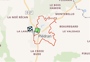
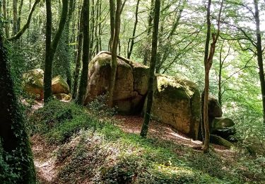
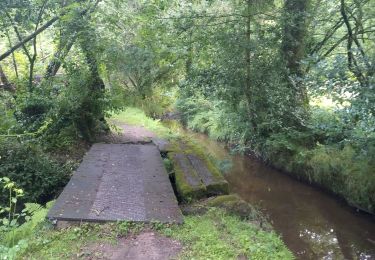
Tour Wandern von 6,9 km verfügbar auf Bretagne, Côtes-d'Armor, Plédran. Diese Tour wird von Alphe vorgeschlagen.
Beschreibung
Rue du Challenge, le bourg, la Belle issue, le Tertre du bourg,la Motte, rue du Val, Carbloux, le Pesle Châtel, Villeneuve, rue du Haut Chemin , le Challenge.
Ort
Land:
France
Region :
Bretagne
Abteilung/Provinz :
Côtes-d'Armor
Kommune :
Plédran
Standort:
Unknown
Gehen Sie:(Dec)
Gehen Sie:(UTM)
518525 ; 5365626 (30U) N.
Kommentare
Touren in der Umgebung
![Tour Wandern Plédran - En suivant l'URNE et en passant par le BOIS. - Photo](https://media.geolcdn.com/t/375/260/6ac5e845-12d0-4dac-9210-e8525380a84b.jpg&format=jpg&maxdim=2)
![Wandern Wandern](https://static1.geolcdn.com/sitytour/trail-icons/101.png)
En suivant l'URNE et en passant par le BOIS.
Wandern
Medium
(1)
Plédran,
Bretagne,
Côtes-d'Armor,
France
![](/images/other/stat-length.png)
15,2 km | 18 km-effort
2h 16min
![](https://static1.geolcdn.com/siteimages/upload/files/16400158638029165_repeat_loop_refresh_sync_direction_icon.png)
Ja
![Tour Radtourismus Saint-Carreuc - 4 étapes en Bretagne à vélo - Photo](https://media.geolcdn.com/t/375/260/b73d1ea1-a210-439a-a2e4-05e8d782bfa8.jpg&format=jpg&maxdim=2)
![Radtourismus Radtourismus](https://static1.geolcdn.com/sitytour/trail-icons/204.png)
4 étapes en Bretagne à vélo
Radtourismus
Medium
Saint-Carreuc,
Bretagne,
Côtes-d'Armor,
France
![](/images/other/stat-length.png)
172 km | 200 km-effort
16h 10min
![](https://static1.geolcdn.com/siteimages/upload/files/16400158638029165_repeat_loop_refresh_sync_direction_icon.png)
Nein
![Tour Wandern Plaintel - Au bois des Mauriers. N 2 - Photo](https://media.geolcdn.com/t/375/260/fbcf397a-65ed-44d6-9dc4-de1ae1163b15.jpg&format=jpg&maxdim=2)
![Wandern Wandern](https://static1.geolcdn.com/sitytour/trail-icons/101.png)
Au bois des Mauriers. N 2
Wandern
Medium
Plaintel,
Bretagne,
Côtes-d'Armor,
France
![](/images/other/stat-length.png)
6,5 km | 8,1 km-effort
1h 55min
![](https://static1.geolcdn.com/siteimages/upload/files/16400158638029165_repeat_loop_refresh_sync_direction_icon.png)
Ja
![Tour Wandern Plaintel - Les Mauriers par le chemin des fées. - Photo](https://media.geolcdn.com/t/375/260/dbc16f7f-f074-4434-9af8-4cba226f873f.jpg&format=jpg&maxdim=2)
![Wandern Wandern](https://static1.geolcdn.com/sitytour/trail-icons/101.png)
Les Mauriers par le chemin des fées.
Wandern
Sehr leicht
Plaintel,
Bretagne,
Côtes-d'Armor,
France
![](/images/other/stat-length.png)
3,3 km | 4,6 km-effort
1h 3min
![](https://static1.geolcdn.com/siteimages/upload/files/16400158638029165_repeat_loop_refresh_sync_direction_icon.png)
Ja
![Tour Laufen Saint-Carreuc - la ville mereuc 1 - Photo](https://media.geolcdn.com/t/375/260/3ad00373-fe78-4964-915b-6e653e4b8a92.jpg&format=jpg&maxdim=2)
![Laufen Laufen](https://static1.geolcdn.com/sitytour/trail-icons/103.png)
la ville mereuc 1
Laufen
Sehr leicht
Saint-Carreuc,
Bretagne,
Côtes-d'Armor,
France
![](/images/other/stat-length.png)
9 km | 11,1 km-effort
58min
![](https://static1.geolcdn.com/siteimages/upload/files/16400158638029165_repeat_loop_refresh_sync_direction_icon.png)
Ja
![Tour Wandern Ploufragan - Les vallées - Photo](https://media.geolcdn.com/t/375/260/ext.jpg?maxdim=2&url=https%3A%2F%2Fstatic1.geolcdn.com%2Fsiteimages%2Fupload%2Ffiles%2F1553511878bg_sport_marche.png)
![Wandern Wandern](https://static1.geolcdn.com/sitytour/trail-icons/101.png)
Les vallées
Wandern
Sehr leicht
Ploufragan,
Bretagne,
Côtes-d'Armor,
France
![](/images/other/stat-length.png)
9,2 km | 10,3 km-effort
1h 56min
![](https://static1.geolcdn.com/siteimages/upload/files/16400158638029165_repeat_loop_refresh_sync_direction_icon.png)
Ja
![Tour Wandern Saint-Julien - Découverte en bois de St- Julien. - Photo](https://media.geolcdn.com/t/375/260/ext.jpg?maxdim=2&url=https%3A%2F%2Fstatic1.geolcdn.com%2Fsiteimages%2Fupload%2Ffiles%2F1553511878bg_sport_marche.png)
![Wandern Wandern](https://static1.geolcdn.com/sitytour/trail-icons/101.png)
Découverte en bois de St- Julien.
Wandern
Medium
Saint-Julien,
Bretagne,
Côtes-d'Armor,
France
![](/images/other/stat-length.png)
5,1 km | 6,3 km-effort
1h 6min
![](https://static1.geolcdn.com/siteimages/upload/files/16400158638029165_repeat_loop_refresh_sync_direction_icon.png)
Ja
![Tour Wandern Plédran - Entre histoire, fil de l'eau et forêt. - Photo](https://media.geolcdn.com/t/375/260/ext.jpg?maxdim=2&url=https%3A%2F%2Fstatic1.geolcdn.com%2Fsiteimages%2Fupload%2Ffiles%2F1553511878bg_sport_marche.png)
![Wandern Wandern](https://static1.geolcdn.com/sitytour/trail-icons/101.png)
Entre histoire, fil de l'eau et forêt.
Wandern
Sehr leicht
Plédran,
Bretagne,
Côtes-d'Armor,
France
![](/images/other/stat-length.png)
12,3 km | 15 km-effort
2h 21min
![](https://static1.geolcdn.com/siteimages/upload/files/16400158638029165_repeat_loop_refresh_sync_direction_icon.png)
Ja
![Tour Wandern Plédran - Bourg de Pledran vers Piruit et retour - Photo](https://media.geolcdn.com/t/375/260/ext.jpg?maxdim=2&url=https%3A%2F%2Fstatic1.geolcdn.com%2Fsiteimages%2Fupload%2Ffiles%2F1553511878bg_sport_marche.png)
![Wandern Wandern](https://static1.geolcdn.com/sitytour/trail-icons/101.png)
Bourg de Pledran vers Piruit et retour
Wandern
Sehr leicht
Plédran,
Bretagne,
Côtes-d'Armor,
France
![](/images/other/stat-length.png)
7,6 km | 9 km-effort
1h 45min
![](https://static1.geolcdn.com/siteimages/upload/files/16400158638029165_repeat_loop_refresh_sync_direction_icon.png)
Ja