![](/images/other/stat-length.png)
![Tour Zu Fuß Malleval-en-Vercors - Col de Neurre- Bec de Neurre- Pas du Follet ( 4h30) - Photo](https://media.geolcdn.com/t/1900/400/bc6418d3-6d14-4df5-869e-b055f3d0a83d.jpg&format=pjpeg&maxdim=2)
Col de Neurre- Bec de Neurre- Pas du Follet ( 4h30)
crocau
Benutzer
![Länge](/images/other/stat-length.png)
![Maximale Höhe](https://static1.geolcdn.com/siteimages/upload/files/1508320355ic_sort_altitude_max_24dp.png)
![Positive Höhendifferenz](https://static1.geolcdn.com/siteimages/upload/files/1508320355ic_sort_den_pos_24dp.png)
![Km-Effort](/images/other/stat-length.png)
![Min. Höhe](https://static1.geolcdn.com/siteimages/upload/files/1508320355ic_sort_altitude_min_24dp.png)
![Negative Höhendifferenz](https://static1.geolcdn.com/siteimages/upload/files/1508320355ic_sort_den_neg_24dp.png)
![Boucle](https://static1.geolcdn.com/siteimages/upload/files/16400158638029165_repeat_loop_refresh_sync_direction_icon.png)
![Zu Fuß](https://static1.geolcdn.com/sitytour/trail-icons/100.png)
2h00
Schwierigkeit : Schwierig
![Scannen Sie diesen QR-Code, um die Tour in der SityTrail-Anwendung zu öffnen](https://capi.geolives.com/qq0zvz2zws4bq2lad0pu/sitytour/trails/2376633/qr.png?size=200)
Kostenlosegpshiking-Anwendung
Über SityTrail
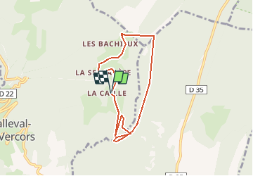
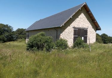
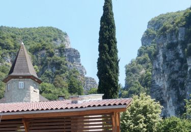
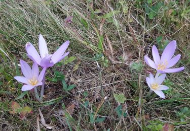
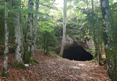
Tour Zu Fuß von 6,9 km verfügbar auf Auvergne-Rhone-Alpen, Isère, Malleval-en-Vercors. Diese Tour wird von crocau vorgeschlagen.
Beschreibung
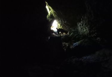
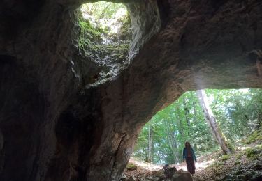
De la Ferme de La Caille, rejoindre le Col de Neurre puis traverser les prés puis les bois sous le Bec (très difficile). Sous le Bec on trouve une sente que l'on crapahute . La vue du Bec est imprenable.
On traverse les bois soit avec l'application , soit on longe les crêtes où l'on trouve un sentier. On rejoint alors le sentier officiel et le Pas du Follet ( joli point de vue) et on redescend à la Ferme.
Ort
Kommentare
Touren in der Umgebung
![Tour Wandern Cognin-les-Gorges - gerlette abs - Photo](https://media.geolcdn.com/t/375/260/c8110e9f-bd5d-4d92-bba6-1a7936beeb04.jpg&format=jpg&maxdim=2)
![Wandern Wandern](https://static1.geolcdn.com/sitytour/trail-icons/101.png)
Wandern
![](/images/other/stat-length.png)
![](https://static1.geolcdn.com/siteimages/upload/files/16400158638029165_repeat_loop_refresh_sync_direction_icon.png)
![Tour Wandern Malleval-en-Vercors - pas du Follet en boucle - Photo](https://media.geolcdn.com/t/375/260/ext.jpg?maxdim=2&url=https%3A%2F%2Fstatic1.geolcdn.com%2Fsiteimages%2Fupload%2Ffiles%2F1553511878bg_sport_marche.png)
![Wandern Wandern](https://static1.geolcdn.com/sitytour/trail-icons/101.png)
Wandern
![](/images/other/stat-length.png)
![](https://static1.geolcdn.com/siteimages/upload/files/16400158638029165_repeat_loop_refresh_sync_direction_icon.png)
![Tour Wandern Malleval-en-Vercors - Patente - Photo](https://media.geolcdn.com/t/375/260/60b129ee-9863-458f-8d0b-886077adfedf.jpg&format=jpg&maxdim=2)
![Wandern Wandern](https://static1.geolcdn.com/sitytour/trail-icons/101.png)
Wandern
![](/images/other/stat-length.png)
![](https://static1.geolcdn.com/siteimages/upload/files/16400158638029165_repeat_loop_refresh_sync_direction_icon.png)
![Tour Wandern Saint-Gervais - Les Écouges - Pas de Pierre Taillée - Photo](https://media.geolcdn.com/t/375/260/c1514613-b24f-48ec-aa78-bb7bfa66a6b4.jpg&format=jpg&maxdim=2)
![Wandern Wandern](https://static1.geolcdn.com/sitytour/trail-icons/101.png)
Wandern
![](/images/other/stat-length.png)
![](https://static1.geolcdn.com/siteimages/upload/files/16400158638029165_repeat_loop_refresh_sync_direction_icon.png)
![Tour Wandern Cognin-les-Gorges - Cognin-les-Gorges - Gorges du Nan - Malleval-en-Vercors - Photo](https://media.geolcdn.com/t/375/260/ade7945e-a7c5-44bc-b392-a4cb822d8799.jpg&format=jpg&maxdim=2)
![Wandern Wandern](https://static1.geolcdn.com/sitytour/trail-icons/101.png)
Wandern
![](/images/other/stat-length.png)
![](https://static1.geolcdn.com/siteimages/upload/files/16400158638029165_repeat_loop_refresh_sync_direction_icon.png)
![Tour Wandern Saint-Pierre-de-Chérennes - Les Coulmes - La Lunette - Photo](https://media.geolcdn.com/t/375/260/3a4910c5-13ba-451d-9478-dccf34306295.jpg&format=jpg&maxdim=2)
![Wandern Wandern](https://static1.geolcdn.com/sitytour/trail-icons/101.png)
Wandern
![](/images/other/stat-length.png)
![](https://static1.geolcdn.com/siteimages/upload/files/16400158638029165_repeat_loop_refresh_sync_direction_icon.png)
![Tour Wandern Presles - Coulmes - La Fontaine de Pétouze par la grotte des Boeufs - Photo](https://media.geolcdn.com/t/375/260/fe4f0ce9-4c0f-4a57-8bf8-01fb087e941a.jpg&format=jpg&maxdim=2)
![Wandern Wandern](https://static1.geolcdn.com/sitytour/trail-icons/101.png)
Wandern
![](/images/other/stat-length.png)
![](https://static1.geolcdn.com/siteimages/upload/files/16400158638029165_repeat_loop_refresh_sync_direction_icon.png)
![Tour Wandern Izeron - La lunette- fontaine et grotte de Byry - Photo](https://media.geolcdn.com/t/375/260/19a19cfc-ea7d-4041-87a8-5cc1f600b8bb.jpg&format=jpg&maxdim=2)
![Wandern Wandern](https://static1.geolcdn.com/sitytour/trail-icons/101.png)
Wandern
![](/images/other/stat-length.png)
![](https://static1.geolcdn.com/siteimages/upload/files/16400158638029165_repeat_loop_refresh_sync_direction_icon.png)
![Tour Wandern Presles - Fontaine de Pétouze- Grotte des boeufs - Photo](https://media.geolcdn.com/t/375/260/6b7d14d3-f76a-45c6-9cc9-34bf1f24a155.jpg&format=jpg&maxdim=2)
![Wandern Wandern](https://static1.geolcdn.com/sitytour/trail-icons/101.png)
Wandern
![](/images/other/stat-length.png)
![](https://static1.geolcdn.com/siteimages/upload/files/16400158638029165_repeat_loop_refresh_sync_direction_icon.png)