![](/images/other/stat-length.png)
Massul - Bercheux
polin
Benutzer
![Länge](/images/other/stat-length.png)
Länge
8,5 km
![Maximale Höhe](https://static1.geolcdn.com/siteimages/upload/files/1508320355ic_sort_altitude_max_24dp.png)
Maximale Höhe
510 m
![Positive Höhendifferenz](https://static1.geolcdn.com/siteimages/upload/files/1508320355ic_sort_den_pos_24dp.png)
Positive Höhendifferenz
143 m
![Km-Effort](/images/other/stat-length.png)
Km-Effort
10,5 km
![Min. Höhe](https://static1.geolcdn.com/siteimages/upload/files/1508320355ic_sort_altitude_min_24dp.png)
Min. Höhe
444 m
![Negative Höhendifferenz](https://static1.geolcdn.com/siteimages/upload/files/1508320355ic_sort_den_neg_24dp.png)
Negative Höhendifferenz
145 m
![Boucle](https://static1.geolcdn.com/siteimages/upload/files/16400158638029165_repeat_loop_refresh_sync_direction_icon.png)
Boucle
Ja
Erstellungsdatum :
2020-03-31 13:24:39.848
Letzte Änderung :
2020-04-01 13:18:56.163
![Wandern](https://static1.geolcdn.com/sitytour/trail-icons/101.png)
2h11
Schwierigkeit : Medium
![Scannen Sie diesen QR-Code, um die Tour in der SityTrail-Anwendung zu öffnen](https://capi.geolives.com/qq0zvz2zws4bq2lad0pu/sitytour/trails/2372499/qr.png?size=200)
Kostenlosegpshiking-Anwendung
Über SityTrail
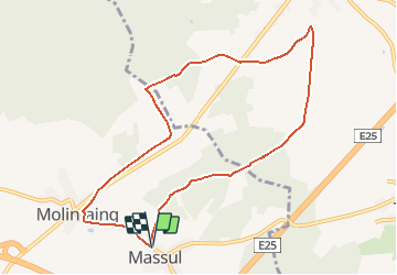
Tour Wandern von 8,5 km verfügbar auf Wallonien, Luxemburg, Neufchâteau. Diese Tour wird von polin vorgeschlagen.
Beschreibung
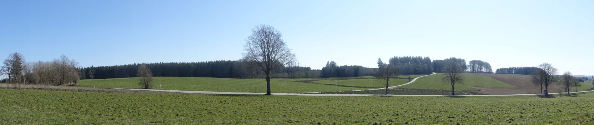
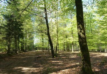
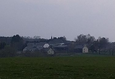
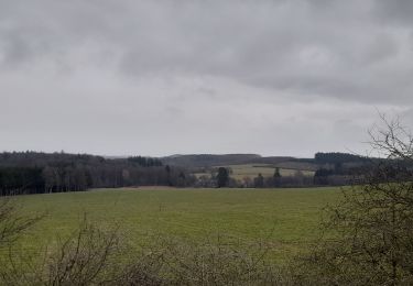
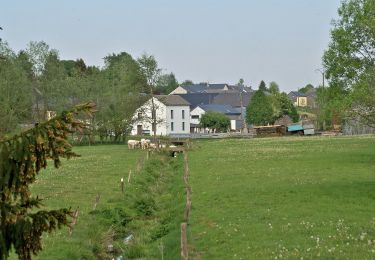
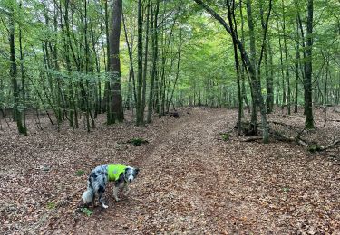
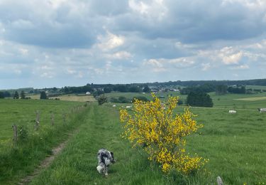
Départ de la chapelle de Massul, direction Bercheux via le Bois l'Awaite, retour de l'autre côté de la national en bordure du bois de Molinfaing.
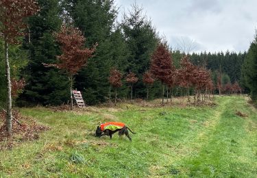
Pour éviter de marcher le long de la nationale, il y a une petite partie "hors sentier" au km 5.5.
Ort
Land:
Belgium
Region :
Wallonien
Abteilung/Provinz :
Luxemburg
Kommune :
Neufchâteau
Standort:
Longlier
Gehen Sie:(Dec)
Gehen Sie:(UTM)
680158 ; 5527770 (31U) N.
Kommentare
Touren in der Umgebung
![Tour Wandern Neufchâteau - Respelt - Bernimont - Photo](https://media.geolcdn.com/t/375/260/ext.jpg?maxdim=2&url=https%3A%2F%2Fmedia.geolcdn.com%2Ff%2Fad5ab438-5e30-4594-9b2d-676ae047109c.JPG)
![Wandern Wandern](https://static1.geolcdn.com/sitytour/trail-icons/101.png)
Respelt - Bernimont
Wandern
Medium
(1)
Neufchâteau,
Wallonien,
Luxemburg,
Belgium
![](/images/other/stat-length.png)
6,3 km | 8,1 km-effort
1h 44min
![](https://static1.geolcdn.com/siteimages/upload/files/16400158638029165_repeat_loop_refresh_sync_direction_icon.png)
Ja
![Tour Wandern Léglise - Ebly - Vaux-lez-Chêne - Photo](https://media.geolcdn.com/t/375/260/ext.jpg?maxdim=2&url=https%3A%2F%2Fmedia.geolcdn.com%2Ff%2F4443fdba-4049-42b8-95b3-28f013a869fb.jpg)
![Wandern Wandern](https://static1.geolcdn.com/sitytour/trail-icons/101.png)
Ebly - Vaux-lez-Chêne
Wandern
Einfach
(1)
Léglise,
Wallonien,
Luxemburg,
Belgium
![](/images/other/stat-length.png)
3 km | 3,9 km-effort
45min
![](https://static1.geolcdn.com/siteimages/upload/files/16400158638029165_repeat_loop_refresh_sync_direction_icon.png)
Ja
![Tour Zu Fuß Vaux-sur-Sûre - Promenade des Sources - Photo](https://media.geolcdn.com/t/375/260/ext.jpg?maxdim=2&url=https%3A%2F%2Fmedia.geolcdn.com%2Ff%2Fd5aec9bb-2a0c-4db4-8e6a-cf956f696afb.jpeg)
![Zu Fuß Zu Fuß](https://static1.geolcdn.com/sitytour/trail-icons/100.png)
Promenade des Sources
Zu Fuß
Einfach
Vaux-sur-Sûre,
Wallonien,
Luxemburg,
Belgium
![](/images/other/stat-length.png)
8 km | 9,8 km-effort
2h 14min
![](https://static1.geolcdn.com/siteimages/upload/files/16400158638029165_repeat_loop_refresh_sync_direction_icon.png)
Ja
![Tour Fahrrad Vaux-sur-Sûre - cyclo legendes 3 - Photo](https://media.geolcdn.com/t/375/260/ext.jpg?maxdim=2&url=https%3A%2F%2Fstatic1.geolcdn.com%2Fsiteimages%2Fupload%2Ffiles%2F1524743154velo.jpg)
![Fahrrad Fahrrad](https://static1.geolcdn.com/sitytour/trail-icons/200.png)
cyclo legendes 3
Fahrrad
Medium
(1)
Vaux-sur-Sûre,
Wallonien,
Luxemburg,
Belgium
![](/images/other/stat-length.png)
51 km | 62 km-effort
3h 28min
![](https://static1.geolcdn.com/siteimages/upload/files/16400158638029165_repeat_loop_refresh_sync_direction_icon.png)
Ja
![Tour Wandern Vaux-sur-Sûre - Bercheux. Natura 2000, des sites qui valent le détour. Lx9 - Photo](https://media.geolcdn.com/t/375/260/ext.jpg?maxdim=2&url=https%3A%2F%2Fservices.sitytrail.com%2FGeolivesWS%2FDownloadMedia.ashx%3FTrailID%3D163634%26Media%3D72b86eed-151f-40b6-a254-39d17ecc1b78.jpg)
![Wandern Wandern](https://static1.geolcdn.com/sitytour/trail-icons/101.png)
Bercheux. Natura 2000, des sites qui valent le détour. Lx9
Wandern
Einfach
(1)
Vaux-sur-Sûre,
Wallonien,
Luxemburg,
Belgium
![](/images/other/stat-length.png)
10,5 km | 12,6 km-effort
2h 45min
![](https://static1.geolcdn.com/siteimages/upload/files/16400158638029165_repeat_loop_refresh_sync_direction_icon.png)
Ja
![Tour Wandern Léglise - Bombois - Photo](https://media.geolcdn.com/t/375/260/ext.jpg?maxdim=2&url=https%3A%2F%2Fmedia.geolcdn.com%2Ff%2Fa9c4a62c-f6a9-4786-9b66-0923f6036753.jpg)
![Wandern Wandern](https://static1.geolcdn.com/sitytour/trail-icons/101.png)
![Tour Wandern Neufchâteau - Marche ADEPS 8K500?? à (Namoussart) Neufchateau - Photo](https://media.geolcdn.com/t/375/260/ext.jpg?maxdim=2&url=https%3A%2F%2Fmedia.geolcdn.com%2Ff%2F394ab4a5-c5a6-43e2-b98b-c33bbaf2a33e.jpg)
![Wandern Wandern](https://static1.geolcdn.com/sitytour/trail-icons/101.png)
Marche ADEPS 8K500?? à (Namoussart) Neufchateau
Wandern
Einfach
Neufchâteau,
Wallonien,
Luxemburg,
Belgium
![](/images/other/stat-length.png)
8,5 km | 10,4 km-effort
1h 43min
![](https://static1.geolcdn.com/siteimages/upload/files/16400158638029165_repeat_loop_refresh_sync_direction_icon.png)
Ja
![Tour Wandern Léglise - Bombois 8-9 km - Photo](https://media.geolcdn.com/t/375/260/ext.jpg?maxdim=2&url=https%3A%2F%2Fmedia.geolcdn.com%2Ff%2Fed085144-3345-4c44-a7e5-1a46fe9d2208.jpg)
![Wandern Wandern](https://static1.geolcdn.com/sitytour/trail-icons/101.png)
Bombois 8-9 km
Wandern
Medium
Léglise,
Wallonien,
Luxemburg,
Belgium
![](/images/other/stat-length.png)
7,9 km | 10 km-effort
1h 55min
![](https://static1.geolcdn.com/siteimages/upload/files/16400158638029165_repeat_loop_refresh_sync_direction_icon.png)
Ja
![Tour Wandern Neufchâteau - Tronquoy - Respelt - Photo](https://media.geolcdn.com/t/375/260/ext.jpg?maxdim=2&url=https%3A%2F%2Fmedia.geolcdn.com%2Ff%2F1553f43e-553a-4c61-b2fa-cb17c8a7814a.jpg)
![Wandern Wandern](https://static1.geolcdn.com/sitytour/trail-icons/101.png)
Tronquoy - Respelt
Wandern
Einfach
Neufchâteau,
Wallonien,
Luxemburg,
Belgium
![](/images/other/stat-length.png)
7,2 km | 9,1 km-effort
1h 52min
![](https://static1.geolcdn.com/siteimages/upload/files/16400158638029165_repeat_loop_refresh_sync_direction_icon.png)
Ja