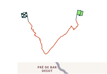

37 km | 70 km-effort


Benutzer


Kostenlosegpshiking-Anwendung
 SityTrail
IGN / Geografische Institute
SityTrail World
Die Welt öffnet sich für Sie
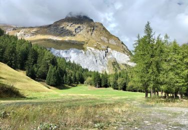
Tour Andere Aktivitäten von 9,4 km verfügbar auf Wallis, Entremont, Orsières. Diese Tour wird von sterrettaz vorgeschlagen.
Avant la partie sommitale (crampons) il est possilbe de monter plus à l''ouest pour éviter certains passages un peu raides...

Zu Fuß

Zu Fuß

Wandern

Zu Fuß

Wandern

Wandern

Wandern