![](/images/other/stat-length.png)
![Tour Wandern Manhay - deux rys 25/02/2020 - Photo](https://media.geolcdn.com/t/1900/400/da94ccef-7cff-413a-9f03-f88b56c7f20f.jpg&format=pjpeg&maxdim=2)
deux rys 25/02/2020
japy54
Benutzer GUIDE
![Länge](/images/other/stat-length.png)
Länge
21 km
![Maximale Höhe](https://static1.geolcdn.com/siteimages/upload/files/1508320355ic_sort_altitude_max_24dp.png)
Maximale Höhe
532 m
![Positive Höhendifferenz](https://static1.geolcdn.com/siteimages/upload/files/1508320355ic_sort_den_pos_24dp.png)
Positive Höhendifferenz
516 m
![Km-Effort](/images/other/stat-length.png)
Km-Effort
28 km
![Min. Höhe](https://static1.geolcdn.com/siteimages/upload/files/1508320355ic_sort_altitude_min_24dp.png)
Min. Höhe
217 m
![Negative Höhendifferenz](https://static1.geolcdn.com/siteimages/upload/files/1508320355ic_sort_den_neg_24dp.png)
Negative Höhendifferenz
518 m
![Boucle](https://static1.geolcdn.com/siteimages/upload/files/16400158638029165_repeat_loop_refresh_sync_direction_icon.png)
Boucle
Ja
Erstellungsdatum :
2020-02-25 07:55:57.274
Letzte Änderung :
2020-02-25 14:30:26.227
![Wandern](https://static1.geolcdn.com/sitytour/trail-icons/101.png)
4h53
Schwierigkeit : Medium
![Scannen Sie diesen QR-Code, um die Tour in der SityTrail-Anwendung zu öffnen](https://capi.geolives.com/qq0zvz2zws4bq2lad0pu/sitytour/trails/2346040/qr.png?size=200)
Kostenlosegpshiking-Anwendung
Über SityTrail
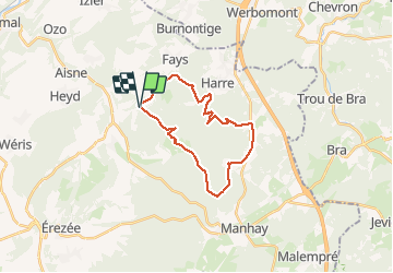
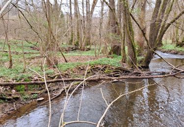
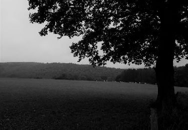
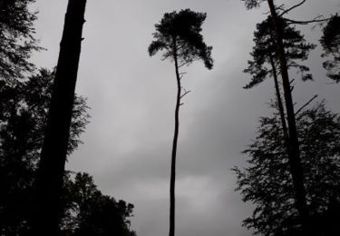
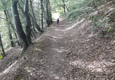
Tour Wandern von 21 km verfügbar auf Wallonien, Luxemburg, Manhay. Diese Tour wird von japy54 vorgeschlagen.
Beschreibung
belle randonnée malheureusement nous avons dû emprunter 4km de petite route a la fin pour éviter les chemins privés surveillés par caméra !!!!incroyable mais vrai
Ort
Land:
Belgium
Region :
Wallonien
Abteilung/Provinz :
Luxemburg
Kommune :
Manhay
Standort:
Harre
Gehen Sie:(Dec)
Gehen Sie:(UTM)
685684 ; 5579854 (31U) N.
Kommentare
Touren in der Umgebung
![Tour Wandern Érezée - Hoursinne. Natura 2000, des sites qui valent le détour. Lx 1 - Photo](https://media.geolcdn.com/t/375/260/ext.jpg?maxdim=2&url=https%3A%2F%2Fservices.sitytrail.com%2FGeolivesWS%2FDownloadMedia.ashx%3FTrailID%3D142589%26Media%3Df0338fc2-a78f-45f3-92a6-ccf3ccce12cc.JPG)
![Wandern Wandern](https://static1.geolcdn.com/sitytour/trail-icons/101.png)
Hoursinne. Natura 2000, des sites qui valent le détour. Lx 1
Wandern
Schwierig
(9)
Érezée,
Wallonien,
Luxemburg,
Belgium
![](/images/other/stat-length.png)
8,1 km | 10,8 km-effort
2h 19min
![](https://static1.geolcdn.com/siteimages/upload/files/16400158638029165_repeat_loop_refresh_sync_direction_icon.png)
Ja
![Tour Wandern Érezée - 2024-10-14_11h35m13_IntincheraEreze - Photo](https://media.geolcdn.com/t/375/260/cc06b86b-a86f-40a6-b741-b1d0842ad353.jpg&format=jpg&maxdim=2)
![Wandern Wandern](https://static1.geolcdn.com/sitytour/trail-icons/101.png)
2024-10-14_11h35m13_IntincheraEreze
Wandern
Medium
(1)
Érezée,
Wallonien,
Luxemburg,
Belgium
![](/images/other/stat-length.png)
10,6 km | 14,5 km-effort
3h 18min
![](https://static1.geolcdn.com/siteimages/upload/files/16400158638029165_repeat_loop_refresh_sync_direction_icon.png)
Ja
![Tour Wandern Manhay - 2021-06-30_10h29m50_Cirkwi-BOIS_DE_HARRE_(Commune_de_MANHAY) - Photo](https://media.geolcdn.com/t/375/260/c09deda8-fc97-4a3a-abcd-a27b1902d3a9.jpg&format=jpg&maxdim=2)
![Wandern Wandern](https://static1.geolcdn.com/sitytour/trail-icons/101.png)
2021-06-30_10h29m50_Cirkwi-BOIS_DE_HARRE_(Commune_de_MANHAY)
Wandern
Medium
(1)
Manhay,
Wallonien,
Luxemburg,
Belgium
![](/images/other/stat-length.png)
13,5 km | 18,9 km-effort
4h 17min
![](https://static1.geolcdn.com/siteimages/upload/files/16400158638029165_repeat_loop_refresh_sync_direction_icon.png)
Ja
![Tour Wandern Ferrières - Marche ADEPS BURNONTIGE (Ferrieres) 10/04/33 - Photo](https://media.geolcdn.com/t/375/260/6e9d890b-6b68-45d8-aaec-5de6224210eb.jpg&format=jpg&maxdim=2)
![Wandern Wandern](https://static1.geolcdn.com/sitytour/trail-icons/101.png)
Marche ADEPS BURNONTIGE (Ferrieres) 10/04/33
Wandern
Medium
(1)
Ferrières,
Wallonien,
Lüttich,
Belgium
![](/images/other/stat-length.png)
15,4 km | 20 km-effort
3h 2min
![](https://static1.geolcdn.com/siteimages/upload/files/16400158638029165_repeat_loop_refresh_sync_direction_icon.png)
Ja
![Tour Wandern Érezée - Hoursine-Hoursine 12kms - Photo](https://media.geolcdn.com/t/375/260/c996774c-2642-4a86-94e0-eab3c7bcc053.jpg&format=jpg&maxdim=2)
![Wandern Wandern](https://static1.geolcdn.com/sitytour/trail-icons/101.png)
Hoursine-Hoursine 12kms
Wandern
Schwierig
(1)
Érezée,
Wallonien,
Luxemburg,
Belgium
![](/images/other/stat-length.png)
12,5 km | 17,1 km-effort
3h 37min
![](https://static1.geolcdn.com/siteimages/upload/files/16400158638029165_repeat_loop_refresh_sync_direction_icon.png)
Ja
![Tour Wandern Durbuy - Deux boucles du Rideux-20kms - Photo](https://media.geolcdn.com/t/375/260/0f5f5c48-cbf4-49e1-bd2e-2bdc08093db1.jpg&format=jpg&maxdim=2)
![Wandern Wandern](https://static1.geolcdn.com/sitytour/trail-icons/101.png)
Deux boucles du Rideux-20kms
Wandern
Sehr schwierig
(1)
Durbuy,
Wallonien,
Luxemburg,
Belgium
![](/images/other/stat-length.png)
21 km | 28 km-effort
5h 54min
![](https://static1.geolcdn.com/siteimages/upload/files/16400158638029165_repeat_loop_refresh_sync_direction_icon.png)
Ja
![Tour Wandern Érezée - Papillon de Fanzel-12 - Photo](https://media.geolcdn.com/t/375/260/f829c3de-70a8-4bc7-954f-0855257a9e97.jpg&format=jpg&maxdim=2)
![Wandern Wandern](https://static1.geolcdn.com/sitytour/trail-icons/101.png)
Papillon de Fanzel-12
Wandern
Schwierig
(1)
Érezée,
Wallonien,
Luxemburg,
Belgium
![](/images/other/stat-length.png)
11,9 km | 17,5 km-effort
3h 39min
![](https://static1.geolcdn.com/siteimages/upload/files/16400158638029165_repeat_loop_refresh_sync_direction_icon.png)
Ja
![Tour Wandern Manhay - De deux Rys à Deux Rys - Photo](https://media.geolcdn.com/t/375/260/41cb57c8-08ee-4a05-8890-be5d31ed9db2.jpg&format=jpg&maxdim=2)
![Wandern Wandern](https://static1.geolcdn.com/sitytour/trail-icons/101.png)
De deux Rys à Deux Rys
Wandern
Einfach
(1)
Manhay,
Wallonien,
Luxemburg,
Belgium
![](/images/other/stat-length.png)
13,8 km | 19,3 km-effort
3h 33min
![](https://static1.geolcdn.com/siteimages/upload/files/16400158638029165_repeat_loop_refresh_sync_direction_icon.png)
Ja
![Tour Wandern Durbuy - Villers - Photo](https://media.geolcdn.com/t/375/260/b8a15ef8-e8ff-4359-b8a8-6141d1419fbb.jpg&format=jpg&maxdim=2)
![Wandern Wandern](https://static1.geolcdn.com/sitytour/trail-icons/101.png)