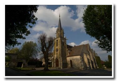
14,5 km | 18,4 km-effort
Foulangues 9,7km
boularand
Benutzer
Länge
9,7 km
Maximale Höhe
113 m
Positive Höhendifferenz
157 m
Km-Effort
11,8 km
Min. Höhe
47 m
Negative Höhendifferenz
156 m
Boucle
Ja
Erstellungsdatum :
2020-01-24 10:16:00.102
Letzte Änderung :
2020-01-24 10:17:23.852
2h33
Schwierigkeit : Medium
Kostenlosegpshiking-Anwendung
Über SityTrail
Tour Wandern von 9,7 km verfügbar auf Nordfrankreich, Oise, Cires-lès-Mello. Diese Tour wird von boularand vorgeschlagen.
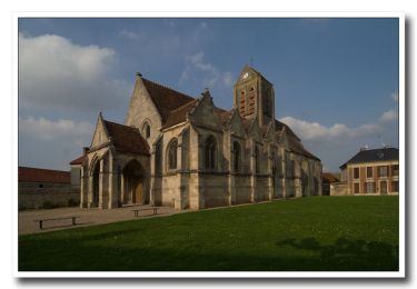
Ort
Land:
France
Region :
Nordfrankreich
Abteilung/Provinz :
Oise
Kommune :
Cires-lès-Mello
Standort:
Unknown
Gehen Sie:(Dec)
Gehen Sie:(UTM)
451038 ; 5456332 (31U) N.
Kommentare
Touren in der Umgebung
Randonnée d'Ully St Georges
Wandern
Schwierig
(2)
Ully-Saint-Georges,
Nordfrankreich,
Oise,
France
3h 40min
Ja
La Vallée de Noé - Neuilly-en-Thelle
Wandern
Schwierig
(1)
Neuilly-en-Thelle,
Nordfrankreich,
Oise,
France
13,5 km | 16,1 km-effort
3h 30min
Ja
La Vallée de Noé - Neuilly en Thelle
Wandern
Medium
(1)
Neuilly-en-Thelle,
Nordfrankreich,
Oise,
France
13,5 km | 16,1 km-effort
3h 30min
Ja
Cires-lès-Mello, coté Ouest
Mountainbike
Medium
Cires-lès-Mello,
Nordfrankreich,
Oise,
France
58 km | 69 km-effort
3h 30min
Ja
Cires les Mello
Wandern
Medium
Cires-lès-Mello,
Nordfrankreich,
Oise,
France
12,7 km | 15,4 km-effort
3h 20min
Ja
Cires les Mello
Wandern
Medium
Cires-lès-Mello,
Nordfrankreich,
Oise,
France
12,7 km | 15,4 km-effort
3h 20min
Ja
Blaincourt-lès-Précy PN
Wandern
Einfach
Blaincourt-lès-Précy,
Nordfrankreich,
Oise,
France
17,3 km | 21 km-effort
4h 40min
Ja
Blaincourt-lès-Précy GP
Wandern
Einfach
Blaincourt-lès-Précy,
Nordfrankreich,
Oise,
France
20 km | 24 km-effort
5h 17min
Ja
Blaincourt-lès-Précy GP
Wandern
Einfach
Blaincourt-lès-Précy,
Nordfrankreich,
Oise,
France
20 km | 24 km-effort
5h 17min
Ja