


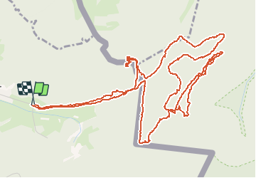

13 km | 16,1 km-effort


Benutzer


Kostenlosegpshiking-Anwendung
 SityTrail
IGN / Geografische Institute
SityTrail World
Die Welt öffnet sich für Sie
Tour Wandern von 8,5 km verfügbar auf Großer Osten, Mosel, Roppweiler. Diese Tour wird von Claude Barbian vorgeschlagen.
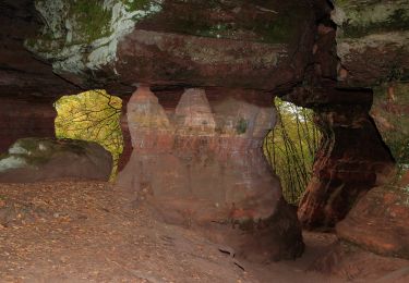
petit circuit du côté du "Colorado" et léger détour par le rocher de Diane
Le tout en forêt de Roppeviller à cheval sur l'Allemagne.


Wandern

Zu Fuß
Zu Fuß
Zu Fuß
Zu Fuß
Zu Fuß
Zu Fuß
Zu Fuß
Zu Fuß