


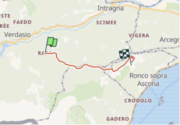

7,1 km | 11,4 km-effort


Benutzer


Kostenlosegpshiking-Anwendung
 SityTrail
IGN / Geografische Institute
SityTrail World
Die Welt öffnet sich für Sie
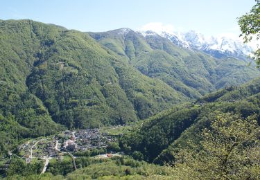
Tour Andere Aktivitäten von 6,6 km verfügbar auf Tessin, Bezirk Locarno, Centovalli. Diese Tour wird von merlot vorgeschlagen.
Herisau,Flawiler Egg, Wolfertswil,Böschenbach,Hoffeld, Ebersol,Necker, Spreitenbach, Reitenberg, Heiterswil, Hemberg, Bächli,Schönau, Urnäsch, Gonten, Appenzell, Haslen,Stein, Hundwil, Herisau
Zu Fuß

Andere Aktivitäten
Andere Aktivitäten

Wandern