![](/images/other/stat-length.png)
![Tour Wandern Bosroumois - Bosc-Roger en Roumois - Photo](https://media.geolcdn.com/t/1900/400/f14cdee5-9c6e-4224-8d7a-17b3527611f6.jpg&format=pjpeg&maxdim=2)
Bosc-Roger en Roumois
MichelRando7656
Benutzer
![Länge](/images/other/stat-length.png)
Länge
11,5 km
![Maximale Höhe](https://static1.geolcdn.com/siteimages/upload/files/1508320355ic_sort_altitude_max_24dp.png)
Maximale Höhe
159 m
![Positive Höhendifferenz](https://static1.geolcdn.com/siteimages/upload/files/1508320355ic_sort_den_pos_24dp.png)
Positive Höhendifferenz
83 m
![Km-Effort](/images/other/stat-length.png)
Km-Effort
12,6 km
![Min. Höhe](https://static1.geolcdn.com/siteimages/upload/files/1508320355ic_sort_altitude_min_24dp.png)
Min. Höhe
120 m
![Negative Höhendifferenz](https://static1.geolcdn.com/siteimages/upload/files/1508320355ic_sort_den_neg_24dp.png)
Negative Höhendifferenz
83 m
![Boucle](https://static1.geolcdn.com/siteimages/upload/files/16400158638029165_repeat_loop_refresh_sync_direction_icon.png)
Boucle
Ja
Erstellungsdatum :
2020-01-15 13:24:36.145
Letzte Änderung :
2020-01-15 16:32:23.846
![Wandern](https://static1.geolcdn.com/sitytour/trail-icons/101.png)
3h06
Schwierigkeit : Medium
![Scannen Sie diesen QR-Code, um die Tour in der SityTrail-Anwendung zu öffnen](https://capi.geolives.com/qq0zvz2zws4bq2lad0pu/sitytour/trails/2306301/qr.png?size=200)
Kostenlosegpshiking-Anwendung
Über SityTrail
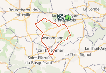
Tour Wandern von 11,5 km verfügbar auf Normandie, Eure, Bosroumois. Diese Tour wird von MichelRando7656 vorgeschlagen.
Beschreibung
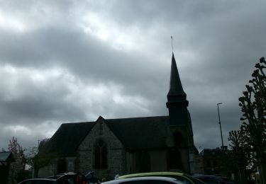
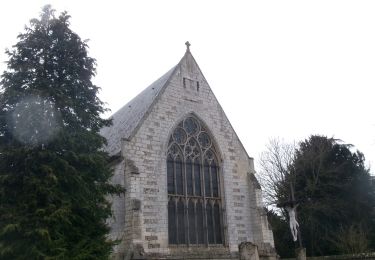
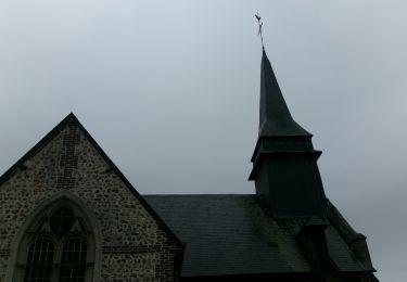
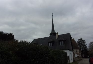
Randonnée des 3 clochers.
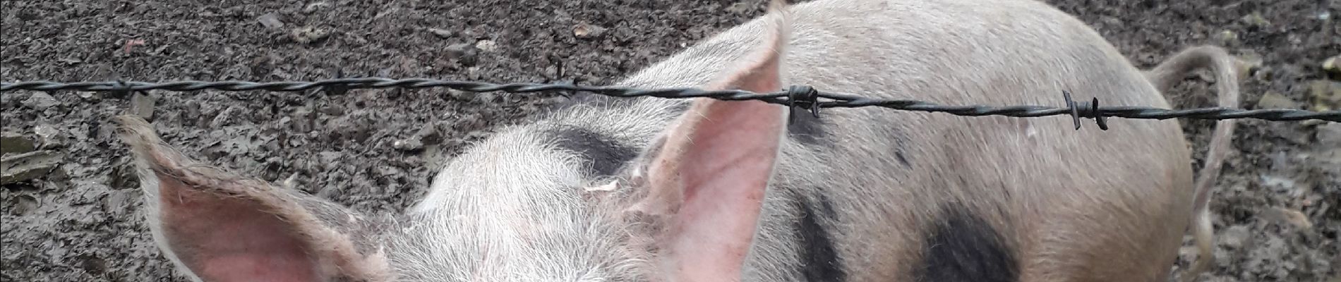
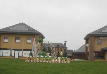
Petites routes de campagne tranquilles et chemins bien boueux actuellement.
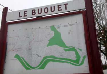
Belles chaumières.
Départ et retour sur le parking mairie/église.
Ort
Land:
France
Region :
Normandie
Abteilung/Provinz :
Eure
Kommune :
Bosroumois
Standort:
Unknown
Gehen Sie:(Dec)
Gehen Sie:(UTM)
348968 ; 5461650 (31U) N.
Kommentare
Touren in der Umgebung
![Tour Wandern La Londe - La Londe 76- 13 km - Photo](https://media.geolcdn.com/t/375/260/23588b19-2689-475f-b2bd-10608cbf7253.jpg&format=jpg&maxdim=2)
![Wandern Wandern](https://static1.geolcdn.com/sitytour/trail-icons/101.png)
La Londe 76- 13 km
Wandern
Schwierig
(1)
La Londe,
Normandie,
Seine-Maritime,
France
![](/images/other/stat-length.png)
13 km | 16,1 km-effort
3h 43min
![](https://static1.geolcdn.com/siteimages/upload/files/16400158638029165_repeat_loop_refresh_sync_direction_icon.png)
Ja
![Tour Wandern Saint-Pierre-du-Bosguérard - Bois De La Caboche XXL 2 - Photo](https://media.geolcdn.com/t/375/260/ext.jpg?maxdim=2&url=https%3A%2F%2Fstatic1.geolcdn.com%2Fsiteimages%2Fupload%2Ffiles%2F1553511878bg_sport_marche.png)
![Wandern Wandern](https://static1.geolcdn.com/sitytour/trail-icons/101.png)
Bois De La Caboche XXL 2
Wandern
Medium
(2)
Saint-Pierre-du-Bosguérard,
Normandie,
Eure,
France
![](/images/other/stat-length.png)
11,9 km | 14,1 km-effort
3h 5min
![](https://static1.geolcdn.com/siteimages/upload/files/16400158638029165_repeat_loop_refresh_sync_direction_icon.png)
Ja
![Wandern Wandern](https://static1.geolcdn.com/sitytour/trail-icons/101.png)
20240409-StPierre des Fleurs Cool
Wandern
Einfach
Saint-Pierre-des-Fleurs,
Normandie,
Eure,
France
![](/images/other/stat-length.png)
7,5 km | 8,5 km-effort
2h 10min
![](https://static1.geolcdn.com/siteimages/upload/files/16400158638029165_repeat_loop_refresh_sync_direction_icon.png)
Ja
![Wandern Wandern](https://static1.geolcdn.com/sitytour/trail-icons/101.png)
la londe
Wandern
Schwierig
La Londe,
Normandie,
Seine-Maritime,
France
![](/images/other/stat-length.png)
11,6 km | 14,3 km-effort
3h 14min
![](https://static1.geolcdn.com/siteimages/upload/files/16400158638029165_repeat_loop_refresh_sync_direction_icon.png)
Nein
![Wandern Wandern](https://static1.geolcdn.com/sitytour/trail-icons/101.png)
20240312-La londe cool
Wandern
Einfach
(1)
La Londe,
Normandie,
Seine-Maritime,
France
![](/images/other/stat-length.png)
7,7 km | 8,9 km-effort
2h 7min
![](https://static1.geolcdn.com/siteimages/upload/files/16400158638029165_repeat_loop_refresh_sync_direction_icon.png)
Ja
![Wandern Wandern](https://static1.geolcdn.com/sitytour/trail-icons/101.png)
20240305-La Saussaye Cool
Wandern
Einfach
La Saussaye,
Normandie,
Eure,
France
![](/images/other/stat-length.png)
7 km | 7,7 km-effort
1h 44min
![](https://static1.geolcdn.com/siteimages/upload/files/16400158638029165_repeat_loop_refresh_sync_direction_icon.png)
Ja
![Wandern Wandern](https://static1.geolcdn.com/sitytour/trail-icons/101.png)
20240210-St Pierre des Fleurs
Wandern
Medium
Saint-Pierre-des-Fleurs,
Normandie,
Eure,
France
![](/images/other/stat-length.png)
12,2 km | 14,7 km-effort
2h 59min
![](https://static1.geolcdn.com/siteimages/upload/files/16400158638029165_repeat_loop_refresh_sync_direction_icon.png)
Ja
![Wandern Wandern](https://static1.geolcdn.com/sitytour/trail-icons/101.png)
20240130-La Saussaye
Wandern
Medium
La Saussaye,
Normandie,
Eure,
France
![](/images/other/stat-length.png)
11 km | 13,4 km-effort
2h 31min
![](https://static1.geolcdn.com/siteimages/upload/files/16400158638029165_repeat_loop_refresh_sync_direction_icon.png)
Ja
![Wandern Wandern](https://static1.geolcdn.com/sitytour/trail-icons/101.png)
20231221-Les Thuits
Wandern
Medium
Le Thuit-de-l'Oison,
Normandie,
Eure,
France
![](/images/other/stat-length.png)
10,5 km | 11,7 km-effort
2h 44min
![](https://static1.geolcdn.com/siteimages/upload/files/16400158638029165_repeat_loop_refresh_sync_direction_icon.png)
Ja