![](/images/other/stat-length.png)
![Tour Wandern Le Puy - Le Puy - Photo](https://media.geolcdn.com/t/1900/400/258f3f3c-c50b-405c-bd68-a6ac42ea325f.jpg&format=pjpeg&maxdim=2)
Le Puy
eltonnermou
Benutzer
![Länge](/images/other/stat-length.png)
Länge
14,1 km
![Maximale Höhe](https://static1.geolcdn.com/siteimages/upload/files/1508320355ic_sort_altitude_max_24dp.png)
Maximale Höhe
511 m
![Positive Höhendifferenz](https://static1.geolcdn.com/siteimages/upload/files/1508320355ic_sort_den_pos_24dp.png)
Positive Höhendifferenz
272 m
![Km-Effort](/images/other/stat-length.png)
Km-Effort
17,8 km
![Min. Höhe](https://static1.geolcdn.com/siteimages/upload/files/1508320355ic_sort_altitude_min_24dp.png)
Min. Höhe
319 m
![Negative Höhendifferenz](https://static1.geolcdn.com/siteimages/upload/files/1508320355ic_sort_den_neg_24dp.png)
Negative Höhendifferenz
273 m
![Boucle](https://static1.geolcdn.com/siteimages/upload/files/16400158638029165_repeat_loop_refresh_sync_direction_icon.png)
Boucle
Ja
Erstellungsdatum :
2020-01-12 09:27:16.605
Letzte Änderung :
2020-01-12 20:06:43.917
![Wandern](https://static1.geolcdn.com/sitytour/trail-icons/101.png)
2h08
Schwierigkeit : Einfach
![Scannen Sie diesen QR-Code, um die Tour in der SityTrail-Anwendung zu öffnen](https://capi.geolives.com/qq0zvz2zws4bq2lad0pu/sitytour/trails/2303249/qr.png?size=200)
Kostenlosegpshiking-Anwendung
Über SityTrail
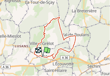
Tour Wandern von 14,1 km verfügbar auf Burgund und Freigrafschaft, Doubs, Le Puy. Diese Tour wird von eltonnermou vorgeschlagen.
Beschreibung
13,8km réel
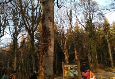
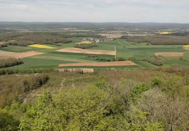
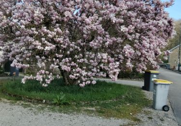
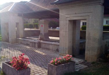
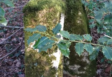
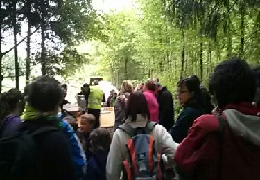
randonnée dans les bois entre Le Puy, Val de Roulans, en passant par le mont Bichoux Villers Grélot. On profite des éoliennes et de leur léger bruit.
Ort
Land:
France
Region :
Burgund und Freigrafschaft
Abteilung/Provinz :
Doubs
Kommune :
Le Puy
Standort:
Unknown
Gehen Sie:(Dec)
Gehen Sie:(UTM)
290659 ; 5247242 (32T) N.
Kommentare
Touren in der Umgebung
![Tour Wandern Roulans - Roulans - Photo](https://media.geolcdn.com/t/375/260/2cbbd98c-ccf8-4bac-a479-dbed0aefef86.jpg&format=jpg&maxdim=2)
![Wandern Wandern](https://static1.geolcdn.com/sitytour/trail-icons/101.png)
Roulans
Wandern
Sehr leicht
(1)
Roulans,
Burgund und Freigrafschaft,
Doubs,
France
![](/images/other/stat-length.png)
10,6 km | 13,7 km-effort
2h 44min
![](https://static1.geolcdn.com/siteimages/upload/files/16400158638029165_repeat_loop_refresh_sync_direction_icon.png)
Ja
![Tour Wandern Ougney-Douvot - ougney la Roche (douvot) - Photo](https://media.geolcdn.com/t/375/260/532e6234-3db8-43f6-834f-754785112099.jpg&format=jpg&maxdim=2)
![Wandern Wandern](https://static1.geolcdn.com/sitytour/trail-icons/101.png)
ougney la Roche (douvot)
Wandern
Einfach
(1)
Ougney-Douvot,
Burgund und Freigrafschaft,
Doubs,
France
![](/images/other/stat-length.png)
11,7 km | 16,9 km-effort
1h 54min
![](https://static1.geolcdn.com/siteimages/upload/files/16400158638029165_repeat_loop_refresh_sync_direction_icon.png)
Ja
![Tour Wandern Séchin - Sechin 23 janvier 2020 CAF - Photo](https://media.geolcdn.com/t/375/260/9bdc166d-03a0-478f-a63a-eb5267e40a66.jpg&format=jpg&maxdim=2)
![Wandern Wandern](https://static1.geolcdn.com/sitytour/trail-icons/101.png)
Sechin 23 janvier 2020 CAF
Wandern
Schwierig
Séchin,
Burgund und Freigrafschaft,
Doubs,
France
![](/images/other/stat-length.png)
19,5 km | 24 km-effort
6h 52min
![](https://static1.geolcdn.com/siteimages/upload/files/16400158638029165_repeat_loop_refresh_sync_direction_icon.png)
Ja
![Tour Wandern La Tour-de-Sçay - tour de scay stade du moireau - Photo](https://media.geolcdn.com/t/375/260/425f68cd-6ed9-4219-9897-a8de90330dd1.jpg&format=jpg&maxdim=2)
![Wandern Wandern](https://static1.geolcdn.com/sitytour/trail-icons/101.png)
tour de scay stade du moireau
Wandern
Medium
La Tour-de-Sçay,
Burgund und Freigrafschaft,
Doubs,
France
![](/images/other/stat-length.png)
12,6 km | 17,5 km-effort
3h 37min
![](https://static1.geolcdn.com/siteimages/upload/files/16400158638029165_repeat_loop_refresh_sync_direction_icon.png)
Ja
![Tour Wandern La Tour-de-Sçay - tour de scey stade - Photo](https://media.geolcdn.com/t/375/260/13803433-29dc-41a7-a887-aef065c694f5.jpg&format=jpg&maxdim=2)
![Wandern Wandern](https://static1.geolcdn.com/sitytour/trail-icons/101.png)
tour de scey stade
Wandern
Medium
La Tour-de-Sçay,
Burgund und Freigrafschaft,
Doubs,
France
![](/images/other/stat-length.png)
13,9 km | 19,9 km-effort
4h 41min
![](https://static1.geolcdn.com/siteimages/upload/files/16400158638029165_repeat_loop_refresh_sync_direction_icon.png)
Ja
![Tour Wandern Marchaux-Chaudefontaine - Chaudfontaine 23-08-2020 - Photo](https://media.geolcdn.com/t/375/260/f085879d-0c4d-4fe3-b3a8-74270207b502.jpg&format=jpg&maxdim=2)
![Wandern Wandern](https://static1.geolcdn.com/sitytour/trail-icons/101.png)
Chaudfontaine 23-08-2020
Wandern
Einfach
Marchaux-Chaudefontaine,
Burgund und Freigrafschaft,
Doubs,
France
![](/images/other/stat-length.png)
8,7 km | 11,8 km-effort
2h 38min
![](https://static1.geolcdn.com/siteimages/upload/files/16400158638029165_repeat_loop_refresh_sync_direction_icon.png)
Ja
![Tour Wandern La Tour-de-Sçay - Le Verjoulot 6 fév 2020 CAF - Photo](https://media.geolcdn.com/t/375/260/51b02ae3-bb57-415c-815d-e0332d5118db.jpg&format=jpg&maxdim=2)
![Wandern Wandern](https://static1.geolcdn.com/sitytour/trail-icons/101.png)
Le Verjoulot 6 fév 2020 CAF
Wandern
Sehr leicht
La Tour-de-Sçay,
Burgund und Freigrafschaft,
Doubs,
France
![](/images/other/stat-length.png)
19,4 km | 27 km-effort
6h 45min
![](https://static1.geolcdn.com/siteimages/upload/files/16400158638029165_repeat_loop_refresh_sync_direction_icon.png)
Nein
![Tour Wandern Roulans - Comper 2013 - Photo](https://media.geolcdn.com/t/375/260/ext.jpg?maxdim=2&url=https%3A%2F%2Fservices.sitytrail.com%2FGeolivesWS%2FDownloadMedia.ashx%3FTrailID%3D195607%26Media%3D20130602091927.jpeg)
![Wandern Wandern](https://static1.geolcdn.com/sitytour/trail-icons/101.png)
Comper 2013
Wandern
Einfach
Roulans,
Burgund und Freigrafschaft,
Doubs,
France
![](/images/other/stat-length.png)
10,3 km | 13,5 km-effort
3h 34min
![](https://static1.geolcdn.com/siteimages/upload/files/16400158638029165_repeat_loop_refresh_sync_direction_icon.png)
Ja
![Tour Wandern La Tour-de-Sçay - rando tour de scey - Photo](https://media.geolcdn.com/t/375/260/ext.jpg?maxdim=2&url=https%3A%2F%2Fstatic1.geolcdn.com%2Fsiteimages%2Fupload%2Ffiles%2F1553511878bg_sport_marche.png)
![Wandern Wandern](https://static1.geolcdn.com/sitytour/trail-icons/101.png)
rando tour de scey
Wandern
Schwierig
La Tour-de-Sçay,
Burgund und Freigrafschaft,
Doubs,
France
![](/images/other/stat-length.png)
12,9 km | 18,8 km-effort
5h 4min
![](https://static1.geolcdn.com/siteimages/upload/files/16400158638029165_repeat_loop_refresh_sync_direction_icon.png)
Ja