![](/images/other/stat-length.png)
![Tour Wandern Serre-les-Moulières - Serre Les Moulières 19 déc 2019 CAF - Photo](https://media.geolcdn.com/t/1900/400/085b86e9-9f2c-43ed-9bfd-6794dae0bad8.jpg&format=pjpeg&maxdim=2)
Serre Les Moulières 19 déc 2019 CAF
TRIMAILLE
Benutzer
![Länge](/images/other/stat-length.png)
Länge
20 km
![Maximale Höhe](https://static1.geolcdn.com/siteimages/upload/files/1508320355ic_sort_altitude_max_24dp.png)
Maximale Höhe
400 m
![Positive Höhendifferenz](https://static1.geolcdn.com/siteimages/upload/files/1508320355ic_sort_den_pos_24dp.png)
Positive Höhendifferenz
532 m
![Km-Effort](/images/other/stat-length.png)
Km-Effort
27 km
![Min. Höhe](https://static1.geolcdn.com/siteimages/upload/files/1508320355ic_sort_altitude_min_24dp.png)
Min. Höhe
202 m
![Negative Höhendifferenz](https://static1.geolcdn.com/siteimages/upload/files/1508320355ic_sort_den_neg_24dp.png)
Negative Höhendifferenz
533 m
![Boucle](https://static1.geolcdn.com/siteimages/upload/files/16400158638029165_repeat_loop_refresh_sync_direction_icon.png)
Boucle
Ja
Erstellungsdatum :
2019-12-19 07:37:13.285
Letzte Änderung :
2019-12-19 16:22:45.983
![Wandern](https://static1.geolcdn.com/sitytour/trail-icons/101.png)
6h52
Schwierigkeit : Schwierig
![Scannen Sie diesen QR-Code, um die Tour in der SityTrail-Anwendung zu öffnen](https://capi.geolives.com/qq0zvz2zws4bq2lad0pu/sitytour/trails/2287729/qr.png?size=200)
Kostenlosegpshiking-Anwendung
Über SityTrail
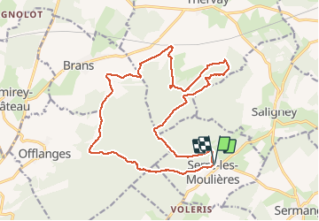
Tour Wandern von 20 km verfügbar auf Burgund und Freigrafschaft, Jura, Serre-les-Moulières. Diese Tour wird von TRIMAILLE vorgeschlagen.
Beschreibung
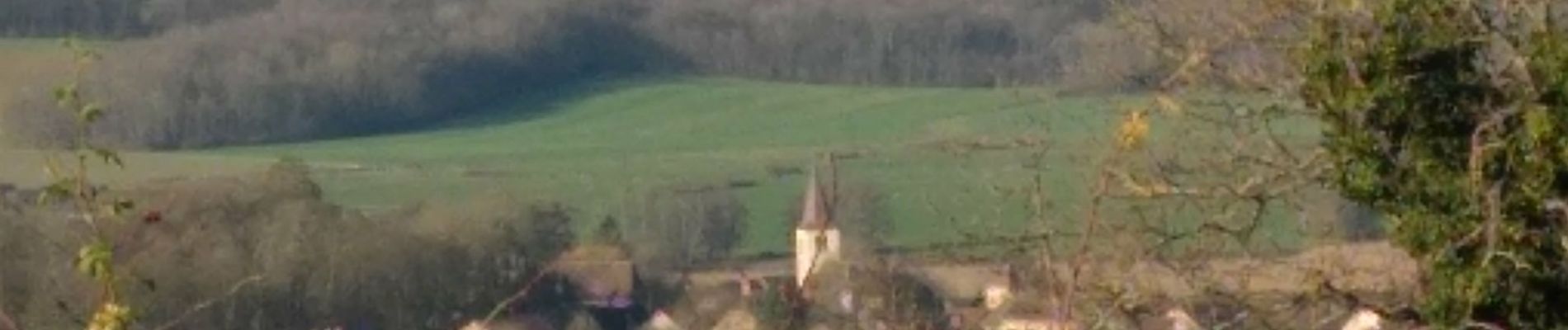
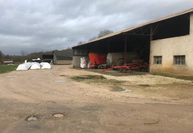
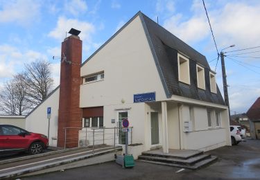
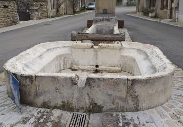
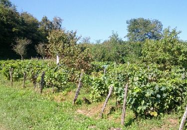
Départ du parking de l’église de Serre Les Moulières. Randonnée pour bonne partie en forêt.
Ort
Land:
France
Region :
Burgund und Freigrafschaft
Abteilung/Provinz :
Jura
Kommune :
Serre-les-Moulières
Standort:
Unknown
Gehen Sie:(Dec)
Gehen Sie:(UTM)
698188 ; 5231234 (31T) N.
Kommentare
Touren in der Umgebung
![Tour Wandern Ougney - Ougney - Photo](https://media.geolcdn.com/t/375/260/8556a756-8301-4946-bcb3-1299892476e6.jpg&format=jpg&maxdim=2)
![Wandern Wandern](https://static1.geolcdn.com/sitytour/trail-icons/101.png)
Ougney
Wandern
Einfach
(1)
Ougney,
Burgund und Freigrafschaft,
Jura,
France
![](/images/other/stat-length.png)
15,4 km | 19,8 km-effort
4h 29min
![](https://static1.geolcdn.com/siteimages/upload/files/16400158638029165_repeat_loop_refresh_sync_direction_icon.png)
Ja
![Tour Nordic Walking Vriange - Vriange - La Serre - Photo](https://media.geolcdn.com/t/375/260/ext.jpg?maxdim=2&url=https%3A%2F%2Fservices.sitytrail.com%2FGeolivesWS%2FDownloadMedia.ashx%3FTrailID%3D215897%26Media%3Dfix__20130822171149.jpg)
![Nordic Walking Nordic Walking](https://static1.geolcdn.com/sitytour/trail-icons/102.png)
Vriange - La Serre
Nordic Walking
Schwierig
(1)
Vriange,
Burgund und Freigrafschaft,
Jura,
France
![](/images/other/stat-length.png)
8,5 km | 11,4 km-effort
1h 47min
![](https://static1.geolcdn.com/siteimages/upload/files/16400158638029165_repeat_loop_refresh_sync_direction_icon.png)
Ja
![Tour Zu Fuß Ougney - Mont de Vassange - Photo](https://media.geolcdn.com/t/375/260/a82bd0f5-b7f2-4fc5-84c3-34d7e9c05f7d.jpeg&format=jpg&maxdim=2)
![Zu Fuß Zu Fuß](https://static1.geolcdn.com/sitytour/trail-icons/100.png)
Mont de Vassange
Zu Fuß
Einfach
Ougney,
Burgund und Freigrafschaft,
Jura,
France
![](/images/other/stat-length.png)
11,6 km | 15,3 km-effort
3h 28min
![](https://static1.geolcdn.com/siteimages/upload/files/16400158638029165_repeat_loop_refresh_sync_direction_icon.png)
Ja
![Tour Zu Fuß Sermange - Circuit des Fontaines - Photo](https://media.geolcdn.com/t/375/260/f006e3f6-e2e1-4693-854f-2d9b686b6d7e.jpeg&format=jpg&maxdim=2)
![Zu Fuß Zu Fuß](https://static1.geolcdn.com/sitytour/trail-icons/100.png)
Circuit des Fontaines
Zu Fuß
Einfach
Sermange,
Burgund und Freigrafschaft,
Jura,
France
![](/images/other/stat-length.png)
8,8 km | 11,1 km-effort
2h 31min
![](https://static1.geolcdn.com/siteimages/upload/files/16400158638029165_repeat_loop_refresh_sync_direction_icon.png)
Ja
![Tour Wandern Taxenne - taxenne - Photo](https://media.geolcdn.com/t/375/260/ffa89f18-ac17-443d-97ec-31e2ee860f3f.jpg&format=jpg&maxdim=2)
![Wandern Wandern](https://static1.geolcdn.com/sitytour/trail-icons/101.png)
taxenne
Wandern
Einfach
(1)
Taxenne,
Burgund und Freigrafschaft,
Jura,
France
![](/images/other/stat-length.png)
14,8 km | 18,2 km-effort
2h 22min
![](https://static1.geolcdn.com/siteimages/upload/files/16400158638029165_repeat_loop_refresh_sync_direction_icon.png)
Ja
![Tour Wandern Amange - Malange 20171009 - Photo](https://media.geolcdn.com/t/375/260/ext.jpg?maxdim=2&url=https%3A%2F%2Fstatic1.geolcdn.com%2Fsiteimages%2Fupload%2Ffiles%2F1553511878bg_sport_marche.png)
![Wandern Wandern](https://static1.geolcdn.com/sitytour/trail-icons/101.png)
Malange 20171009
Wandern
Sehr leicht
(1)
Amange,
Burgund und Freigrafschaft,
Jura,
France
![](/images/other/stat-length.png)
10 km | 13,3 km-effort
2h 45min
![](https://static1.geolcdn.com/siteimages/upload/files/16400158638029165_repeat_loop_refresh_sync_direction_icon.png)
Ja
![Tour Nordic Walking Taxenne - Taxenne - Vitreux - Rouffange - Photo](https://media.geolcdn.com/t/375/260/ext.jpg?maxdim=2&url=https%3A%2F%2Fservices.sitytrail.com%2FGeolivesWS%2FDownloadMedia.ashx%3FTrailID%3D342230%26Media%3Dfix__20140904160222.jpg)
![Nordic Walking Nordic Walking](https://static1.geolcdn.com/sitytour/trail-icons/102.png)
Taxenne - Vitreux - Rouffange
Nordic Walking
Medium
(1)
Taxenne,
Burgund und Freigrafschaft,
Jura,
France
![](/images/other/stat-length.png)
10,7 km | 14,9 km-effort
2h 43min
![](https://static1.geolcdn.com/siteimages/upload/files/16400158638029165_repeat_loop_refresh_sync_direction_icon.png)
Ja
![Tour Nordic Walking Saligney - Saligney - Mont de Vassange - Photo](https://media.geolcdn.com/t/375/260/ext.jpg?maxdim=2&url=https%3A%2F%2Fservices.sitytrail.com%2FGeolivesWS%2FDownloadMedia.ashx%3FTrailID%3D265122%26Media%3Dfix__20140410161220.jpg)
![Nordic Walking Nordic Walking](https://static1.geolcdn.com/sitytour/trail-icons/102.png)
Saligney - Mont de Vassange
Nordic Walking
Schwierig
Saligney,
Burgund und Freigrafschaft,
Jura,
France
![](/images/other/stat-length.png)
13,2 km | 17,1 km-effort
2h 37min
![](https://static1.geolcdn.com/siteimages/upload/files/16400158638029165_repeat_loop_refresh_sync_direction_icon.png)
Ja
![Tour Wandern Serre-les-Moulières - Serre les Moulières - Photo](https://media.geolcdn.com/t/375/260/ext.jpg?maxdim=2&url=https%3A%2F%2Fservices.sitytrail.com%2FGeolivesWS%2FDownloadMedia.ashx%3FTrailID%3D233789%26Media%3Dfix__20131121170136.jpg)
![Wandern Wandern](https://static1.geolcdn.com/sitytour/trail-icons/101.png)
Serre les Moulières
Wandern
Medium
(3)
Serre-les-Moulières,
Burgund und Freigrafschaft,
Jura,
France
![](/images/other/stat-length.png)
13 km | 17,5 km-effort
3h 9min
![](https://static1.geolcdn.com/siteimages/upload/files/16400158638029165_repeat_loop_refresh_sync_direction_icon.png)
Ja