![](/images/other/stat-length.png)
![Tour Wandern Beauvoir-sur-Niort - Beauvoir-sur-Niort (Rimbault) - Photo](https://media.geolcdn.com/t/1900/400/ext.pjpeg?maxdim=2&url=https%3A%2F%2Fservices.sitytrail.com%2FGeolivesWS%2FDownloadMedia.ashx%3FTrailID%3D228406%26Media%3Dfix__20131022162109.jpg)
Beauvoir-sur-Niort (Rimbault)
olaze
Benutzer
![Länge](/images/other/stat-length.png)
Länge
9,6 km
![Maximale Höhe](https://static1.geolcdn.com/siteimages/upload/files/1508320355ic_sort_altitude_max_24dp.png)
Maximale Höhe
86 m
![Positive Höhendifferenz](https://static1.geolcdn.com/siteimages/upload/files/1508320355ic_sort_den_pos_24dp.png)
Positive Höhendifferenz
81 m
![Km-Effort](/images/other/stat-length.png)
Km-Effort
10,7 km
![Min. Höhe](https://static1.geolcdn.com/siteimages/upload/files/1508320355ic_sort_altitude_min_24dp.png)
Min. Höhe
56 m
![Negative Höhendifferenz](https://static1.geolcdn.com/siteimages/upload/files/1508320355ic_sort_den_neg_24dp.png)
Negative Höhendifferenz
81 m
![Boucle](https://static1.geolcdn.com/siteimages/upload/files/16400158638029165_repeat_loop_refresh_sync_direction_icon.png)
Boucle
Ja
Erstellungsdatum :
2014-12-10 00:00:00.0
Letzte Änderung :
2014-12-10 00:00:00.0
![Wandern](https://static1.geolcdn.com/sitytour/trail-icons/101.png)
2h22
Schwierigkeit : Einfach
![Scannen Sie diesen QR-Code, um die Tour in der SityTrail-Anwendung zu öffnen](https://capi.geolives.com/qq0zvz2zws4bq2lad0pu/sitytour/trails/228406/qr.png?size=200)
Kostenlosegpshiking-Anwendung
Über SityTrail
Tour Wandern von 9,6 km verfügbar auf Neu-Aquitanien, Deux-Sèvres, Beauvoir-sur-Niort. Diese Tour wird von olaze vorgeschlagen.
Beschreibung
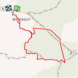
Départ & retour, Moulin de Rimbault (Beauvoir-sur-Niort).
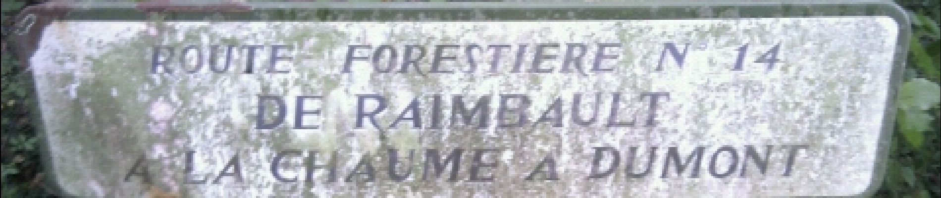
Dans la forêt de Chizé. Le plan de Rimbault.
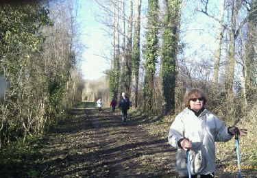
Club rando Bessines oct.2013.
Ort
Land:
France
Region :
Neu-Aquitanien
Abteilung/Provinz :
Deux-Sèvres
Kommune :
Beauvoir-sur-Niort
Standort:
Unknown
Gehen Sie:(Dec)
Gehen Sie:(UTM)
696050 ; 5116631 (30T) N.
Kommentare
Touren in der Umgebung
![Tour Wandern Granzay-Gript - Gript-8,5km-01_2014 - Photo](https://media.geolcdn.com/t/375/260/ext.jpg?maxdim=2&url=https%3A%2F%2Fservices.sitytrail.com%2FGeolivesWS%2FDownloadMedia.ashx%3FTrailID%3D242752%26Media%3Dfix__20140114152642.jpg)
![Wandern Wandern](https://static1.geolcdn.com/sitytour/trail-icons/101.png)
Gript-8,5km-01_2014
Wandern
Sehr leicht
Granzay-Gript,
Neu-Aquitanien,
Deux-Sèvres,
France
![](/images/other/stat-length.png)
8,5 km | 9 km-effort
2h 0min
![](https://static1.geolcdn.com/siteimages/upload/files/16400158638029165_repeat_loop_refresh_sync_direction_icon.png)
Ja
![Tour Laufen Beauvoir-sur-Niort - 16km - Photo](https://media.geolcdn.com/t/375/260/ext.jpg?maxdim=2&url=https%3A%2F%2Fstatic1.geolcdn.com%2Fsiteimages%2Fupload%2Ffiles%2F1524743154running.jpg)
![Laufen Laufen](https://static1.geolcdn.com/sitytour/trail-icons/103.png)
16km
Laufen
Sehr leicht
Beauvoir-sur-Niort,
Neu-Aquitanien,
Deux-Sèvres,
France
![](/images/other/stat-length.png)
16,9 km | 18,6 km-effort
1h 38min
![](https://static1.geolcdn.com/siteimages/upload/files/16400158638029165_repeat_loop_refresh_sync_direction_icon.png)
Ja
![Tour Wandern Marigny - Marigny - Photo](https://media.geolcdn.com/t/375/260/ext.jpg?maxdim=2&url=https%3A%2F%2Fstatic1.geolcdn.com%2Fsiteimages%2Fupload%2Ffiles%2F1553511878bg_sport_marche.png)
![Wandern Wandern](https://static1.geolcdn.com/sitytour/trail-icons/101.png)
Marigny
Wandern
Einfach
Marigny,
Neu-Aquitanien,
Deux-Sèvres,
France
![](/images/other/stat-length.png)
7,8 km | 8,6 km-effort
2h 7min
![](https://static1.geolcdn.com/siteimages/upload/files/16400158638029165_repeat_loop_refresh_sync_direction_icon.png)
Ja
![Tour Wandern Granzay-Gript - GRIPT 19/04/2011 - Photo](https://media.geolcdn.com/t/375/260/ext.jpg?maxdim=2&url=https%3A%2F%2Fstatic1.geolcdn.com%2Fsiteimages%2Fupload%2Ffiles%2F1553511878bg_sport_marche.png)
![Wandern Wandern](https://static1.geolcdn.com/sitytour/trail-icons/101.png)
GRIPT 19/04/2011
Wandern
Einfach
Granzay-Gript,
Neu-Aquitanien,
Deux-Sèvres,
France
![](/images/other/stat-length.png)
8,5 km | 9 km-effort
2h 20min
![](https://static1.geolcdn.com/siteimages/upload/files/16400158638029165_repeat_loop_refresh_sync_direction_icon.png)
Ja
![Tour Wandern Marigny - tgf - Photo](https://media.geolcdn.com/t/375/260/ext.jpg?maxdim=2&url=https%3A%2F%2Fstatic1.geolcdn.com%2Fsiteimages%2Fupload%2Ffiles%2F1553511878bg_sport_marche.png)
![Wandern Wandern](https://static1.geolcdn.com/sitytour/trail-icons/101.png)
![Tour Wandern Marigny - chize - Photo](https://media.geolcdn.com/t/375/260/ext.jpg?maxdim=2&url=https%3A%2F%2Fstatic1.geolcdn.com%2Fsiteimages%2Fupload%2Ffiles%2F1553511878bg_sport_marche.png)
![Wandern Wandern](https://static1.geolcdn.com/sitytour/trail-icons/101.png)
chize
Wandern
Medium
Marigny,
Neu-Aquitanien,
Deux-Sèvres,
France
![](/images/other/stat-length.png)
6,6 km | 7,3 km-effort
1h 43min
![](https://static1.geolcdn.com/siteimages/upload/files/16400158638029165_repeat_loop_refresh_sync_direction_icon.png)
Ja
![Tour Wandern Marigny - chize - Photo](https://media.geolcdn.com/t/375/260/ext.jpg?maxdim=2&url=https%3A%2F%2Fstatic1.geolcdn.com%2Fsiteimages%2Fupload%2Ffiles%2F1553511878bg_sport_marche.png)
![Wandern Wandern](https://static1.geolcdn.com/sitytour/trail-icons/101.png)
chize
Wandern
Medium
Marigny,
Neu-Aquitanien,
Deux-Sèvres,
France
![](/images/other/stat-length.png)
6,7 km | 7,3 km-effort
1h 38min
![](https://static1.geolcdn.com/siteimages/upload/files/16400158638029165_repeat_loop_refresh_sync_direction_icon.png)
Ja
![Tour Wandern Villiers-en-Bois - gghy - Photo](https://media.geolcdn.com/t/375/260/ext.jpg?maxdim=2&url=https%3A%2F%2Fstatic1.geolcdn.com%2Fsiteimages%2Fupload%2Ffiles%2F1553511878bg_sport_marche.png)
![Wandern Wandern](https://static1.geolcdn.com/sitytour/trail-icons/101.png)
gghy
Wandern
Sehr leicht
Villiers-en-Bois,
Neu-Aquitanien,
Deux-Sèvres,
France
![](/images/other/stat-length.png)
6,1 km | 6,8 km-effort
1h 41min
![](https://static1.geolcdn.com/siteimages/upload/files/16400158638029165_repeat_loop_refresh_sync_direction_icon.png)
Nein
![Tour Wandern Villiers-en-Bois - ff - Photo](https://media.geolcdn.com/t/375/260/ext.jpg?maxdim=2&url=https%3A%2F%2Fstatic1.geolcdn.com%2Fsiteimages%2Fupload%2Ffiles%2F1553511878bg_sport_marche.png)
![Wandern Wandern](https://static1.geolcdn.com/sitytour/trail-icons/101.png)
ff
Wandern
Sehr leicht
Villiers-en-Bois,
Neu-Aquitanien,
Deux-Sèvres,
France
![](/images/other/stat-length.png)
6,1 km | 6,8 km-effort
1h 41min
![](https://static1.geolcdn.com/siteimages/upload/files/16400158638029165_repeat_loop_refresh_sync_direction_icon.png)
Nein