


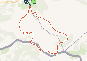

18,8 km | 27 km-effort


Benutzer GUIDE


Kostenlosegpshiking-Anwendung
 SityTrail
IGN / Geografische Institute
SityTrail World
Die Welt öffnet sich für Sie
Tour Zu Fuß von 10,3 km verfügbar auf Neu-Aquitanien, Pyrenäen-Atlantik, Urrugne. Diese Tour wird von marmotte65 vorgeschlagen.
Reco faite le 4/12/2019 avec J-c et M-j
Sortie autoroute Urrugne. Au rond point à l'entrée du village prendre la
direction d'Ibardin et aller vers Olhette continuer vers Ascain. a la sortie de Olhette
hôtel restaurant prendre le deuxième à D chemin de Xuruen-Borda
jusqu'au bout et se garer au parking sur la droite.
le PN pourra se prendre sur la frontière en dessous de la Rhune (s'il ni a pas de vent).
Ne as manquer le GR 10 pour la descente vers Olhette, et si tout se pase bien nous aurons passer une superbe journée.

Wandern

Wandern

Wandern

Wandern

Wandern

Mountainbike
Wandern
Wandern
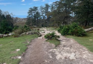
Wandern