![](/images/other/stat-length.png)
![Tour Mountainbike Lezoux - lexoux 24kms - Photo](https://media.geolcdn.com/t/1900/400/ext.pjpeg?maxdim=2&url=https%3A%2F%2Fstatic1.geolcdn.com%2Fsiteimages%2Fupload%2Ffiles%2F1524743154velo.jpg)
lexoux 24kms
loursblanc
Benutzer
![Länge](/images/other/stat-length.png)
Länge
23 km
![Maximale Höhe](https://static1.geolcdn.com/siteimages/upload/files/1508320355ic_sort_altitude_max_24dp.png)
Maximale Höhe
457 m
![Positive Höhendifferenz](https://static1.geolcdn.com/siteimages/upload/files/1508320355ic_sort_den_pos_24dp.png)
Positive Höhendifferenz
294 m
![Km-Effort](/images/other/stat-length.png)
Km-Effort
27 km
![Min. Höhe](https://static1.geolcdn.com/siteimages/upload/files/1508320355ic_sort_altitude_min_24dp.png)
Min. Höhe
310 m
![Negative Höhendifferenz](https://static1.geolcdn.com/siteimages/upload/files/1508320355ic_sort_den_neg_24dp.png)
Negative Höhendifferenz
293 m
![Boucle](https://static1.geolcdn.com/siteimages/upload/files/16400158638029165_repeat_loop_refresh_sync_direction_icon.png)
Boucle
Ja
Erstellungsdatum :
2019-11-25 13:15:28.399
Letzte Änderung :
2019-11-25 15:53:07.694
![Mountainbike](https://static1.geolcdn.com/sitytour/trail-icons/202.png)
1h48
Schwierigkeit : Medium
![Elektrofahrrad](https://static1.geolcdn.com/sitytour/trail-icons/205.png)
1h51
Schwierigkeit : Sehr leicht
![Scannen Sie diesen QR-Code, um die Tour in der SityTrail-Anwendung zu öffnen](https://capi.geolives.com/qq0zvz2zws4bq2lad0pu/sitytour/trails/2271926/qr.png?size=200)
Kostenlosegpshiking-Anwendung
Über SityTrail
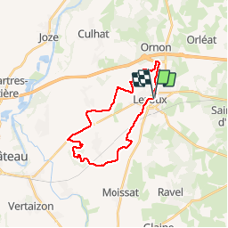
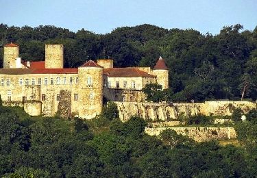
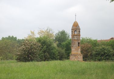
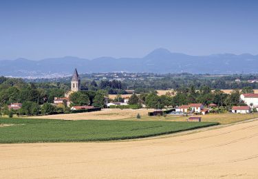
Tour Mountainbike von 23 km verfügbar auf Auvergne-Rhone-Alpen, Puy-de-Dôme, Lezoux. Diese Tour wird von loursblanc vorgeschlagen.
Beschreibung
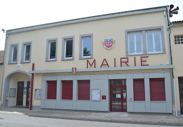
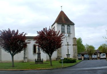
Au départ de Lezoux Place de la Mairie ou Parking proche du Musée de la poterie.
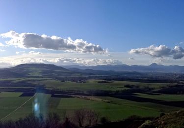
Parcours facile la seule difficulté est la montée du puy Courcourt.
KMs 11 a 13 prendre le chemin parallèle a la route.
Ort
Land:
France
Region :
Auvergne-Rhone-Alpen
Abteilung/Provinz :
Puy-de-Dôme
Kommune :
Lezoux
Standort:
Unknown
Gehen Sie:(Dec)
Gehen Sie:(UTM)
529810 ; 5075042 (31T) N.
Kommentare
Touren in der Umgebung
![Tour Zu Fuß Orléat - lezoux cote nature - Photo](https://media.geolcdn.com/t/375/260/ext.jpg?maxdim=2&url=https%3A%2F%2Fmedia.geolcdn.com%2Ff%2F35c15c2a-f157-4b0b-8a1c-3662d8159719.jpeg)
![Zu Fuß Zu Fuß](https://static1.geolcdn.com/sitytour/trail-icons/100.png)
lezoux cote nature
Zu Fuß
Einfach
Orléat,
Auvergne-Rhone-Alpen,
Puy-de-Dôme,
France
![](/images/other/stat-length.png)
14,1 km | 15,9 km-effort
3h 36min
![](https://static1.geolcdn.com/siteimages/upload/files/16400158638029165_repeat_loop_refresh_sync_direction_icon.png)
Ja
![Tour Zu Fuß Ravel - La Morille - Photo](https://media.geolcdn.com/t/375/260/ext.jpg?maxdim=2&url=https%3A%2F%2Fmedia.geolcdn.com%2Ff%2F887d8b5b-6672-48e9-999d-3b1ebb46e113.jpeg)
![Zu Fuß Zu Fuß](https://static1.geolcdn.com/sitytour/trail-icons/100.png)
La Morille
Zu Fuß
Einfach
Ravel,
Auvergne-Rhone-Alpen,
Puy-de-Dôme,
France
![](/images/other/stat-length.png)
6 km | 7,2 km-effort
1h 38min
![](https://static1.geolcdn.com/siteimages/upload/files/16400158638029165_repeat_loop_refresh_sync_direction_icon.png)
Ja
![Tour Wandern Culhat - les Berges du Litroux, 7km300,59m - Photo](https://media.geolcdn.com/t/375/260/ext.jpg?maxdim=2&url=https%3A%2F%2Fmedia.geolcdn.com%2Ff%2Fb60c59f2-2d70-4cad-a96e-175da2f9f2f4.jpg)
![Wandern Wandern](https://static1.geolcdn.com/sitytour/trail-icons/101.png)
les Berges du Litroux, 7km300,59m
Wandern
Einfach
Culhat,
Auvergne-Rhone-Alpen,
Puy-de-Dôme,
France
![](/images/other/stat-length.png)
7,3 km | 8,1 km-effort
1h 50min
![](https://static1.geolcdn.com/siteimages/upload/files/16400158638029165_repeat_loop_refresh_sync_direction_icon.png)
Ja
![Tour Wandern Ravel - Ravel_Morille - Photo](https://media.geolcdn.com/t/375/260/ext.jpg?maxdim=2&url=https%3A%2F%2Fmedia.geolcdn.com%2Ff%2F0b0ea189-6e95-4fc5-9bb4-ba786c1ac899.png)
![Wandern Wandern](https://static1.geolcdn.com/sitytour/trail-icons/101.png)
Ravel_Morille
Wandern
Medium
Ravel,
Auvergne-Rhone-Alpen,
Puy-de-Dôme,
France
![](/images/other/stat-length.png)
5,9 km | 7,1 km-effort
1h 36min
![](https://static1.geolcdn.com/siteimages/upload/files/16400158638029165_repeat_loop_refresh_sync_direction_icon.png)
Ja
![Tour Zu Fuß Culhat - Les berges du litroux - Photo](https://media.geolcdn.com/t/375/260/ext.jpg?maxdim=2&url=https%3A%2F%2Fmedia.geolcdn.com%2Ff%2Fb455793d-fd72-46b6-a443-473d5331581d.jpeg)
![Zu Fuß Zu Fuß](https://static1.geolcdn.com/sitytour/trail-icons/100.png)
Les berges du litroux
Zu Fuß
Einfach
Culhat,
Auvergne-Rhone-Alpen,
Puy-de-Dôme,
France
![](/images/other/stat-length.png)
7,3 km | 8,1 km-effort
1h 50min
![](https://static1.geolcdn.com/siteimages/upload/files/16400158638029165_repeat_loop_refresh_sync_direction_icon.png)
Ja
![Tour Zu Fuß Seychalles - La Tour de Courcourt - Photo](https://media.geolcdn.com/t/375/260/ext.jpg?maxdim=2&url=https%3A%2F%2Fmedia.geolcdn.com%2Ff%2F488550a5-a975-46c3-b3c1-9493c7f0199b.jpeg)
![Zu Fuß Zu Fuß](https://static1.geolcdn.com/sitytour/trail-icons/100.png)
La Tour de Courcourt
Zu Fuß
Einfach
Seychalles,
Auvergne-Rhone-Alpen,
Puy-de-Dôme,
France
![](/images/other/stat-length.png)
8,2 km | 10,2 km-effort
2h 18min
![](https://static1.geolcdn.com/siteimages/upload/files/16400158638029165_repeat_loop_refresh_sync_direction_icon.png)
Ja
![Tour Wandern Culhat - Culhat_Berges_Litroux - Photo](https://media.geolcdn.com/t/375/260/ext.jpg?maxdim=2&url=https%3A%2F%2Fmedia.geolcdn.com%2Ff%2F48677131-af85-4b04-960e-38dccdbd5e1c.jpg)
![Wandern Wandern](https://static1.geolcdn.com/sitytour/trail-icons/101.png)
Culhat_Berges_Litroux
Wandern
Einfach
Culhat,
Auvergne-Rhone-Alpen,
Puy-de-Dôme,
France
![](/images/other/stat-length.png)
7,2 km | 8 km-effort
2h 15min
![](https://static1.geolcdn.com/siteimages/upload/files/16400158638029165_repeat_loop_refresh_sync_direction_icon.png)
Ja
![Tour Wandern Seychalles - Seychalles_Courcourt - Photo](https://media.geolcdn.com/t/375/260/ext.jpg?maxdim=2&url=https%3A%2F%2Fmedia.geolcdn.com%2Ff%2F37d412ed-4fc4-48df-8648-8a5785ef6f4a.JPG)
![Wandern Wandern](https://static1.geolcdn.com/sitytour/trail-icons/101.png)
Seychalles_Courcourt
Wandern
Einfach
Seychalles,
Auvergne-Rhone-Alpen,
Puy-de-Dôme,
France
![](/images/other/stat-length.png)
7,7 km | 9,7 km-effort
2h 15min
![](https://static1.geolcdn.com/siteimages/upload/files/16400158638029165_repeat_loop_refresh_sync_direction_icon.png)
Ja
![Tour Wandern Saint-Jean-d'Heurs - St_Jean_Balad_Heurs - Photo](https://media.geolcdn.com/t/375/260/ext.jpg?maxdim=2&url=https%3A%2F%2Fmedia.geolcdn.com%2Ff%2F70867797-eb0a-431e-98c2-446179b70859.jpg)
![Wandern Wandern](https://static1.geolcdn.com/sitytour/trail-icons/101.png)
St_Jean_Balad_Heurs
Wandern
Einfach
Saint-Jean-d'Heurs,
Auvergne-Rhone-Alpen,
Puy-de-Dôme,
France
![](/images/other/stat-length.png)
12,1 km | 14,1 km-effort
3h 30min
![](https://static1.geolcdn.com/siteimages/upload/files/16400158638029165_repeat_loop_refresh_sync_direction_icon.png)
Ja