![](/images/other/stat-length.png)
![Tour Wandern Vielle-Aure - 2019-11-02_20h13m30_-11.o - Photo](https://media.geolcdn.com/t/1900/400/ext.pjpeg?maxdim=2&url=https%3A%2F%2Fstatic1.geolcdn.com%2Fsiteimages%2Fupload%2Ffiles%2F1553511878bg_sport_marche.png)
2019-11-02_20h13m30_-11.o
dawed311
Benutzer
![Länge](/images/other/stat-length.png)
![Maximale Höhe](https://static1.geolcdn.com/siteimages/upload/files/1508320355ic_sort_altitude_max_24dp.png)
![Positive Höhendifferenz](https://static1.geolcdn.com/siteimages/upload/files/1508320355ic_sort_den_pos_24dp.png)
![Km-Effort](/images/other/stat-length.png)
![Min. Höhe](https://static1.geolcdn.com/siteimages/upload/files/1508320355ic_sort_altitude_min_24dp.png)
![Negative Höhendifferenz](https://static1.geolcdn.com/siteimages/upload/files/1508320355ic_sort_den_neg_24dp.png)
![Boucle](https://static1.geolcdn.com/siteimages/upload/files/16400158638029165_repeat_loop_refresh_sync_direction_icon.png)
![Wandern](https://static1.geolcdn.com/sitytour/trail-icons/101.png)
2h27
Schwierigkeit : Sehr leicht
![Schneeschuhwandern](https://static1.geolcdn.com/sitytour/trail-icons/504.png)
2h27
Schwierigkeit : Medium
![Scannen Sie diesen QR-Code, um die Tour in der SityTrail-Anwendung zu öffnen](https://capi.geolives.com/qq0zvz2zws4bq2lad0pu/sitytour/trails/2256191/qr.png?size=200)
Kostenlosegpshiking-Anwendung
Über SityTrail
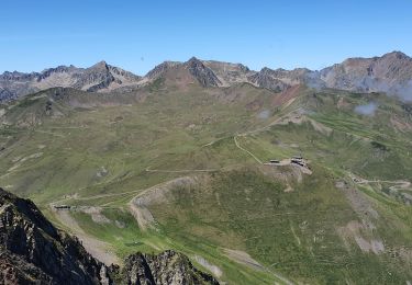
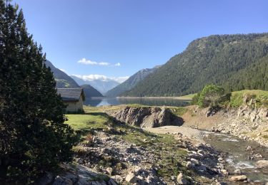
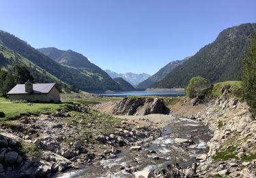
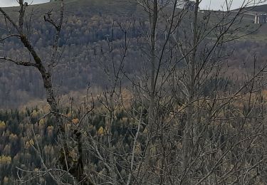
Tour Wandern von 6,7 km verfügbar auf Okzitanien, Hautes-Pyrénées, Vielle-Aure. Diese Tour wird von dawed311 vorgeschlagen.
Beschreibung
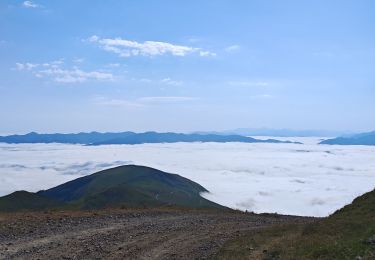
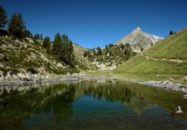
Randonnée faite d'abord en téléphérique jusqu'au col de Portet, puis en raquette. Pente raide sous le sommet, et neige dure, nous avons fini en crampons. Vue splendide au sommet sur le Bastan, la réserve du Néouvielle, mais aussi sur les pistes de ski toutes proches et bien désertes à cette époque. Le lac de l'Oule n'est pas visible du sommet, mais les lacs de Bastan, complètement enneigés, eux le sont. A refaire en été pour remise en forme. Randonnée notée très facile pour l'été, moyen pour l'hiver à cause de la pente raide et utilisation des crampons si neige dure.
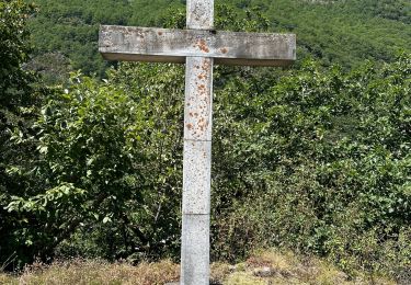
Ort
Kommentare
Touren in der Umgebung
![Tour Wandern Saint-Lary-Soulan - refuge de bastan et lacs - Photo](https://media.geolcdn.com/t/375/260/39cee356-b9bc-4599-b9dd-36b8ef943f1a.jpg&format=jpg&maxdim=2)
![Wandern Wandern](https://static1.geolcdn.com/sitytour/trail-icons/101.png)
Wandern
![](/images/other/stat-length.png)
![](https://static1.geolcdn.com/siteimages/upload/files/16400158638029165_repeat_loop_refresh_sync_direction_icon.png)
![Tour Wandern Saint-Lary-Soulan - Pène-Male par les crêtes de Heche-Barrade - Photo](https://media.geolcdn.com/t/375/260/de632eea-ef64-4a92-92e4-bd24316e8942.jpg&format=jpg&maxdim=2)
![Wandern Wandern](https://static1.geolcdn.com/sitytour/trail-icons/101.png)
Wandern
![](/images/other/stat-length.png)
![](https://static1.geolcdn.com/siteimages/upload/files/16400158638029165_repeat_loop_refresh_sync_direction_icon.png)
![Tour Wandern Saint-Lary-Soulan - 2023-09-11 Col du Portet - Lac de l'Oule - Refuge de Bastan - Photo](https://media.geolcdn.com/t/375/260/063df153-8983-4dce-b8b6-891d73f87363.jpg&format=jpg&maxdim=2)
![Wandern Wandern](https://static1.geolcdn.com/sitytour/trail-icons/101.png)
Wandern
![](/images/other/stat-length.png)
![](https://static1.geolcdn.com/siteimages/upload/files/16400158638029165_repeat_loop_refresh_sync_direction_icon.png)
![Tour Wandern Saint-Lary-Soulan - Col Portet➡️ lac Bastan - Photo](https://media.geolcdn.com/t/375/260/8dd696dc-0c4b-408a-989a-cb4edb7898d5.jpg&format=jpg&maxdim=2)
![Wandern Wandern](https://static1.geolcdn.com/sitytour/trail-icons/101.png)
Wandern
![](/images/other/stat-length.png)
![](https://static1.geolcdn.com/siteimages/upload/files/16400158638029165_repeat_loop_refresh_sync_direction_icon.png)
![Tour sport Tramezaïgues - Au dessus de tramezaigues - Photo](https://media.geolcdn.com/t/375/260/6241ad0b-d07e-4c7e-b6a4-b04d00176721.jpg&format=jpg&maxdim=2)
sport
![](/images/other/stat-length.png)
![](https://static1.geolcdn.com/siteimages/upload/files/16400158638029165_repeat_loop_refresh_sync_direction_icon.png)
![Tour Zu Fuß Aragnouet - Lacs de Bastan - Photo](https://media.geolcdn.com/t/375/260/8a4c791c-fa52-4ea3-bc46-ebf557b68975.jpeg&format=jpg&maxdim=2)
![Zu Fuß Zu Fuß](https://static1.geolcdn.com/sitytour/trail-icons/100.png)
Zu Fuß
![](/images/other/stat-length.png)
![](https://static1.geolcdn.com/siteimages/upload/files/16400158638029165_repeat_loop_refresh_sync_direction_icon.png)
![Tour Wandern Aragnouet - Le lac de l'Oule variante en passant par le bas du barrage - Photo](https://media.geolcdn.com/t/375/260/d318441e-a86c-4066-9e34-374f8b617d7a.jpg&format=jpg&maxdim=2)
![Wandern Wandern](https://static1.geolcdn.com/sitytour/trail-icons/101.png)
Wandern
![](/images/other/stat-length.png)
![](https://static1.geolcdn.com/siteimages/upload/files/16400158638029165_repeat_loop_refresh_sync_direction_icon.png)
![Tour Wandern Aragnouet - Cabane d'Artigusse - Le lac de l'Oule - Photo](https://media.geolcdn.com/t/375/260/4d3ea36b-1a56-4250-a085-6e0e65a4cda4.jpg&format=jpg&maxdim=2)
![Wandern Wandern](https://static1.geolcdn.com/sitytour/trail-icons/101.png)
Wandern
![](/images/other/stat-length.png)
![](https://static1.geolcdn.com/siteimages/upload/files/16400158638029165_repeat_loop_refresh_sync_direction_icon.png)
![Tour Wandern Saint-Lary-Soulan - Soulan - les granges de Lias - Soulan - Photo](https://media.geolcdn.com/t/375/260/3bbe5244-bcfa-48ac-8df8-d0cf387d682b.jpg&format=jpg&maxdim=2)
![Wandern Wandern](https://static1.geolcdn.com/sitytour/trail-icons/101.png)
Wandern
![](/images/other/stat-length.png)
![](https://static1.geolcdn.com/siteimages/upload/files/16400158638029165_repeat_loop_refresh_sync_direction_icon.png)