![](/images/other/stat-length.png)
![Tour Wandern Fressines - Fressines-8,5km - Photo](https://media.geolcdn.com/t/1900/400/ext.pjpeg?maxdim=2&url=https%3A%2F%2Fservices.sitytrail.com%2FGeolivesWS%2FDownloadMedia.ashx%3FTrailID%3D224755%26Media%3Dfix__20131001161142.jpg)
Fressines-8,5km
olaze
Benutzer
![Länge](/images/other/stat-length.png)
Länge
8,5 km
![Maximale Höhe](https://static1.geolcdn.com/siteimages/upload/files/1508320355ic_sort_altitude_max_24dp.png)
Maximale Höhe
120 m
![Positive Höhendifferenz](https://static1.geolcdn.com/siteimages/upload/files/1508320355ic_sort_den_pos_24dp.png)
Positive Höhendifferenz
122 m
![Km-Effort](/images/other/stat-length.png)
Km-Effort
10,2 km
![Min. Höhe](https://static1.geolcdn.com/siteimages/upload/files/1508320355ic_sort_altitude_min_24dp.png)
Min. Höhe
67 m
![Negative Höhendifferenz](https://static1.geolcdn.com/siteimages/upload/files/1508320355ic_sort_den_neg_24dp.png)
Negative Höhendifferenz
122 m
![Boucle](https://static1.geolcdn.com/siteimages/upload/files/16400158638029165_repeat_loop_refresh_sync_direction_icon.png)
Boucle
Ja
Erstellungsdatum :
2016-10-05 00:00:00.0
Letzte Änderung :
2016-10-05 00:00:00.0
![Wandern](https://static1.geolcdn.com/sitytour/trail-icons/101.png)
2h12
Schwierigkeit : Medium
![Scannen Sie diesen QR-Code, um die Tour in der SityTrail-Anwendung zu öffnen](https://capi.geolives.com/qq0zvz2zws4bq2lad0pu/sitytour/trails/224755/qr.png?size=200)
Kostenlosegpshiking-Anwendung
Über SityTrail
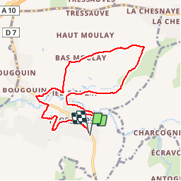
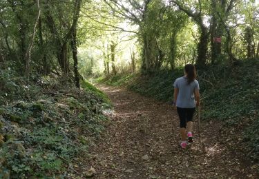
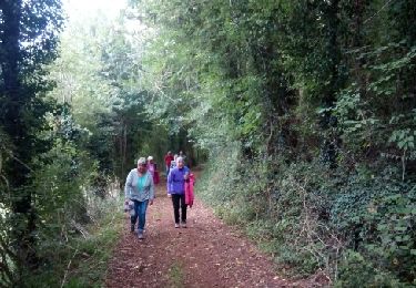
Tour Wandern von 8,5 km verfügbar auf Neu-Aquitanien, Deux-Sèvres, Fressines. Diese Tour wird von olaze vorgeschlagen.
Beschreibung
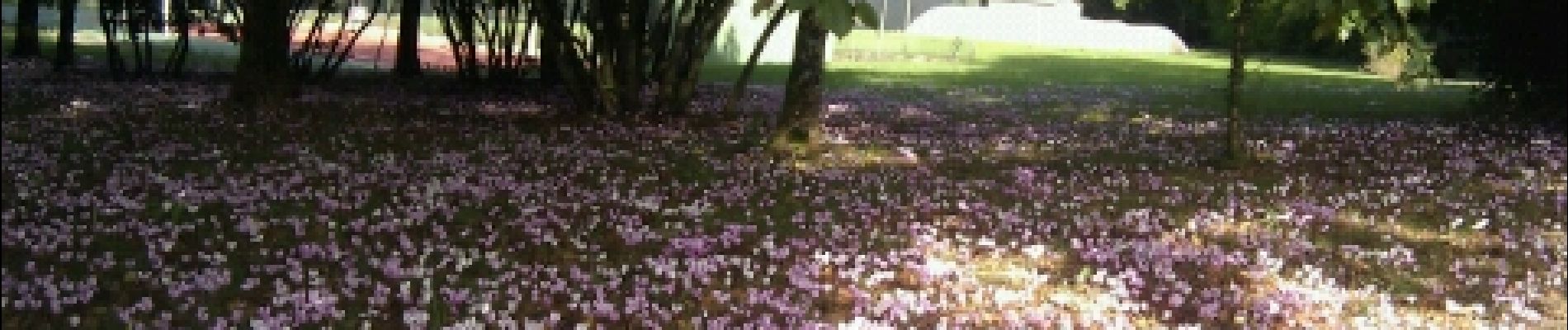
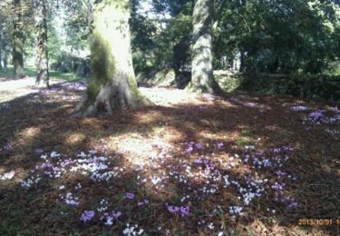
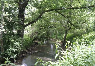
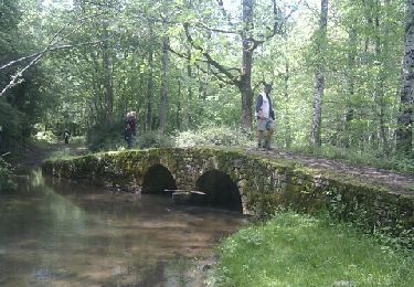
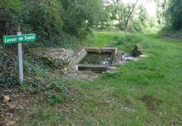
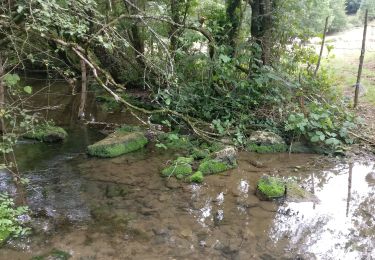
Agréable promenade autour de Fressines. Le long du Lambon et à travers les chemins souvent ombragés.version 9 km
Club rando Bessines.Octobre 2013,02/2014,10/2016
Ort
Land:
France
Region :
Neu-Aquitanien
Abteilung/Provinz :
Deux-Sèvres
Kommune :
Fressines
Standort:
Unknown
Gehen Sie:(Dec)
Gehen Sie:(UTM)
708563 ; 5133115 (30T) N.
Kommentare
Touren in der Umgebung
![Tour Wandern Fressines - Fressines-8,5km - Photo](https://media.geolcdn.com/t/375/260/ext.jpg?maxdim=2&url=https%3A%2F%2Fservices.sitytrail.com%2FGeolivesWS%2FDownloadMedia.ashx%3FTrailID%3D1043610%26Media%3D0965c3c4-63c0-4683-9b04-1ba1cf7b8e11.jpg)
![Wandern Wandern](https://static1.geolcdn.com/sitytour/trail-icons/101.png)
Fressines-8,5km
Wandern
Medium
Fressines,
Neu-Aquitanien,
Deux-Sèvres,
France
![](/images/other/stat-length.png)
8,5 km | 10,2 km-effort
2h 12min
![](https://static1.geolcdn.com/siteimages/upload/files/16400158638029165_repeat_loop_refresh_sync_direction_icon.png)
Ja
![Tour Wandern Fressines - Fressines-11,7km - Photo](https://media.geolcdn.com/t/375/260/ext.jpg?maxdim=2&url=https%3A%2F%2Fservices.sitytrail.com%2FGeolivesWS%2FDownloadMedia.ashx%3FTrailID%3D132266%26Media%3D20120605143055.jpeg)
![Wandern Wandern](https://static1.geolcdn.com/sitytour/trail-icons/101.png)
Fressines-11,7km
Wandern
Einfach
Fressines,
Neu-Aquitanien,
Deux-Sèvres,
France
![](/images/other/stat-length.png)
11,7 km | 13,7 km-effort
3h 0min
![](https://static1.geolcdn.com/siteimages/upload/files/16400158638029165_repeat_loop_refresh_sync_direction_icon.png)
Ja
![Tour Wandern Aigondigné - Thorigné (St Cous) - Photo](https://media.geolcdn.com/t/375/260/ext.jpg?maxdim=2&url=https%3A%2F%2Fservices.sitytrail.com%2FGeolivesWS%2FDownloadMedia.ashx%3FTrailID%3D129315%26Media%3D20120522160521.jpeg)
![Wandern Wandern](https://static1.geolcdn.com/sitytour/trail-icons/101.png)
Thorigné (St Cous)
Wandern
Einfach
Aigondigné,
Neu-Aquitanien,
Deux-Sèvres,
France
![](/images/other/stat-length.png)
8,7 km | 10,1 km-effort
2h 46min
![](https://static1.geolcdn.com/siteimages/upload/files/16400158638029165_repeat_loop_refresh_sync_direction_icon.png)
Ja
![Tour Wandern Fressines - 2021-09-29 Vers Fressines - Photo](https://media.geolcdn.com/t/375/260/28378c98-0e8f-4c16-b712-2d642594c8be.jpg&format=jpg&maxdim=2)
![Wandern Wandern](https://static1.geolcdn.com/sitytour/trail-icons/101.png)
2021-09-29 Vers Fressines
Wandern
Medium
Fressines,
Neu-Aquitanien,
Deux-Sèvres,
France
![](/images/other/stat-length.png)
8,4 km | 10,3 km-effort
2h 16min
![](https://static1.geolcdn.com/siteimages/upload/files/16400158638029165_repeat_loop_refresh_sync_direction_icon.png)
Ja
![Tour Wandern Aigondigné - 2021-07-26 Autour d'Aigonnay - Photo](https://media.geolcdn.com/t/375/260/99508bdd-92a4-49de-b540-92127da4177f.jpg&format=jpg&maxdim=2)
![Wandern Wandern](https://static1.geolcdn.com/sitytour/trail-icons/101.png)
2021-07-26 Autour d'Aigonnay
Wandern
Medium
Aigondigné,
Neu-Aquitanien,
Deux-Sèvres,
France
![](/images/other/stat-length.png)
19,2 km | 22 km-effort
2h 0min
![](https://static1.geolcdn.com/siteimages/upload/files/16400158638029165_repeat_loop_refresh_sync_direction_icon.png)
Nein
![Tour Wandern Aigondigné - 2019-09-09 Vers Aigonnay - Photo](https://media.geolcdn.com/t/375/260/75f33146-3b96-48ab-adc9-e41bf617b277.jpg&format=jpg&maxdim=2)
![Wandern Wandern](https://static1.geolcdn.com/sitytour/trail-icons/101.png)
2019-09-09 Vers Aigonnay
Wandern
Medium
(1)
Aigondigné,
Neu-Aquitanien,
Deux-Sèvres,
France
![](/images/other/stat-length.png)
8,7 km | 10,3 km-effort
2h 15min
![](https://static1.geolcdn.com/siteimages/upload/files/16400158638029165_repeat_loop_refresh_sync_direction_icon.png)
Ja
![Tour Wandern Vouillé - 2019-05-12 Les ponts de pierre sur le Lambon - Photo](https://media.geolcdn.com/t/375/260/4b4f099c-674a-4550-886c-d825d6a188d2.jpg&format=jpg&maxdim=2)
![Wandern Wandern](https://static1.geolcdn.com/sitytour/trail-icons/101.png)
2019-05-12 Les ponts de pierre sur le Lambon
Wandern
Medium
Vouillé,
Neu-Aquitanien,
Deux-Sèvres,
France
![](/images/other/stat-length.png)
9,5 km | 10,7 km-effort
2h 21min
![](https://static1.geolcdn.com/siteimages/upload/files/16400158638029165_repeat_loop_refresh_sync_direction_icon.png)
Ja
![Tour Wandern Fressines - Fressines-8,5km - Photo](https://media.geolcdn.com/t/375/260/cf59bf8b-5ee0-4871-899c-76be2f40d87d.jpg&format=jpg&maxdim=2)
![Wandern Wandern](https://static1.geolcdn.com/sitytour/trail-icons/101.png)
Fressines-8,5km
Wandern
Medium
Fressines,
Neu-Aquitanien,
Deux-Sèvres,
France
![](/images/other/stat-length.png)
8 km | 9,6 km-effort
2h 12min
![](https://static1.geolcdn.com/siteimages/upload/files/16400158638029165_repeat_loop_refresh_sync_direction_icon.png)
Ja
![Tour Wandern Aigondigné - AIGONNAY. 2017 - Photo](https://media.geolcdn.com/t/375/260/ext.jpg?maxdim=2&url=https%3A%2F%2Fservices.sitytrail.com%2FGeolivesWS%2FDownloadMedia.ashx%3FTrailID%3D831911%26Media%3Dfix__20170919160802.jpg)
![Wandern Wandern](https://static1.geolcdn.com/sitytour/trail-icons/101.png)
AIGONNAY. 2017
Wandern
Medium
(1)
Aigondigné,
Neu-Aquitanien,
Deux-Sèvres,
France
![](/images/other/stat-length.png)
8,8 km | 10,5 km-effort
2h 6min
![](https://static1.geolcdn.com/siteimages/upload/files/16400158638029165_repeat_loop_refresh_sync_direction_icon.png)
Ja