

Le Chêne à l'Image _ 6,8 km

Pousscailleux
Benutzer

Länge
6,8 km

Maximale Höhe
182 m

Positive Höhendifferenz
115 m

Km-Effort
8,3 km

Min. Höhe
113 m

Negative Höhendifferenz
115 m
Boucle
Ja
Erstellungsdatum :
2014-12-10 00:00:00.0
Letzte Änderung :
2014-12-10 00:00:00.0
1h48
Schwierigkeit : Einfach

Kostenlosegpshiking-Anwendung
Über SityTrail
Tour Wandern von 6,8 km verfügbar auf Nordfrankreich, Oise, Chamant. Diese Tour wird von Pousscailleux vorgeschlagen.
Beschreibung
Départ du parking du Poteau des Blancs Sablons.
Le Chêne à l'Image est un arbre vénéré sur lequel, en haut du tronc, a été installée une reproduction de la Vierge Marie.
Ort
Land:
France
Region :
Nordfrankreich
Abteilung/Provinz :
Oise
Kommune :
Chamant
Standort:
Unknown
Gehen Sie:(Dec)
Gehen Sie:(UTM)
471773 ; 5454834 (31U) N.
Kommentare
Touren in der Umgebung
MR_OGNON (par BALAGNY-sur-AUNETTE)_5.4Km


Wandern
Medium
(3)
Villers-Saint-Frambourg-Ognon,
Nordfrankreich,
Oise,
France

5,4 km | 6,4 km-effort
1h 27min
Ja
SENLIS CITE ROYALE(FFK)


Zu Fuß
Sehr leicht
(1)
Senlis,
Nordfrankreich,
Oise,
France

4,6 km | 5,2 km-effort
2h 0min
Ja

Fleurines Grand parcours


Wandern
Einfach
(1)
Fleurines,
Nordfrankreich,
Oise,
France

20 km | 24 km-effort
5h 8min
Ja

Chamant Supermini-rando


Wandern
Einfach
(8)
Chamant,
Nordfrankreich,
Oise,
France

8 km | 9,3 km-effort
2h 7min
Ja

Mont Pagnotte Grand parcours


Wandern
Medium
(2)
Pontpoint,
Nordfrankreich,
Oise,
France

16,6 km | 22 km-effort
4h 36min
Ja
randonnée Au5v OT Ccpoh halatte


Hybrid-Bike
Einfach
Fleurines,
Nordfrankreich,
Oise,
France

30 km | 35 km-effort
Unbekannt
Ja
De Orrouy à Coye


Zu Fuß
Einfach
Senlis,
Nordfrankreich,
Oise,
France

10,1 km | 11,2 km-effort
2h 33min
Nein

Chemin Royal


Zu Fuß
Einfach
Aumont-en-Halatte,
Nordfrankreich,
Oise,
France

3,5 km | 4 km-effort
54min
Nein
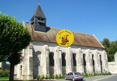
SM_OGNON-(ex BALAGNY-sur-AUNETTE)_8.3Km


Wandern
Medium
(4)
Villers-Saint-Frambourg-Ognon,
Nordfrankreich,
Oise,
France

8,3 km | 9,6 km-effort
2h 10min
Ja


 SityTrail


