![](/images/other/stat-length.png)
![Tour Wandern Vinadio - les lacs de lausfer - Photo](https://media.geolcdn.com/t/1900/400/c0b410b7-bf1c-47f3-9441-cc06a51043d6.jpg&format=pjpeg&maxdim=2)
les lacs de lausfer
GILOU440
Benutzer
![Länge](/images/other/stat-length.png)
Länge
13,1 km
![Maximale Höhe](https://static1.geolcdn.com/siteimages/upload/files/1508320355ic_sort_altitude_max_24dp.png)
Maximale Höhe
2473 m
![Positive Höhendifferenz](https://static1.geolcdn.com/siteimages/upload/files/1508320355ic_sort_den_pos_24dp.png)
Positive Höhendifferenz
673 m
![Km-Effort](/images/other/stat-length.png)
Km-Effort
22 km
![Min. Höhe](https://static1.geolcdn.com/siteimages/upload/files/1508320355ic_sort_altitude_min_24dp.png)
Min. Höhe
1998 m
![Negative Höhendifferenz](https://static1.geolcdn.com/siteimages/upload/files/1508320355ic_sort_den_neg_24dp.png)
Negative Höhendifferenz
696 m
![Boucle](https://static1.geolcdn.com/siteimages/upload/files/16400158638029165_repeat_loop_refresh_sync_direction_icon.png)
Boucle
Ja
Erstellungsdatum :
2019-10-04 07:19:37.029
Letzte Änderung :
2019-10-04 17:59:08.722
![Wandern](https://static1.geolcdn.com/sitytour/trail-icons/101.png)
5h33
Schwierigkeit : Einfach
![Scannen Sie diesen QR-Code, um die Tour in der SityTrail-Anwendung zu öffnen](https://capi.geolives.com/qq0zvz2zws4bq2lad0pu/sitytour/trails/2221954/qr.png?size=200)
Kostenlosegpshiking-Anwendung
Über SityTrail
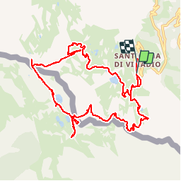
Tour Wandern von 13,1 km verfügbar auf Piemont, Cuneo, Vinadio. Diese Tour wird von GILOU440 vorgeschlagen.
Beschreibung
départ du sanctuaire de saint anne et de vinadio.
la durée est moindre car nous avons beaucoup flâner.
rando donnée pour 3h30
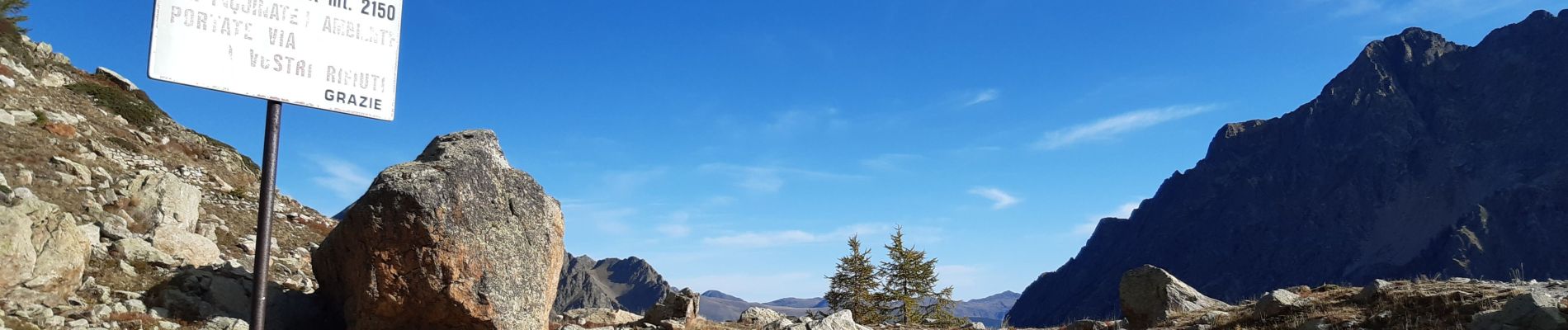
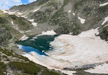
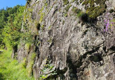
Ort
Land:
Italy
Region :
Piemont
Abteilung/Provinz :
Cuneo
Kommune :
Vinadio
Standort:
Unknown
Gehen Sie:(Dec)
Gehen Sie:(UTM)
348739 ; 4899099 (32T) N.
Kommentare
Touren in der Umgebung
![Tour Wandern Isola - Châtaigneraie ISOLA - Photo](https://media.geolcdn.com/t/375/260/ext.jpg?maxdim=2&url=https%3A%2F%2Fservices.sitytrail.com%2FGeolivesWS%2FDownloadMedia.ashx%3FTrailID%3D470503%26Media%3D20150910120215.jpg)
![Wandern Wandern](https://static1.geolcdn.com/sitytour/trail-icons/101.png)
Châtaigneraie ISOLA
Wandern
Sehr leicht
(1)
Isola,
Provence-Alpes-Côte d'Azur,
Seealpen,
France
![](/images/other/stat-length.png)
4,4 km | 7,1 km-effort
2h 9min
![](https://static1.geolcdn.com/siteimages/upload/files/16400158638029165_repeat_loop_refresh_sync_direction_icon.png)
Ja
![Tour Andere Aktivitäten Isola - Isola 2000 baisse Druos refuge Quesa - Photo](https://media.geolcdn.com/t/375/260/ext.jpg?maxdim=2&url=https%3A%2F%2Fservices.sitytrail.com%2FGeolivesWS%2FDownloadMedia.ashx%3FTrailID%3D631831%26Media%3Dfix__20160806152443.jpg)
![Andere Aktivitäten Andere Aktivitäten](https://static1.geolcdn.com/sitytour/trail-icons/900.png)
Isola 2000 baisse Druos refuge Quesa
Andere Aktivitäten
Sehr leicht
(1)
Isola,
Provence-Alpes-Côte d'Azur,
Seealpen,
France
![](/images/other/stat-length.png)
21 km | 35 km-effort
8h 5min
![](https://static1.geolcdn.com/siteimages/upload/files/16400158638029165_repeat_loop_refresh_sync_direction_icon.png)
Ja
![Tour Zu Fuß Vinadio - Tour du Lausfer - Photo](https://media.geolcdn.com/t/375/260/cc4c2b4d-e173-4a84-be7d-4686c9701dd6.jpeg&format=jpg&maxdim=2)
![Zu Fuß Zu Fuß](https://static1.geolcdn.com/sitytour/trail-icons/100.png)
![Tour Zu Fuß Vinadio - (SI E13) Sant'Anna di Vinadio - Vinadio Frazione Strepeis - Photo](https://media.geolcdn.com/t/375/260/2964e30b-263b-42c3-aa1c-ecaafebd0df1.jpeg&format=jpg&maxdim=2)
![Zu Fuß Zu Fuß](https://static1.geolcdn.com/sitytour/trail-icons/100.png)
(SI E13) Sant'Anna di Vinadio - Vinadio Frazione Strepeis
Zu Fuß
Einfach
Vinadio,
Piemont,
Cuneo,
Italy
![](/images/other/stat-length.png)
9,1 km | 16,1 km-effort
3h 40min
![](https://static1.geolcdn.com/siteimages/upload/files/16400158638029165_repeat_loop_refresh_sync_direction_icon.png)
Nein
![Tour Wandern Vinadio - Cime de la Lombarde 2800m 26.8.24 - Photo](https://media.geolcdn.com/t/375/260/a90fbc15-b832-4be5-b4ba-c6dcb34efb02.jpg&format=jpg&maxdim=2)
![Wandern Wandern](https://static1.geolcdn.com/sitytour/trail-icons/101.png)
Cime de la Lombarde 2800m 26.8.24
Wandern
Sehr schwierig
Vinadio,
Piemont,
Cuneo,
Italy
![](/images/other/stat-length.png)
3,4 km | 9,1 km-effort
2h 30min
![](https://static1.geolcdn.com/siteimages/upload/files/16400158638029165_repeat_loop_refresh_sync_direction_icon.png)
Ja
![Tour Wandern Vinadio - Tour du Lausfer 25.8.24 - Photo](https://media.geolcdn.com/t/375/260/72863bea-5e16-4036-8653-9180a45481ca.jpg&format=jpg&maxdim=2)
![Wandern Wandern](https://static1.geolcdn.com/sitytour/trail-icons/101.png)
Tour du Lausfer 25.8.24
Wandern
Medium
Vinadio,
Piemont,
Cuneo,
Italy
![](/images/other/stat-length.png)
9 km | 16,2 km-effort
3h 30min
![](https://static1.geolcdn.com/siteimages/upload/files/16400158638029165_repeat_loop_refresh_sync_direction_icon.png)
Ja
![Tour sport Vinadio - Lacs de laisser - Photo](https://media.geolcdn.com/t/375/260/3bdd8a54-1c52-4a56-821f-1ccd76f561b6.jpg&format=jpg&maxdim=2)
Lacs de laisser
sport
Sehr leicht
Vinadio,
Piemont,
Cuneo,
Italy
![](/images/other/stat-length.png)
12,4 km | 21 km-effort
Unbekannt
![](https://static1.geolcdn.com/siteimages/upload/files/16400158638029165_repeat_loop_refresh_sync_direction_icon.png)
Ja
![Tour Wandern Isola - Fontaine St Laurent par Collet de Léchio et Cascade de Louch Isola Village - Photo](https://media.geolcdn.com/t/375/260/db3d6713-0c9e-4c65-af5d-a138b43add5e.jpg&format=jpg&maxdim=2)
![Wandern Wandern](https://static1.geolcdn.com/sitytour/trail-icons/101.png)
Fontaine St Laurent par Collet de Léchio et Cascade de Louch Isola Village
Wandern
Einfach
Isola,
Provence-Alpes-Côte d'Azur,
Seealpen,
France
![](/images/other/stat-length.png)
9,5 km | 16,3 km-effort
4h 44min
![](https://static1.geolcdn.com/siteimages/upload/files/16400158638029165_repeat_loop_refresh_sync_direction_icon.png)
Ja
![Tour Schneeschuhwandern Isola - Cime de Tavels - Photo](https://media.geolcdn.com/t/375/260/47b87ec6-cb26-4b85-87fc-e2f750781dc5.jpg&format=jpg&maxdim=2)
![Schneeschuhwandern Schneeschuhwandern](https://static1.geolcdn.com/sitytour/trail-icons/504.png)
Cime de Tavels
Schneeschuhwandern
Sehr schwierig
Isola,
Provence-Alpes-Côte d'Azur,
Seealpen,
France
![](/images/other/stat-length.png)
8 km | 17,8 km-effort
6h 42min
![](https://static1.geolcdn.com/siteimages/upload/files/16400158638029165_repeat_loop_refresh_sync_direction_icon.png)
Ja