![](/images/other/stat-length.png)
![Tour Zu Fuß Saint-Privat-de-Champclos - L'ermitage de St Ferreol -St Privat de Champclos-03/10/19 - Photo](https://media.geolcdn.com/t/1900/400/f8065411-a577-4e77-b480-7e9c274c2fda.jpg&format=pjpeg&maxdim=2)
L'ermitage de St Ferreol -St Privat de Champclos-03/10/19
fario
Benutzer
![Länge](/images/other/stat-length.png)
![Maximale Höhe](https://static1.geolcdn.com/siteimages/upload/files/1508320355ic_sort_altitude_max_24dp.png)
![Positive Höhendifferenz](https://static1.geolcdn.com/siteimages/upload/files/1508320355ic_sort_den_pos_24dp.png)
![Km-Effort](/images/other/stat-length.png)
![Min. Höhe](https://static1.geolcdn.com/siteimages/upload/files/1508320355ic_sort_altitude_min_24dp.png)
![Negative Höhendifferenz](https://static1.geolcdn.com/siteimages/upload/files/1508320355ic_sort_den_neg_24dp.png)
![Boucle](https://static1.geolcdn.com/siteimages/upload/files/16400158638029165_repeat_loop_refresh_sync_direction_icon.png)
![Zu Fuß](https://static1.geolcdn.com/sitytour/trail-icons/100.png)
4h54
Schwierigkeit : Medium
![Scannen Sie diesen QR-Code, um die Tour in der SityTrail-Anwendung zu öffnen](https://capi.geolives.com/qq0zvz2zws4bq2lad0pu/sitytour/trails/2220956/qr.png?size=200)
Kostenlosegpshiking-Anwendung
Über SityTrail
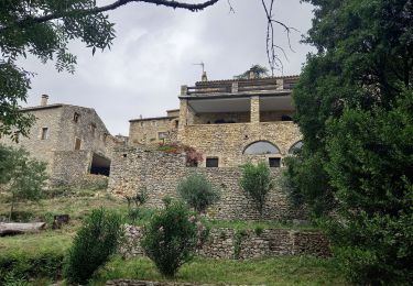
Tour Zu Fuß von 15,2 km verfügbar auf Okzitanien, Gard, Saint-Privat-de-Champclos. Diese Tour wird von fario vorgeschlagen.
Beschreibung
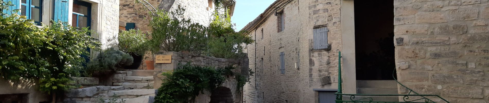
Randonnée agréable au départ de la Mairie de Champclos,
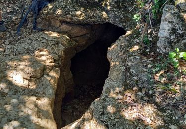
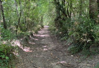
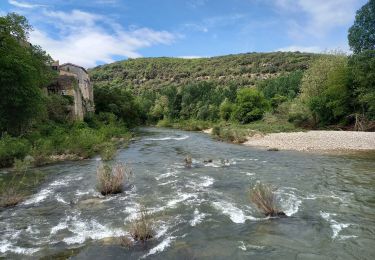
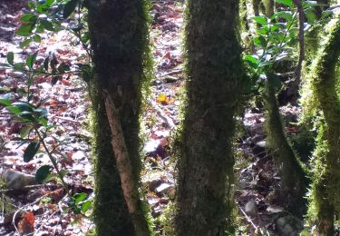
Nous traversons Cabiac, très beau village et nous allons au serre du Barri au nous montons à l'Oppidum, dont il ne reste que le tour sur un chemin de pierre. Nous allons à l'ermitage de St Ferréol, belle bâtisse, avec une petite chapelle ouverte (assez rare). Nous descendons à la Cèze où nous piqueniquons . Après le repas nous repartons et rapidement une belle montée assez raide s'offre à notre digestion. Puis nous allons au château de Ferreyrolles , beaux vestiges surplombant la Cèze. Retour par le sentier de découverte / santé .
Ort
Kommentare
Touren in der Umgebung
![Tour Wandern Saint-Privat-de-Champclos - Château de Ferreyrolle - Photo](https://media.geolcdn.com/t/375/260/6d35cd9d-375d-4f33-83e5-2813e967a743.jpg&format=jpg&maxdim=2)
![Wandern Wandern](https://static1.geolcdn.com/sitytour/trail-icons/101.png)
Wandern
![](/images/other/stat-length.png)
![](https://static1.geolcdn.com/siteimages/upload/files/16400158638029165_repeat_loop_refresh_sync_direction_icon.png)
![Tour Wandern Tharaux - Tharaux - Photo](https://media.geolcdn.com/t/375/260/01bc6044-7c62-4cc1-8831-f55311bb9329.jpg&format=jpg&maxdim=2)
![Wandern Wandern](https://static1.geolcdn.com/sitytour/trail-icons/101.png)
![Tour Wandern Montclus - Montclus - Photo](https://media.geolcdn.com/t/375/260/5b5dca1f-e2f4-40c9-83d1-740385f65a5b.jpg&format=jpg&maxdim=2)
![Wandern Wandern](https://static1.geolcdn.com/sitytour/trail-icons/101.png)
![Tour Wandern Montclus - montclus - Photo](https://media.geolcdn.com/t/375/260/fc92434c-2f04-4c3b-985b-744df58331b6.jpg&format=jpg&maxdim=2)
![Wandern Wandern](https://static1.geolcdn.com/sitytour/trail-icons/101.png)
![Tour Wandern Tharaux - Tharaux la Cèze - Photo](https://media.geolcdn.com/t/375/260/4bdb970c-b0f9-4e30-b3b2-4f135c4250be.jpg&format=jpg&maxdim=2)
![Wandern Wandern](https://static1.geolcdn.com/sitytour/trail-icons/101.png)
![Tour Wandern Méjannes-le-Clap - Méjane le Clap-la Ceze - Photo](https://media.geolcdn.com/t/375/260/8b5b47a2-d6b0-403d-bb1d-98739d33c39b.jpg&format=jpg&maxdim=2)
![Wandern Wandern](https://static1.geolcdn.com/sitytour/trail-icons/101.png)
Wandern
![](/images/other/stat-length.png)
![](https://static1.geolcdn.com/siteimages/upload/files/16400158638029165_repeat_loop_refresh_sync_direction_icon.png)
![Tour Wandern Tharaux - Randonnée Tharaux - Photo](https://media.geolcdn.com/t/375/260/aeffd296-c647-4a25-8735-0527452388ed.jpg&format=jpg&maxdim=2)
![Wandern Wandern](https://static1.geolcdn.com/sitytour/trail-icons/101.png)
Wandern
![](/images/other/stat-length.png)
![](https://static1.geolcdn.com/siteimages/upload/files/16400158638029165_repeat_loop_refresh_sync_direction_icon.png)
![Tour Wandern Méjannes-le-Clap - SVG 180627 - Photo](https://media.geolcdn.com/t/375/260/ext.jpg?maxdim=2&url=https%3A%2F%2Fservices.sitytrail.com%2FGeolivesWS%2FDownloadMedia.ashx%3FTrailID%3D995085%26Media%3Dfix__20180627111203.jpg)
![Wandern Wandern](https://static1.geolcdn.com/sitytour/trail-icons/101.png)
Wandern
![](/images/other/stat-length.png)
![](https://static1.geolcdn.com/siteimages/upload/files/16400158638029165_repeat_loop_refresh_sync_direction_icon.png)
![Tour Wandern Méjannes-le-Clap - 180627 EnCours - Photo](https://media.geolcdn.com/t/375/260/ext.jpg?maxdim=2&url=https%3A%2F%2Fservices.sitytrail.com%2FGeolivesWS%2FDownloadMedia.ashx%3FTrailID%3D995084%26Media%3Dfix__20180627111203.jpg)
![Wandern Wandern](https://static1.geolcdn.com/sitytour/trail-icons/101.png)
Wandern
![](/images/other/stat-length.png)
![](https://static1.geolcdn.com/siteimages/upload/files/16400158638029165_repeat_loop_refresh_sync_direction_icon.png)