![](/images/other/stat-length.png)
![Tour Wandern Rebecq - RB-BW-15-raccourci 2 - Flânerie entre Senne et Coeurcq - Photo](https://media.geolcdn.com/t/1900/400/ext.pjpeg?maxdim=2&url=https%3A%2F%2Fservices.sitytrail.com%2FGeolivesWS%2FDownloadMedia.ashx%3FTrailID%3D221652%26Media%3D1bf86fcb-c1a5-4116-8d1a-312b51935dfd.jpg)
RB-BW-15-raccourci 2 - Flânerie entre Senne et Coeurcq
GR Rando
Randonnez sur et autour des GR ® wallons (Sentiers de Grande Randonnée). PRO
![Länge](/images/other/stat-length.png)
![Maximale Höhe](https://static1.geolcdn.com/siteimages/upload/files/1508320355ic_sort_altitude_max_24dp.png)
![Positive Höhendifferenz](https://static1.geolcdn.com/siteimages/upload/files/1508320355ic_sort_den_pos_24dp.png)
![Km-Effort](/images/other/stat-length.png)
![Min. Höhe](https://static1.geolcdn.com/siteimages/upload/files/1508320355ic_sort_altitude_min_24dp.png)
![Negative Höhendifferenz](https://static1.geolcdn.com/siteimages/upload/files/1508320355ic_sort_den_neg_24dp.png)
![Boucle](https://static1.geolcdn.com/siteimages/upload/files/16400158638029165_repeat_loop_refresh_sync_direction_icon.png)
![Wandern](https://static1.geolcdn.com/sitytour/trail-icons/101.png)
7h13
Schwierigkeit : Sehr schwierig
![Scannen Sie diesen QR-Code, um die Tour in der SityTrail-Anwendung zu öffnen](https://capi.geolives.com/qq0zvz2zws4bq2lad0pu/sitytour/trails/221652/qr.png?size=200)
Kostenlosegpshiking-Anwendung
Über SityTrail
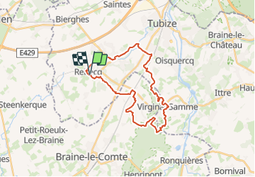
Tour Wandern von 26 km verfügbar auf Wallonien, Wallonisch-Brabant, Rebecq. Diese Tour wird von GR Rando vorgeschlagen.
Beschreibung
Rebecq – Hennuyères – Tubize – Quenast – Rebecq
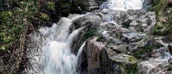
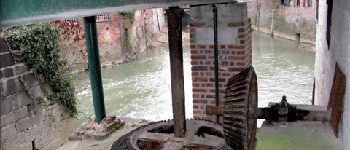
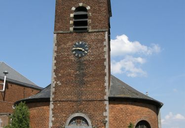
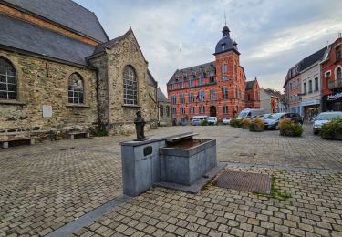
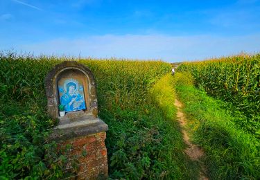
Ce périple varié alterne tout d’abord chemins et sentiers, dans une campagne bien tranquille. Après quelques montagnes russes, il s’incline ensuite, doucement, vers les vallées du Coeurcq et de la Senne. Souvent tracé au plus près de ces deux rivières, il enchantera ceux qui raffolent de traversées de prairies, de tourniquets, échaliers et autres chicanes. Cerises sur le gâteau, à Rebecq : les anciens hospices et le moulin d’Arenberg.
Cartographie et documentation
Cartes IGN au 1 : 20 000, 39/1-2 « Rebecq – Ittre » et 39/5-6 « Braine-le-Comte –
Feluy ».
Topo-guide du GR 12 « Amsterdam – Bruxelles – Paris ».
Où se désaltérer et se restaurer
- À Rebecq, la taverne du Moulin d’Arenberg, fermée le lundi, offre une carte avec
les bières artisanales de la brasserie Lefèbvre. Juste à côté, la taverne-restaurant
« Au petit pont ». À deux pas, à la Grand-Place, « Le Morreale », « Le Petit En Cas »
et «Le Cercle » (pointage du TBW). La buvette de l’ancienne gare est ouverte les jours d’activité du Petit train du Bonheur.
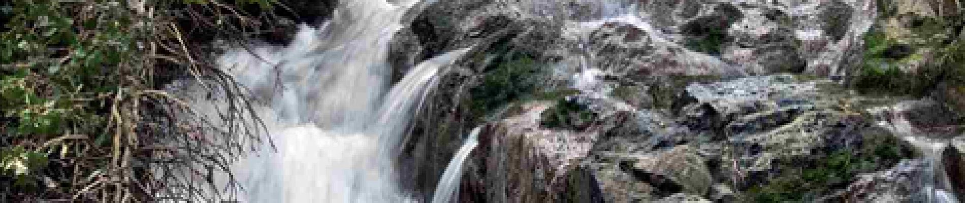
- Aux étangs de Coeurcq, il y a la buvette des pêcheurs
et un bistrot, « La Cascade de Coeurcq ».
- À Quenast, sur la place, la taverne du 30/40 et, à proximité,
le restaurant « la Ferme du Faubourg ».
Ort
Kommentare
Touren in der Umgebung
![Tour Wandern Rebecq - RB-BW-15-raccourci 1 - Flânerie entre Senne et Coeurcq - Photo](https://media.geolcdn.com/t/375/260/ext.jpg?maxdim=2&url=https%3A%2F%2Fservices.sitytrail.com%2FGeolivesWS%2FDownloadMedia.ashx%3FTrailID%3D221651%26Media%3D1bf86fcb-c1a5-4116-8d1a-312b51935dfd.jpg)
![Wandern Wandern](https://static1.geolcdn.com/sitytour/trail-icons/101.png)
Wandern
![](/images/other/stat-length.png)
![](https://static1.geolcdn.com/siteimages/upload/files/16400158638029165_repeat_loop_refresh_sync_direction_icon.png)
![Tour Wandern Rebecq - RB-Bw-15_Rebecq - Photo](https://media.geolcdn.com/t/375/260/ext.jpg?maxdim=2&url=https%3A%2F%2Fservices.sitytrail.com%2FGeolivesWS%2FDownloadMedia.ashx%3FTrailID%3D179590%26Media%3D1bf86fcb-c1a5-4116-8d1a-312b51935dfd.jpg)
![Wandern Wandern](https://static1.geolcdn.com/sitytour/trail-icons/101.png)
Wandern
![](/images/other/stat-length.png)
![](https://static1.geolcdn.com/siteimages/upload/files/16400158638029165_repeat_loop_refresh_sync_direction_icon.png)
![Wandern Wandern](https://static1.geolcdn.com/sitytour/trail-icons/101.png)
Wandern
![](/images/other/stat-length.png)
![](https://static1.geolcdn.com/siteimages/upload/files/16400158638029165_repeat_loop_refresh_sync_direction_icon.png)
![Wandern Wandern](https://static1.geolcdn.com/sitytour/trail-icons/101.png)
Wandern
![](/images/other/stat-length.png)
![](https://static1.geolcdn.com/siteimages/upload/files/16400158638029165_repeat_loop_refresh_sync_direction_icon.png)
![Tour Wandern Tubize - Balade à Tubize - Photo](https://media.geolcdn.com/t/375/260/69d74dbc-0628-4bb4-9bfb-952693a1a5ea.jpeg&format=jpg&maxdim=2)
![Wandern Wandern](https://static1.geolcdn.com/sitytour/trail-icons/101.png)
Wandern
![](/images/other/stat-length.png)
![](https://static1.geolcdn.com/siteimages/upload/files/16400158638029165_repeat_loop_refresh_sync_direction_icon.png)
![Tour Wandern Braine-le-Comte - Marche Adeps à Hennuyères - Photo](https://media.geolcdn.com/t/375/260/608847fe-1474-47cf-90a3-fcd797c276e0.jpeg&format=jpg&maxdim=2)
![Wandern Wandern](https://static1.geolcdn.com/sitytour/trail-icons/101.png)
Wandern
![](/images/other/stat-length.png)
![](https://static1.geolcdn.com/siteimages/upload/files/16400158638029165_repeat_loop_refresh_sync_direction_icon.png)
![Tour Wandern Tubize - rass 20 kms 2019 - Photo](https://media.geolcdn.com/t/375/260/ext.jpg?maxdim=2&url=https%3A%2F%2Fstatic1.geolcdn.com%2Fsiteimages%2Fupload%2Ffiles%2F1553511878bg_sport_marche.png)
![Wandern Wandern](https://static1.geolcdn.com/sitytour/trail-icons/101.png)
Wandern
![](/images/other/stat-length.png)
![](https://static1.geolcdn.com/siteimages/upload/files/16400158638029165_repeat_loop_refresh_sync_direction_icon.png)
![Tour Wandern Tubize - rass 10 kms 2019 - Photo](https://media.geolcdn.com/t/375/260/ext.jpg?maxdim=2&url=https%3A%2F%2Fstatic1.geolcdn.com%2Fsiteimages%2Fupload%2Ffiles%2F1553511878bg_sport_marche.png)
![Wandern Wandern](https://static1.geolcdn.com/sitytour/trail-icons/101.png)
Wandern
![](/images/other/stat-length.png)
![](https://static1.geolcdn.com/siteimages/upload/files/16400158638029165_repeat_loop_refresh_sync_direction_icon.png)
![Tour Wandern Ittre - virginal 0118 - Photo](https://media.geolcdn.com/t/375/260/ext.jpg?maxdim=2&url=https%3A%2F%2Fstatic1.geolcdn.com%2Fsiteimages%2Fupload%2Ffiles%2F1553511878bg_sport_marche.png)
![Wandern Wandern](https://static1.geolcdn.com/sitytour/trail-icons/101.png)
Wandern
![](/images/other/stat-length.png)
![](https://static1.geolcdn.com/siteimages/upload/files/16400158638029165_repeat_loop_refresh_sync_direction_icon.png)
sympathique randonnée champêtre.
très agréable