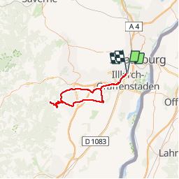
![](/images/other/stat-length.png)
![Tour Rennrad Ostwald - Sortie piste et route - Photo](https://media.geolcdn.com/t/1900/400/9fb28e6a-dc46-49cf-9443-8a3b97e7f318.jpg&format=pjpeg&maxdim=2)
Sortie piste et route
26051010
Benutzer
![Länge](/images/other/stat-length.png)
![Maximale Höhe](https://static1.geolcdn.com/siteimages/upload/files/1508320355ic_sort_altitude_max_24dp.png)
![Positive Höhendifferenz](https://static1.geolcdn.com/siteimages/upload/files/1508320355ic_sort_den_pos_24dp.png)
![Km-Effort](/images/other/stat-length.png)
![Min. Höhe](https://static1.geolcdn.com/siteimages/upload/files/1508320355ic_sort_altitude_min_24dp.png)
![Negative Höhendifferenz](https://static1.geolcdn.com/siteimages/upload/files/1508320355ic_sort_den_neg_24dp.png)
![Boucle](https://static1.geolcdn.com/siteimages/upload/files/16400158638029165_repeat_loop_refresh_sync_direction_icon.png)
![Rennrad](https://static1.geolcdn.com/sitytour/trail-icons/201.png)
4h15
Schwierigkeit : Medium
![Scannen Sie diesen QR-Code, um die Tour in der SityTrail-Anwendung zu öffnen](https://capi.geolives.com/qq0zvz2zws4bq2lad0pu/sitytour/trails/2190050/qr.png?size=200)
Kostenlosegpshiking-Anwendung
Über SityTrail
Tour Rennrad von 72 km verfügbar auf Großer Osten, Unterelsass, Ostwald. Diese Tour wird von 26051010 vorgeschlagen.
Beschreibung
Sortie piste et route
Départ Ostwald direction Geispolsheim Gare
Geispolsheim -Blaesheim à Blaesheim prendre
Direction Hindisheim une petite route bien
Tranquille jusqu’à l’intersection direction
Krautergersheim à la fin du village prendre
à gauche direction Obernai -St-Leonard-
Ottrott -Klingenthal petite visite de la
manufacture - d’armes blanches
Puis redirection Ottrott vers St-Nabor
pour prendre la piste chemin des carrières
Portes Bonheur jusqu’à Rosheim
Griesheim-près-Molsheim -Innenheim- piste
sur Blaesheim Geispolsheim et ostwald
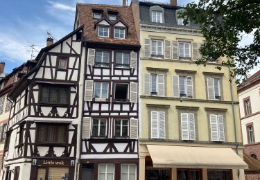
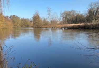
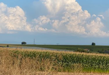
Ort
Kommentare
Touren in der Umgebung
![Tour Wandern Straßburg - Strasbourg - Centre historique - Photo](https://media.geolcdn.com/t/375/260/ext.jpg?maxdim=2&url=https%3A%2F%2Fservices.sitytrail.com%2FGeolivesWS%2FDownloadMedia.ashx%3FTrailID%3D714530%26Media%3Dfix__20170315162311.jpg)
![Wandern Wandern](https://static1.geolcdn.com/sitytour/trail-icons/101.png)
Wandern
![](/images/other/stat-length.png)
![](https://static1.geolcdn.com/siteimages/upload/files/16400158638029165_repeat_loop_refresh_sync_direction_icon.png)
![Tour Wandern Straßburg - Untitled - Photo](https://media.geolcdn.com/t/375/260/ext.jpg?maxdim=2&url=https%3A%2F%2Fservices.sitytrail.com%2FGeolivesWS%2FDownloadMedia.ashx%3FTrailID%3D378325%26Media%3D20150118104613.jpg)
![Wandern Wandern](https://static1.geolcdn.com/sitytour/trail-icons/101.png)
Wandern
![](/images/other/stat-length.png)
![](https://static1.geolcdn.com/siteimages/upload/files/16400158638029165_repeat_loop_refresh_sync_direction_icon.png)
![Tour Wandern Straßburg - Strasbourg Krutenau Université - Photo](https://media.geolcdn.com/t/375/260/8cbb56df-c20b-4a21-8b38-d84143e8ba5e.jpg&format=jpg&maxdim=2)
![Wandern Wandern](https://static1.geolcdn.com/sitytour/trail-icons/101.png)
Wandern
![](/images/other/stat-length.png)
![](https://static1.geolcdn.com/siteimages/upload/files/16400158638029165_repeat_loop_refresh_sync_direction_icon.png)
![Tour sport Wolfisheim - 20241213 Wolfisheim - Photo](https://media.geolcdn.com/t/375/260/b82d77db-7d71-4ee9-aaab-c2a4d356d4d1.jpg&format=jpg&maxdim=2)
sport
![](/images/other/stat-length.png)
![](https://static1.geolcdn.com/siteimages/upload/files/16400158638029165_repeat_loop_refresh_sync_direction_icon.png)
![Tour Wandern Ostwald - Tayla - Photo](https://media.geolcdn.com/t/375/260/236e4d72-747b-45d2-ae4f-84e3c8bc8c57.jpg&format=jpg&maxdim=2)
![Wandern Wandern](https://static1.geolcdn.com/sitytour/trail-icons/101.png)
![Tour Wandern Ostwald - Lundi - Photo](https://media.geolcdn.com/t/375/260/7f259d80-50fa-422a-96ef-cd2ae8fbda1c.jpg&format=jpg&maxdim=2)
![Wandern Wandern](https://static1.geolcdn.com/sitytour/trail-icons/101.png)
Wandern
![](/images/other/stat-length.png)
![](https://static1.geolcdn.com/siteimages/upload/files/16400158638029165_repeat_loop_refresh_sync_direction_icon.png)
![Tour Elektrofahrrad Ostwald - Promenade Vosges - Photo](https://media.geolcdn.com/t/375/260/f9c256ef-dfcd-431d-8977-ca099c8aa398.jpg&format=jpg&maxdim=2)
![Elektrofahrrad Elektrofahrrad](https://static1.geolcdn.com/sitytour/trail-icons/205.png)
Elektrofahrrad
![](/images/other/stat-length.png)
![](https://static1.geolcdn.com/siteimages/upload/files/16400158638029165_repeat_loop_refresh_sync_direction_icon.png)
![Tour Elektrofahrrad Ostwald - Nideck carrefour des Pandours - Photo](https://media.geolcdn.com/t/375/260/e2ea2c89-1b62-4f65-a986-fc596c752bcf.jpg&format=jpg&maxdim=2)
![Elektrofahrrad Elektrofahrrad](https://static1.geolcdn.com/sitytour/trail-icons/205.png)
Elektrofahrrad
![](/images/other/stat-length.png)
![](https://static1.geolcdn.com/siteimages/upload/files/16400158638029165_repeat_loop_refresh_sync_direction_icon.png)
![Tour Mountainbike Ostwald - Ostwald Etang du loup - Photo](https://media.geolcdn.com/t/375/260/b25b355f-15e8-48e3-8757-005d4424f736.jpg&format=jpg&maxdim=2)
![Mountainbike Mountainbike](https://static1.geolcdn.com/sitytour/trail-icons/202.png)
Mountainbike
![](/images/other/stat-length.png)
![](https://static1.geolcdn.com/siteimages/upload/files/16400158638029165_repeat_loop_refresh_sync_direction_icon.png)