


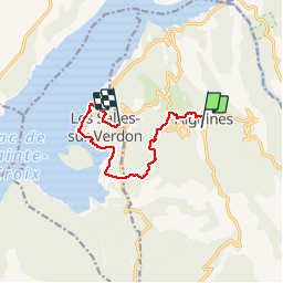

16,8 km | 31 km-effort


Benutzer


Kostenlosegpshiking-Anwendung
 SityTrail
IGN / Geografische Institute
SityTrail World
Die Welt öffnet sich für Sie
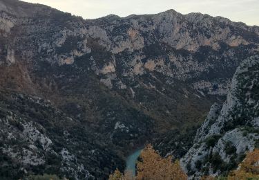
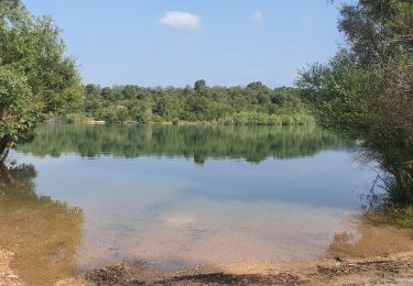
Tour Wandern von 8,9 km verfügbar auf Provence-Alpes-Côte d'Azur, Var, Aiguines. Diese Tour wird von marchev vorgeschlagen.
départ salles hôtel hermitage. Visite du très joli village d'Aiguines et retour par les plages et baignade. Petite randonnée sympathique. Nous arrivons à l'hôtel Hermitage


Wandern
Wandern
Wandern

Wandern
Wandern
Wandern
Wandern
Wandern
Wandern