


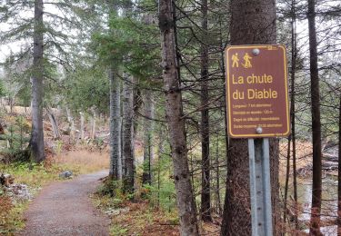
4,5 km | 7 km-effort


Benutzer GUIDE


Kostenlosegpshiking-Anwendung
 SityTrail
IGN / Geografische Institute
SityTrail World
Die Welt öffnet sich für Sie
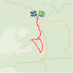
Tour Wandern von 17 km verfügbar auf Québec, La Haute-Gaspésie, Mont-Albert. Diese Tour wird von Alizée.pee vorgeschlagen.
Randonnée avec un dénivelé assez important mais qui en vaut la peine ! Agréable en été comme en hiver. De magnifiques paysages.

Wandern
Wandern
Wandern
Wandern
Wandern
Wandern
Wandern
Wandern
Wandern