


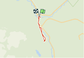

4,5 km | 7 km-effort


Benutzer GUIDE


Kostenlosegpshiking-Anwendung
 SityTrail
IGN / Geografische Institute
SityTrail World
Die Welt öffnet sich für Sie
Tour Wandern von 7,1 km verfügbar auf Québec, La Haute-Gaspésie, Mont-Albert. Diese Tour wird von Alizée.pee vorgeschlagen.
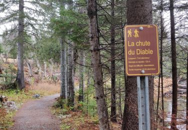
Randonnée très agréable un peu caillouteuse. Magnifique cascade. Conviens à tous les niveaux de compétence. Cette randonnée se situe près du Lac-Supérieur.

Wandern
Wandern
Wandern
Wandern
Wandern
Wandern
Wandern
Wandern
Wandern