![](/images/other/stat-length.png)
![Tour Wandern Auzet - AUZET Le Fanget .Le Clot du Bouc o l s - Photo](https://media.geolcdn.com/t/1900/400/dcfc1c1b-ce16-49e9-8c09-defdd504d644.jpg&format=pjpeg&maxdim=2)
AUZET Le Fanget .Le Clot du Bouc o l s
RobinMicheline
Benutzer GUIDE
![Länge](/images/other/stat-length.png)
Länge
15,7 km
![Maximale Höhe](https://static1.geolcdn.com/siteimages/upload/files/1508320355ic_sort_altitude_max_24dp.png)
Maximale Höhe
1952 m
![Positive Höhendifferenz](https://static1.geolcdn.com/siteimages/upload/files/1508320355ic_sort_den_pos_24dp.png)
Positive Höhendifferenz
621 m
![Km-Effort](/images/other/stat-length.png)
Km-Effort
24 km
![Min. Höhe](https://static1.geolcdn.com/siteimages/upload/files/1508320355ic_sort_altitude_min_24dp.png)
Min. Höhe
1450 m
![Negative Höhendifferenz](https://static1.geolcdn.com/siteimages/upload/files/1508320355ic_sort_den_neg_24dp.png)
Negative Höhendifferenz
623 m
![Boucle](https://static1.geolcdn.com/siteimages/upload/files/16400158638029165_repeat_loop_refresh_sync_direction_icon.png)
Boucle
Ja
Erstellungsdatum :
2019-08-15 03:52:16.561
Letzte Änderung :
2020-04-01 16:26:51.942
![Wandern](https://static1.geolcdn.com/sitytour/trail-icons/101.png)
6h27
Schwierigkeit : Medium
![Scannen Sie diesen QR-Code, um die Tour in der SityTrail-Anwendung zu öffnen](https://capi.geolives.com/qq0zvz2zws4bq2lad0pu/sitytour/trails/2171502/qr.png?size=200)
Kostenlosegpshiking-Anwendung
Über SityTrail
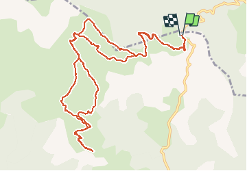
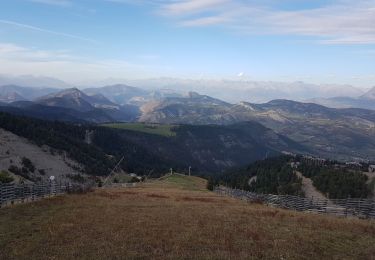
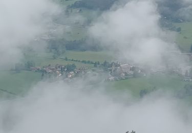
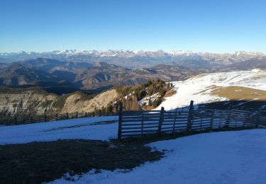
Tour Wandern von 15,7 km verfügbar auf Provence-Alpes-Côte d'Azur, Alpes-de-Haute-Provence, Auzet. Diese Tour wird von RobinMicheline vorgeschlagen.
Beschreibung
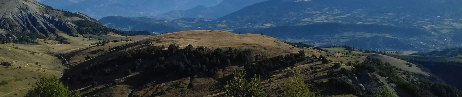
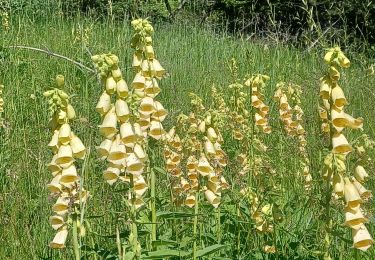
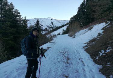
5 h marche 16 kms 700 me dénivelé vu chamois marmottes vue à 360 degré au sommet magnifique
Ort
Land:
France
Region :
Provence-Alpes-Côte d'Azur
Abteilung/Provinz :
Alpes-de-Haute-Provence
Kommune :
Auzet
Standort:
Unknown
Gehen Sie:(Dec)
Gehen Sie:(UTM)
286903 ; 4911772 (32T) N.
Kommentare
Touren in der Umgebung
![Tour Wandern Selonnet - Chabanon-Chauvet 06-08-2017 - Photo](https://media.geolcdn.com/t/375/260/ext.jpg?maxdim=2&url=https%3A%2F%2Fstatic1.geolcdn.com%2Fsiteimages%2Fupload%2Ffiles%2F1553511878bg_sport_marche.png)
![Wandern Wandern](https://static1.geolcdn.com/sitytour/trail-icons/101.png)
Chabanon-Chauvet 06-08-2017
Wandern
Sehr leicht
(1)
Selonnet,
Provence-Alpes-Côte d'Azur,
Alpes-de-Haute-Provence,
France
![](/images/other/stat-length.png)
8,7 km | 12 km-effort
3h 50min
![](https://static1.geolcdn.com/siteimages/upload/files/16400158638029165_repeat_loop_refresh_sync_direction_icon.png)
Ja
![Tour Wandern Auzet - Auzet marzenc 993m 17kms - Photo](https://media.geolcdn.com/t/375/260/9853ba02-1e45-4039-9d76-c79724a3a31a.jpg&format=jpg&maxdim=2)
![Wandern Wandern](https://static1.geolcdn.com/sitytour/trail-icons/101.png)
Auzet marzenc 993m 17kms
Wandern
Medium
Auzet,
Provence-Alpes-Côte d'Azur,
Alpes-de-Haute-Provence,
France
![](/images/other/stat-length.png)
16,4 km | 28 km-effort
7h 23min
![](https://static1.geolcdn.com/siteimages/upload/files/16400158638029165_repeat_loop_refresh_sync_direction_icon.png)
Nein
![Tour Schneeschuhwandern Selonnet - chabanon selonnet 442m 7.5kms - Photo](https://media.geolcdn.com/t/375/260/0359f5d5-74db-4e3b-9b64-b3fb764b8d12.jpg&format=jpg&maxdim=2)
![Schneeschuhwandern Schneeschuhwandern](https://static1.geolcdn.com/sitytour/trail-icons/504.png)
chabanon selonnet 442m 7.5kms
Schneeschuhwandern
Einfach
Selonnet,
Provence-Alpes-Côte d'Azur,
Alpes-de-Haute-Provence,
France
![](/images/other/stat-length.png)
6,5 km | 11,9 km-effort
5h 2min
![](https://static1.geolcdn.com/siteimages/upload/files/16400158638029165_repeat_loop_refresh_sync_direction_icon.png)
Ja
![Tour Wandern Auzet - Col du Fanget - Photo](https://media.geolcdn.com/t/375/260/cf6079d8-6531-4519-888f-9f3fb1a9e26a.jpg&format=jpg&maxdim=2)
![Wandern Wandern](https://static1.geolcdn.com/sitytour/trail-icons/101.png)
Col du Fanget
Wandern
Sehr leicht
Auzet,
Provence-Alpes-Côte d'Azur,
Alpes-de-Haute-Provence,
France
![](/images/other/stat-length.png)
7,1 km | 9,9 km-effort
3h 35min
![](https://static1.geolcdn.com/siteimages/upload/files/16400158638029165_repeat_loop_refresh_sync_direction_icon.png)
Ja
![Tour Wandern Auzet - AUZET. COL DE LA PINEE . LE MARZENC . N . O L - Photo](https://media.geolcdn.com/t/375/260/57c3a040-1098-4fee-8a46-8cd116133a23.jpg&format=jpg&maxdim=2)
![Wandern Wandern](https://static1.geolcdn.com/sitytour/trail-icons/101.png)
AUZET. COL DE LA PINEE . LE MARZENC . N . O L
Wandern
Schwierig
Auzet,
Provence-Alpes-Côte d'Azur,
Alpes-de-Haute-Provence,
France
![](/images/other/stat-length.png)
11,7 km | 22 km-effort
3h 47min
![](https://static1.geolcdn.com/siteimages/upload/files/16400158638029165_repeat_loop_refresh_sync_direction_icon.png)
Ja
![Tour Wandern Selonnet - Tête Grosse - Photo](https://media.geolcdn.com/t/375/260/1ee91be0-c069-4334-9021-aaf88212d0f7.jpg&format=jpg&maxdim=2)
![Wandern Wandern](https://static1.geolcdn.com/sitytour/trail-icons/101.png)
Tête Grosse
Wandern
Medium
Selonnet,
Provence-Alpes-Côte d'Azur,
Alpes-de-Haute-Provence,
France
![](/images/other/stat-length.png)
9,2 km | 16,2 km-effort
3h 24min
![](https://static1.geolcdn.com/siteimages/upload/files/16400158638029165_repeat_loop_refresh_sync_direction_icon.png)
Ja
![Tour Wandern Seyne - SEYNES LES ALPES Bas et haut Chardavon , balade de la Rochette , ravin des Ganiayes , les Côtes n - Photo](https://media.geolcdn.com/t/375/260/e6f88ff0-a947-4b7f-a63d-1284f3398514.jpg&format=jpg&maxdim=2)
![Wandern Wandern](https://static1.geolcdn.com/sitytour/trail-icons/101.png)
SEYNES LES ALPES Bas et haut Chardavon , balade de la Rochette , ravin des G...
Wandern
Medium
Seyne,
Provence-Alpes-Côte d'Azur,
Alpes-de-Haute-Provence,
France
![](/images/other/stat-length.png)
10,6 km | 17,8 km-effort
3h 10min
![](https://static1.geolcdn.com/siteimages/upload/files/16400158638029165_repeat_loop_refresh_sync_direction_icon.png)
Ja
![Tour Wandern Selonnet - Tête Grosse 250122 - Photo](https://media.geolcdn.com/t/375/260/f5527992-a088-4f5b-b304-a264fde7c7e7.jpg&format=jpg&maxdim=2)
![Wandern Wandern](https://static1.geolcdn.com/sitytour/trail-icons/101.png)
Tête Grosse 250122
Wandern
Sehr leicht
Selonnet,
Provence-Alpes-Côte d'Azur,
Alpes-de-Haute-Provence,
France
![](/images/other/stat-length.png)
10,3 km | 17,6 km-effort
5h 26min
![](https://static1.geolcdn.com/siteimages/upload/files/16400158638029165_repeat_loop_refresh_sync_direction_icon.png)
Ja
![Tour Wandern Selonnet - Chabanon 230122 - Photo](https://media.geolcdn.com/t/375/260/ff34c742-06db-49f8-bae4-a13e5627de29.jpg&format=jpg&maxdim=2)
![Wandern Wandern](https://static1.geolcdn.com/sitytour/trail-icons/101.png)
Chabanon 230122
Wandern
Sehr leicht
Selonnet,
Provence-Alpes-Côte d'Azur,
Alpes-de-Haute-Provence,
France
![](/images/other/stat-length.png)
7,8 km | 11,4 km-effort
3h 1min
![](https://static1.geolcdn.com/siteimages/upload/files/16400158638029165_repeat_loop_refresh_sync_direction_icon.png)
Nein