![](/images/other/stat-length.png)
![Tour Wandern Livarot-Pays-d'Auge - Cerqueux - Photo](https://media.geolcdn.com/t/1900/400/2f45acee-67f3-45b7-9c60-c3e7bdd88b3b.jpg&format=pjpeg&maxdim=2)
Cerqueux
Eve - Line
Benutzer
![Länge](/images/other/stat-length.png)
Länge
8,2 km
![Maximale Höhe](https://static1.geolcdn.com/siteimages/upload/files/1508320355ic_sort_altitude_max_24dp.png)
Maximale Höhe
206 m
![Positive Höhendifferenz](https://static1.geolcdn.com/siteimages/upload/files/1508320355ic_sort_den_pos_24dp.png)
Positive Höhendifferenz
74 m
![Km-Effort](/images/other/stat-length.png)
Km-Effort
9,1 km
![Min. Höhe](https://static1.geolcdn.com/siteimages/upload/files/1508320355ic_sort_altitude_min_24dp.png)
Min. Höhe
164 m
![Negative Höhendifferenz](https://static1.geolcdn.com/siteimages/upload/files/1508320355ic_sort_den_neg_24dp.png)
Negative Höhendifferenz
74 m
![Boucle](https://static1.geolcdn.com/siteimages/upload/files/16400158638029165_repeat_loop_refresh_sync_direction_icon.png)
Boucle
Ja
Erstellungsdatum :
2019-08-07 11:31:53.815
Letzte Änderung :
2019-08-07 13:41:46.409
![Wandern](https://static1.geolcdn.com/sitytour/trail-icons/101.png)
2h08
Schwierigkeit : Einfach
![Scannen Sie diesen QR-Code, um die Tour in der SityTrail-Anwendung zu öffnen](https://capi.geolives.com/qq0zvz2zws4bq2lad0pu/sitytour/trails/2162931/qr.png?size=200)
Kostenlosegpshiking-Anwendung
Über SityTrail
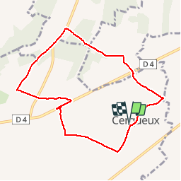
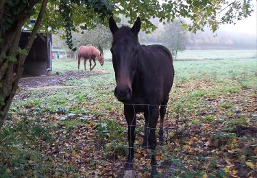
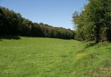
Tour Wandern von 8,2 km verfügbar auf Normandie, Calvados, Livarot-Pays-d'Auge. Diese Tour wird von Eve - Line vorgeschlagen.
Beschreibung
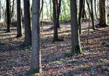
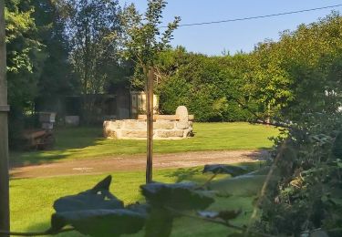
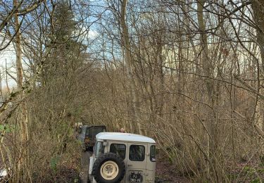
Départ église de Cerqueux. Prendre en photo le circuit et suivre le balisage de randonnée bleu. La photo du circuit servira de plan car le balisage est manquant à certains endroits. Bonne rando
Ort
Land:
France
Region :
Normandie
Abteilung/Provinz :
Calvados
Kommune :
Livarot-Pays-d'Auge
Standort:
Unknown
Gehen Sie:(Dec)
Gehen Sie:(UTM)
307051 ; 5430168 (31U) N.
Kommentare
Touren in der Umgebung
![Tour Wandern Cernay - A l'Est de Cernay - Photo](https://media.geolcdn.com/t/375/260/ext.jpg?maxdim=2&url=https%3A%2F%2Fservices.sitytrail.com%2FGeolivesWS%2FDownloadMedia.ashx%3FTrailID%3D317507%26Media%3D16746_6.jpg)
![Wandern Wandern](https://static1.geolcdn.com/sitytour/trail-icons/101.png)
A l'Est de Cernay
Wandern
Medium
(1)
Cernay,
Normandie,
Calvados,
France
![](/images/other/stat-length.png)
8 km | 9,5 km-effort
2h 0min
![](https://static1.geolcdn.com/siteimages/upload/files/16400158638029165_repeat_loop_refresh_sync_direction_icon.png)
Ja
![Tour Wandern Cernay - Au sud de Cernay - Photo](https://media.geolcdn.com/t/375/260/ext.jpg?maxdim=2&url=https%3A%2F%2Fservices.sitytrail.com%2FGeolivesWS%2FDownloadMedia.ashx%3FTrailID%3D317506%26Media%3D16744_6.jpg)
![Wandern Wandern](https://static1.geolcdn.com/sitytour/trail-icons/101.png)
Au sud de Cernay
Wandern
Medium
Cernay,
Normandie,
Calvados,
France
![](/images/other/stat-length.png)
13,8 km | 15,8 km-effort
3h 10min
![](https://static1.geolcdn.com/siteimages/upload/files/16400158638029165_repeat_loop_refresh_sync_direction_icon.png)
Ja
![Tour Motor Cernay - Cernay-Bernay13/10/13 - Photo](https://media.geolcdn.com/t/375/260/ext.jpg?maxdim=2&url=https%3A%2F%2Fstatic1.geolcdn.com%2Fsiteimages%2Fupload%2Ffiles%2F15247431544x4.jpg)
![Motor Motor](https://static1.geolcdn.com/sitytour/trail-icons/400.png)
Cernay-Bernay13/10/13
Motor
Sehr leicht
(1)
Cernay,
Normandie,
Calvados,
France
![](/images/other/stat-length.png)
33 km | 38 km-effort
1h 0min
![](https://static1.geolcdn.com/siteimages/upload/files/16400158638029165_repeat_loop_refresh_sync_direction_icon.png)
Nein
![Tour Wandern Livarot-Pays-d'Auge - Cerqueux (14) - Photo](https://media.geolcdn.com/t/375/260/fa66af0f-7d93-434d-88a9-997e464e8dc8.jpg&format=jpg&maxdim=2)
![Wandern Wandern](https://static1.geolcdn.com/sitytour/trail-icons/101.png)
Cerqueux (14)
Wandern
Medium
Livarot-Pays-d'Auge,
Normandie,
Calvados,
France
![](/images/other/stat-length.png)
15,8 km | 18,1 km-effort
3h 43min
![](https://static1.geolcdn.com/siteimages/upload/files/16400158638029165_repeat_loop_refresh_sync_direction_icon.png)
Ja
![Tour Wandern Cernay - Cernay - Photo](https://media.geolcdn.com/t/375/260/03fd9fe7-3bc3-40b8-9afd-a9b466cf0429.jpg&format=jpg&maxdim=2)
![Wandern Wandern](https://static1.geolcdn.com/sitytour/trail-icons/101.png)
![Tour 4x4 Livarot-Pays-d'Auge - Sortie après midi 19/01/2020 - Photo](https://media.geolcdn.com/t/375/260/11ac66eb-d1b2-4f2b-bc0a-5b40b7846ffa.jpg&format=jpg&maxdim=2)
![4x4 4x4](https://static1.geolcdn.com/sitytour/trail-icons/403.png)
Sortie après midi 19/01/2020
4x4
Livarot-Pays-d'Auge,
Normandie,
Calvados,
France
![](/images/other/stat-length.png)
57 km | 68 km-effort
3h 44min
![](https://static1.geolcdn.com/siteimages/upload/files/16400158638029165_repeat_loop_refresh_sync_direction_icon.png)
Nein
![Tour Wandern La Vespière-Friardel - La Vespiere - Photo](https://media.geolcdn.com/t/375/260/da48bb98-df54-46a8-9e2f-aee2a972f759.jpg&format=jpg&maxdim=2)
![Wandern Wandern](https://static1.geolcdn.com/sitytour/trail-icons/101.png)
La Vespiere
Wandern
Medium
La Vespière-Friardel,
Normandie,
Calvados,
France
![](/images/other/stat-length.png)
22 km | 27 km-effort
4h 22min
![](https://static1.geolcdn.com/siteimages/upload/files/16400158638029165_repeat_loop_refresh_sync_direction_icon.png)
Ja
![Tour Wandern Livarot-Pays-d'Auge - Balade autour de Préaux St Sébastien - Photo](https://media.geolcdn.com/t/375/260/ext.jpg?maxdim=2&url=https%3A%2F%2Fservices.sitytrail.com%2FGeolivesWS%2FDownloadMedia.ashx%3FTrailID%3D172980%26Media%3D14471_2.jpg)
![Wandern Wandern](https://static1.geolcdn.com/sitytour/trail-icons/101.png)
Balade autour de Préaux St Sébastien
Wandern
Medium
Livarot-Pays-d'Auge,
Normandie,
Calvados,
France
![](/images/other/stat-length.png)
17,6 km | 19,8 km-effort
3h 30min
![](https://static1.geolcdn.com/siteimages/upload/files/16400158638029165_repeat_loop_refresh_sync_direction_icon.png)
Ja
![Tour Wandern La Folletière-Abenon - Source de l'Orbiquet avec Cressonnière - Photo](https://media.geolcdn.com/t/375/260/ext.jpg?maxdim=2&url=https%3A%2F%2Fstatic1.geolcdn.com%2Fsiteimages%2Fupload%2Ffiles%2F1553511878bg_sport_marche.png)
![Wandern Wandern](https://static1.geolcdn.com/sitytour/trail-icons/101.png)
Source de l'Orbiquet avec Cressonnière
Wandern
Einfach
La Folletière-Abenon,
Normandie,
Calvados,
France
![](/images/other/stat-length.png)
14,1 km | 17,5 km-effort
3h 58min
![](https://static1.geolcdn.com/siteimages/upload/files/16400158638029165_repeat_loop_refresh_sync_direction_icon.png)
Ja