![](/images/other/stat-length.png)
![Tour Mountainbike Noirmoutier-en-l'Île - Le gois - Photo](https://media.geolcdn.com/t/1900/400/ext.pjpeg?maxdim=2&url=https%3A%2F%2Fservices.sitytrail.com%2FGeolivesWS%2FDownloadMedia.ashx%3FTrailID%3D215581%26Media%3Dfix__20130821135917.jpg)
Le gois
malc
Benutzer
![Länge](/images/other/stat-length.png)
Länge
73 km
![Maximale Höhe](https://static1.geolcdn.com/siteimages/upload/files/1508320355ic_sort_altitude_max_24dp.png)
Maximale Höhe
15 m
![Positive Höhendifferenz](https://static1.geolcdn.com/siteimages/upload/files/1508320355ic_sort_den_pos_24dp.png)
Positive Höhendifferenz
211 m
![Km-Effort](/images/other/stat-length.png)
Km-Effort
75 km
![Min. Höhe](https://static1.geolcdn.com/siteimages/upload/files/1508320355ic_sort_altitude_min_24dp.png)
Min. Höhe
-4 m
![Negative Höhendifferenz](https://static1.geolcdn.com/siteimages/upload/files/1508320355ic_sort_den_neg_24dp.png)
Negative Höhendifferenz
211 m
![Boucle](https://static1.geolcdn.com/siteimages/upload/files/16400158638029165_repeat_loop_refresh_sync_direction_icon.png)
Boucle
Ja
Erstellungsdatum :
2014-12-10 00:00:00.0
Letzte Änderung :
2014-12-10 00:00:00.0
![Mountainbike](https://static1.geolcdn.com/sitytour/trail-icons/202.png)
4h28
Schwierigkeit : Schwierig
![Scannen Sie diesen QR-Code, um die Tour in der SityTrail-Anwendung zu öffnen](https://capi.geolives.com/qq0zvz2zws4bq2lad0pu/sitytour/trails/215581/qr.png?size=200)
Kostenlosegpshiking-Anwendung
Über SityTrail
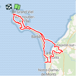
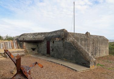
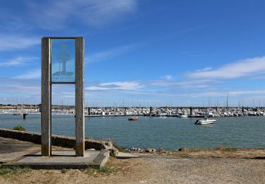
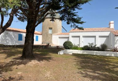
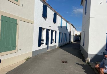
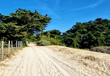
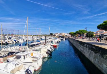
Tour Mountainbike von 73 km verfügbar auf Pays de la Loire, Vendée, Noirmoutier-en-l'Île. Diese Tour wird von malc vorgeschlagen.
Beschreibung
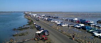
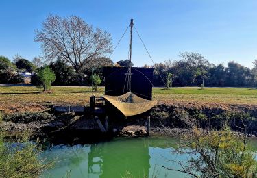
Longue randonnée qui passe par le Gois (a faire marée basse). Il y a moyen de d'améliorer le tracé vers la Barre de Monts pour aller en forêt.
Ort
Land:
France
Region :
Pays de la Loire
Abteilung/Provinz :
Vendée
Kommune :
Noirmoutier-en-l'Île
Standort:
Unknown
Gehen Sie:(Dec)
Gehen Sie:(UTM)
553615 ; 5207352 (30T) N.
Kommentare
Touren in der Umgebung
![Tour Wandern L'Épine - Les Marais de Luzeronde - Photo](https://media.geolcdn.com/t/375/260/ext.jpg?maxdim=2&url=https%3A%2F%2Fstatic1.geolcdn.com%2Fsiteimages%2Fupload%2Ffiles%2F1553511878bg_sport_marche.png)
![Wandern Wandern](https://static1.geolcdn.com/sitytour/trail-icons/101.png)
Les Marais de Luzeronde
Wandern
Medium
(1)
L'Épine,
Pays de la Loire,
Vendée,
France
![](/images/other/stat-length.png)
6,9 km | 7,3 km-effort
1h 39min
![](https://static1.geolcdn.com/siteimages/upload/files/16400158638029165_repeat_loop_refresh_sync_direction_icon.png)
Ja
![Tour Zu Fuß Noirmoutier-en-l'Île - Roses trémières - Photo](https://media.geolcdn.com/t/375/260/504a4f09-026b-4f3b-a144-9641852cfb05.jpeg&format=jpg&maxdim=2)
![Zu Fuß Zu Fuß](https://static1.geolcdn.com/sitytour/trail-icons/100.png)
Roses trémières
Zu Fuß
Einfach
Noirmoutier-en-l'Île,
Pays de la Loire,
Vendée,
France
![](/images/other/stat-length.png)
5,5 km | 5,7 km-effort
1h 18min
![](https://static1.geolcdn.com/siteimages/upload/files/16400158638029165_repeat_loop_refresh_sync_direction_icon.png)
Ja
![Tour Zu Fuß La Guérinière - En Passant par les Moulins - Photo](https://media.geolcdn.com/t/375/260/ccc103f2-0cff-4e2a-b30b-b4e364a262b4.jpeg&format=jpg&maxdim=2)
![Zu Fuß Zu Fuß](https://static1.geolcdn.com/sitytour/trail-icons/100.png)
En Passant par les Moulins
Zu Fuß
Einfach
La Guérinière,
Pays de la Loire,
Vendée,
France
![](/images/other/stat-length.png)
12,1 km | 13 km-effort
2h 56min
![](https://static1.geolcdn.com/siteimages/upload/files/16400158638029165_repeat_loop_refresh_sync_direction_icon.png)
Nein
![Tour Zu Fuß L'Épine - Chemin de mer et de marais - Photo](https://media.geolcdn.com/t/375/260/ded2016b-df3d-4278-8be0-d3af6896ca41.jpeg&format=jpg&maxdim=2)
![Zu Fuß Zu Fuß](https://static1.geolcdn.com/sitytour/trail-icons/100.png)
Chemin de mer et de marais
Zu Fuß
Einfach
L'Épine,
Pays de la Loire,
Vendée,
France
![](/images/other/stat-length.png)
8,1 km | 8,5 km-effort
1h 55min
![](https://static1.geolcdn.com/siteimages/upload/files/16400158638029165_repeat_loop_refresh_sync_direction_icon.png)
Nein
![Tour Wandern L'Épine - Noirmoutier 3 - Photo](https://media.geolcdn.com/t/375/260/640ca307-094e-454b-910c-add2497a7004.jpg&format=jpg&maxdim=2)
![Wandern Wandern](https://static1.geolcdn.com/sitytour/trail-icons/101.png)
Noirmoutier 3
Wandern
L'Épine,
Pays de la Loire,
Vendée,
France
![](/images/other/stat-length.png)
15,1 km | 16,2 km-effort
2h 24min
![](https://static1.geolcdn.com/siteimages/upload/files/16400158638029165_repeat_loop_refresh_sync_direction_icon.png)
Nein
![Tour Wandern Noirmoutier-en-l'Île - Noirmoutier, premier jour, mise en jambe - Photo](https://media.geolcdn.com/t/375/260/44557226-b7a7-4ccf-bccc-db2a3325466d.jpg&format=jpg&maxdim=2)
![Wandern Wandern](https://static1.geolcdn.com/sitytour/trail-icons/101.png)
Noirmoutier, premier jour, mise en jambe
Wandern
Noirmoutier-en-l'Île,
Pays de la Loire,
Vendée,
France
![](/images/other/stat-length.png)
9,2 km | 10,1 km-effort
2h 29min
![](https://static1.geolcdn.com/siteimages/upload/files/16400158638029165_repeat_loop_refresh_sync_direction_icon.png)
Ja
![Tour Wandern Noirmoutier-en-l'Île - Jeun et Rando J4 Balade en solo PM - Photo](https://media.geolcdn.com/t/375/260/eb7c763a-a030-4a1f-ae82-d99a5c4d2be8.jpg&format=jpg&maxdim=2)
![Wandern Wandern](https://static1.geolcdn.com/sitytour/trail-icons/101.png)
Jeun et Rando J4 Balade en solo PM
Wandern
Sehr leicht
Noirmoutier-en-l'Île,
Pays de la Loire,
Vendée,
France
![](/images/other/stat-length.png)
11,1 km | 11,6 km-effort
2h 18min
![](https://static1.geolcdn.com/siteimages/upload/files/16400158638029165_repeat_loop_refresh_sync_direction_icon.png)
Nein
![Tour Wandern Noirmoutier-en-l'Île - Jeun et rando J4 Balade à travers les marais depuis le gite - Photo](https://media.geolcdn.com/t/375/260/28e06035-e643-44c8-9f99-69e01451012c.jpg&format=jpg&maxdim=2)
![Wandern Wandern](https://static1.geolcdn.com/sitytour/trail-icons/101.png)
Jeun et rando J4 Balade à travers les marais depuis le gite
Wandern
Sehr leicht
Noirmoutier-en-l'Île,
Pays de la Loire,
Vendée,
France
![](/images/other/stat-length.png)
10,8 km | 11,4 km-effort
2h 26min
![](https://static1.geolcdn.com/siteimages/upload/files/16400158638029165_repeat_loop_refresh_sync_direction_icon.png)
Ja
![Tour Wandern Noirmoutier-en-l'Île - Jeune et rando J3 le port de l'Herbaudière - Photo](https://media.geolcdn.com/t/375/260/b9beff6b-e12b-4355-acfd-1e67900224be.jpg&format=jpg&maxdim=2)
![Wandern Wandern](https://static1.geolcdn.com/sitytour/trail-icons/101.png)
Jeune et rando J3 le port de l'Herbaudière
Wandern
Sehr leicht
Noirmoutier-en-l'Île,
Pays de la Loire,
Vendée,
France
![](/images/other/stat-length.png)
1,9 km | 2,1 km-effort
36min
![](https://static1.geolcdn.com/siteimages/upload/files/16400158638029165_repeat_loop_refresh_sync_direction_icon.png)
Ja