![](/images/other/stat-length.png)
![Tour Wandern Kerlouan - Boucle Meneham - Anse de Guissény - Photo](https://media.geolcdn.com/t/1900/400/ext.pjpeg?maxdim=2&url=https%3A%2F%2Fmedia.geolcdn.com%2Ff%2F84b78504-263f-4a60-b064-202c183e530a.jpg)
Boucle Meneham - Anse de Guissény
olibreizh
Benutzer
![Länge](/images/other/stat-length.png)
Länge
17,8 km
![Maximale Höhe](https://static1.geolcdn.com/siteimages/upload/files/1508320355ic_sort_altitude_max_24dp.png)
Maximale Höhe
12 m
![Positive Höhendifferenz](https://static1.geolcdn.com/siteimages/upload/files/1508320355ic_sort_den_pos_24dp.png)
Positive Höhendifferenz
86 m
![Km-Effort](/images/other/stat-length.png)
Km-Effort
19 km
![Min. Höhe](https://static1.geolcdn.com/siteimages/upload/files/1508320355ic_sort_altitude_min_24dp.png)
Min. Höhe
0 m
![Negative Höhendifferenz](https://static1.geolcdn.com/siteimages/upload/files/1508320355ic_sort_den_neg_24dp.png)
Negative Höhendifferenz
87 m
![Boucle](https://static1.geolcdn.com/siteimages/upload/files/16400158638029165_repeat_loop_refresh_sync_direction_icon.png)
Boucle
Ja
Erstellungsdatum :
2019-07-29 08:55:22.81
Letzte Änderung :
2019-07-31 10:03:15.709
![Wandern](https://static1.geolcdn.com/sitytour/trail-icons/101.png)
4h14
Schwierigkeit : Medium
![Scannen Sie diesen QR-Code, um die Tour in der SityTrail-Anwendung zu öffnen](https://capi.geolives.com/qq0zvz2zws4bq2lad0pu/sitytour/trails/2153005/qr.png?size=200)
Kostenlosegpshiking-Anwendung
Über SityTrail
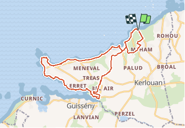
Tour Wandern von 17,8 km verfügbar auf Bretagne, Finistère, Kerlouan. Diese Tour wird von olibreizh vorgeschlagen.
Beschreibung
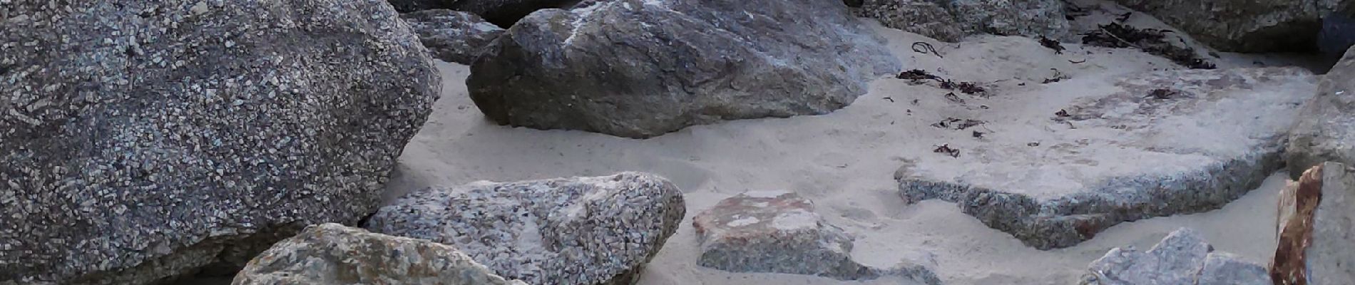
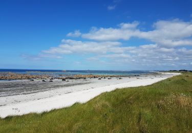
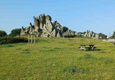
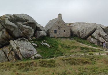
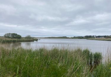
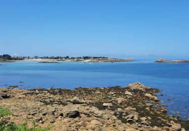
Au départ du village de pécheur restauré de Meneham, on suit le chemin côtier vers l'Ouest jusqu'à la pointe puis on longe le coté nord de l'anse de Guisseny.
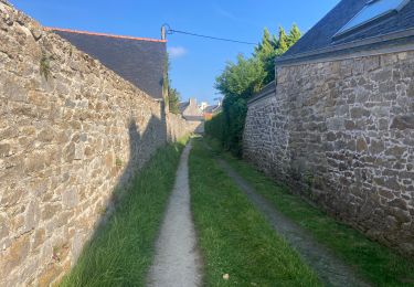
On revient ensuite à travers champs vers Meneham.
Ort
Land:
France
Region :
Bretagne
Abteilung/Provinz :
Finistère
Kommune :
Kerlouan
Standort:
Unknown
Gehen Sie:(Dec)
Gehen Sie:(UTM)
399101 ; 5391432 (30U) N.
Kommentare
Touren in der Umgebung
![Tour Wandern Plounéour-Brignogan-Plages - Tour de Brignogan - Photo](https://media.geolcdn.com/t/375/260/ext.jpg?maxdim=2&url=https%3A%2F%2Fservices.sitytrail.com%2FGeolivesWS%2FDownloadMedia.ashx%3FTrailID%3D978278%26Media%3Dfix__20180601173344.jpg)
![Wandern Wandern](https://static1.geolcdn.com/sitytour/trail-icons/101.png)
Tour de Brignogan
Wandern
Einfach
(1)
Plounéour-Brignogan-Plages,
Bretagne,
Finistère,
France
![](/images/other/stat-length.png)
12,3 km | 13,4 km-effort
2h 30min
![](https://static1.geolcdn.com/siteimages/upload/files/16400158638029165_repeat_loop_refresh_sync_direction_icon.png)
Ja
![Tour Wandern Plounéour-Brignogan-Plages - Brignogan Plage - Photo](https://media.geolcdn.com/t/375/260/ext.jpg?maxdim=2&url=https%3A%2F%2Fstatic1.geolcdn.com%2Fsiteimages%2Fupload%2Ffiles%2F1553511878bg_sport_marche.png)
![Wandern Wandern](https://static1.geolcdn.com/sitytour/trail-icons/101.png)
Brignogan Plage
Wandern
Schwierig
(1)
Plounéour-Brignogan-Plages,
Bretagne,
Finistère,
France
![](/images/other/stat-length.png)
16,1 km | 17,2 km-effort
4h 0min
![](https://static1.geolcdn.com/siteimages/upload/files/16400158638029165_repeat_loop_refresh_sync_direction_icon.png)
Ja
![Tour sport Guissény - Boucle Guissény / Vougot - Photo](https://media.geolcdn.com/t/375/260/ext.jpg?maxdim=2&url=https%3A%2F%2Fmedia.geolcdn.com%2Ff%2F35bd3d15-fd21-4f9b-9e96-2c34af716224.jpg)
Boucle Guissény / Vougot
sport
Sehr leicht
Guissény,
Bretagne,
Finistère,
France
![](/images/other/stat-length.png)
9,5 km | 10,2 km-effort
Unbekannt
![](https://static1.geolcdn.com/siteimages/upload/files/16400158638029165_repeat_loop_refresh_sync_direction_icon.png)
Ja
![Tour sport Guissény - Guissény Terre/Mer - Photo](https://media.geolcdn.com/t/375/260/ext.jpg?maxdim=2&url=https%3A%2F%2Fmedia.geolcdn.com%2Ff%2Fc93b3ac4-7de3-42df-b45e-c9c565d360f7.jpg)
Guissény Terre/Mer
sport
Sehr leicht
Guissény,
Bretagne,
Finistère,
France
![](/images/other/stat-length.png)
6,6 km | 7,2 km-effort
Unbekannt
![](https://static1.geolcdn.com/siteimages/upload/files/16400158638029165_repeat_loop_refresh_sync_direction_icon.png)
Ja
![Tour Wandern Guissény - Guissény-Kervelt - Photo](https://media.geolcdn.com/t/375/260/ext.jpg?maxdim=2&url=https%3A%2F%2Fmedia.geolcdn.com%2Ff%2F7caa590c-0ac5-443a-98fe-4142efe5c7eb.jpg)
![Wandern Wandern](https://static1.geolcdn.com/sitytour/trail-icons/101.png)
Guissény-Kervelt
Wandern
Einfach
Guissény,
Bretagne,
Finistère,
France
![](/images/other/stat-length.png)
21 km | 23 km-effort
5h 9min
![](https://static1.geolcdn.com/siteimages/upload/files/16400158638029165_repeat_loop_refresh_sync_direction_icon.png)
Nein
![Tour Wandern Kerlouan - 04.09.23 Guissény -- Lilia - Photo](https://media.geolcdn.com/t/375/260/ext.jpg?maxdim=2&url=https%3A%2F%2Fmedia.geolcdn.com%2Ff%2F76ba77c3-a923-41d6-9828-feb192ee7270.jpg)
![Wandern Wandern](https://static1.geolcdn.com/sitytour/trail-icons/101.png)
04.09.23 Guissény -- Lilia
Wandern
Sehr schwierig
Kerlouan,
Bretagne,
Finistère,
France
![](/images/other/stat-length.png)
24 km | 28 km-effort
6h 16min
![](https://static1.geolcdn.com/siteimages/upload/files/16400158638029165_repeat_loop_refresh_sync_direction_icon.png)
Nein
![Tour Wandern Plounéour-Brignogan-Plages - 03.09.23 Brignogan Plages -- Guissény - Photo](https://media.geolcdn.com/t/375/260/ext.jpg?maxdim=2&url=https%3A%2F%2Fmedia.geolcdn.com%2Ff%2F5c62bb70-12d4-4437-81b3-b8458c653c10.jpg)
![Wandern Wandern](https://static1.geolcdn.com/sitytour/trail-icons/101.png)
03.09.23 Brignogan Plages -- Guissény
Wandern
Schwierig
Plounéour-Brignogan-Plages,
Bretagne,
Finistère,
France
![](/images/other/stat-length.png)
16,6 km | 17,9 km-effort
4h 4min
![](https://static1.geolcdn.com/siteimages/upload/files/16400158638029165_repeat_loop_refresh_sync_direction_icon.png)
Nein
![Tour Wandern Plounéour-Brignogan-Plages - Bretagne 1 - Photo](https://media.geolcdn.com/t/375/260/ext.jpg?maxdim=2&url=https%3A%2F%2Fstatic1.geolcdn.com%2Fsiteimages%2Fupload%2Ffiles%2F1553511878bg_sport_marche.png)
![Wandern Wandern](https://static1.geolcdn.com/sitytour/trail-icons/101.png)
Bretagne 1
Wandern
Schwierig
(1)
Plounéour-Brignogan-Plages,
Bretagne,
Finistère,
France
![](/images/other/stat-length.png)
15,9 km | 17,2 km-effort
4h 14min
![](https://static1.geolcdn.com/siteimages/upload/files/16400158638029165_repeat_loop_refresh_sync_direction_icon.png)
Nein
![Tour Wandern Guissény - brgnogan Grève blanche 17km - Photo](https://media.geolcdn.com/t/375/260/ext.jpg?maxdim=2&url=https%3A%2F%2Fmedia.geolcdn.com%2Ff%2F8a620c7f-ce53-42d0-ae3e-be9b75e9273e.jpg)
![Wandern Wandern](https://static1.geolcdn.com/sitytour/trail-icons/101.png)
brgnogan Grève blanche 17km
Wandern
Medium
Guissény,
Bretagne,
Finistère,
France
![](/images/other/stat-length.png)
16,6 km | 19 km-effort
5h 58min
![](https://static1.geolcdn.com/siteimages/upload/files/16400158638029165_repeat_loop_refresh_sync_direction_icon.png)
Nein