


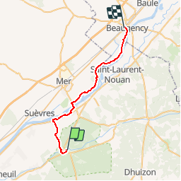

8,2 km | 8,9 km-effort


Benutzer


Kostenlosegpshiking-Anwendung
 SityTrail
IGN / Geografische Institute
SityTrail World
Die Welt öffnet sich für Sie
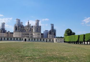
Tour Fahrrad von 28 km verfügbar auf Zentrum-Loiretal, Loir-et-Cher, Chambord. Diese Tour wird von tracegps vorgeschlagen.
Une jolie balade familiale où se mêlent Loire Sauvage et villages pittoresques. Puis c'est la Sologne et son massif forestier qui nous enveloppe. Un parcours apaisant effectué en majorité sur pistes cyclables. A faire absolument!


Zu Fuß
Zu Fuß
Wandern
Wandern

Zu Fuß

Mountainbike

Wandern

Wandern
Wandern