


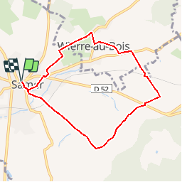


10,7 km | 13,2 km-effort

Benutzer


Kostenlosegpshiking-Anwendung
 SityTrail
IGN / Geografische Institute
SityTrail World
Die Welt öffnet sich für Sie
Tour Wandern von 7 km verfügbar auf Nordfrankreich, Pas-de-Calais, Samer. Diese Tour wird von tracegps vorgeschlagen.
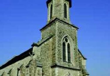
Balade idéale en famille autour de Samer, découverte du village de Wierre au Bois et son manoir de Sainte-Beuve, le plus grand manoir du Boulonnais.


Wandern
Wandern

Mountainbike
Wandern
Mountainbike
Mountainbike

Wandern
Wandern
Wandern