![](/images/other/stat-length.png)
![Tour Wandern Carbis Bay - zennor - Photo](https://media.geolcdn.com/t/1900/400/ext.pjpeg?maxdim=2&url=https%3A%2F%2Fstatic1.geolcdn.com%2Fsiteimages%2Fupload%2Ffiles%2F1553511878bg_sport_marche.png)
zennor
cecile_ya
Benutzer
![Länge](/images/other/stat-length.png)
Länge
11,7 km
![Maximale Höhe](https://static1.geolcdn.com/siteimages/upload/files/1508320355ic_sort_altitude_max_24dp.png)
Maximale Höhe
160 m
![Positive Höhendifferenz](https://static1.geolcdn.com/siteimages/upload/files/1508320355ic_sort_den_pos_24dp.png)
Positive Höhendifferenz
429 m
![Km-Effort](/images/other/stat-length.png)
Km-Effort
17 km
![Min. Höhe](https://static1.geolcdn.com/siteimages/upload/files/1508320355ic_sort_altitude_min_24dp.png)
Min. Höhe
8 m
![Negative Höhendifferenz](https://static1.geolcdn.com/siteimages/upload/files/1508320355ic_sort_den_neg_24dp.png)
Negative Höhendifferenz
296 m
![Boucle](https://static1.geolcdn.com/siteimages/upload/files/16400158638029165_repeat_loop_refresh_sync_direction_icon.png)
Boucle
Nein
Erstellungsdatum :
2019-06-23 09:16:54.466
Letzte Änderung :
2019-06-23 15:38:03.745
![Wandern](https://static1.geolcdn.com/sitytour/trail-icons/101.png)
5h28
Schwierigkeit : Schwierig
![Scannen Sie diesen QR-Code, um die Tour in der SityTrail-Anwendung zu öffnen](https://capi.geolives.com/qq0zvz2zws4bq2lad0pu/sitytour/trails/2122014/qr.png?size=200)
Kostenlosegpshiking-Anwendung
Über SityTrail
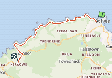
Tour Wandern von 11,7 km verfügbar auf England, Cornwall. Diese Tour wird von cecile_ya vorgeschlagen.
Beschreibung
splendide côte mais journée de pluie😣 la fin juin nous permet de voir les digitales et les bruyères, la mer est émeraude. le passage de rochers près de la plage avant Zennor point n'a de chemin que le nom.
Ort
Land:
United Kingdom
Region :
England
Abteilung/Provinz :
Cornwall
Kommune :
Carbis Bay
Standort:
Unknown
Gehen Sie:(Dec)
Gehen Sie:(UTM)
322707 ; 5565413 (30U) N.
Kommentare
Touren in der Umgebung
![Tour Wandern - pendeen-drnnen cove + ale au old success Inn (stopwatch+30 Mon) - Photo](https://media.geolcdn.com/t/375/260/ext.jpg?maxdim=2&url=https%3A%2F%2Fstatic1.geolcdn.com%2Fsiteimages%2Fupload%2Ffiles%2F1553511878bg_sport_marche.png)
![Wandern Wandern](https://static1.geolcdn.com/sitytour/trail-icons/101.png)
pendeen-drnnen cove + ale au old success Inn (stopwatch+30 Mon)
Wandern
Medium
,
England,
Cornwall,
United Kingdom
![](/images/other/stat-length.png)
17,2 km | 23 km-effort
7h 2min
![](https://static1.geolcdn.com/siteimages/upload/files/16400158638029165_repeat_loop_refresh_sync_direction_icon.png)
Nein
![Tour Wandern - penzance à St Michaël mounts et retour - Photo](https://media.geolcdn.com/t/375/260/ext.jpg?maxdim=2&url=https%3A%2F%2Fstatic1.geolcdn.com%2Fsiteimages%2Fupload%2Ffiles%2F1553511878bg_sport_marche.png)
![Wandern Wandern](https://static1.geolcdn.com/sitytour/trail-icons/101.png)
penzance à St Michaël mounts et retour
Wandern
Sehr leicht
,
England,
Cornwall,
United Kingdom
![](/images/other/stat-length.png)
13,9 km | 15 km-effort
3h 41min
![](https://static1.geolcdn.com/siteimages/upload/files/16400158638029165_repeat_loop_refresh_sync_direction_icon.png)
Ja
![Tour Wandern - Cornouaille Ouest - Photo](https://media.geolcdn.com/t/375/260/ext.jpg?maxdim=2&url=https%3A%2F%2Fstatic1.geolcdn.com%2Fsiteimages%2Fupload%2Ffiles%2F1553511878bg_sport_marche.png)
![Wandern Wandern](https://static1.geolcdn.com/sitytour/trail-icons/101.png)
Cornouaille Ouest
Wandern
Einfach
,
England,
Cornwall,
United Kingdom
![](/images/other/stat-length.png)
14,8 km | 18,8 km-effort
4h 15min
![](https://static1.geolcdn.com/siteimages/upload/files/16400158638029165_repeat_loop_refresh_sync_direction_icon.png)
Ja
![Tour Wandern - sortie du 13septembre - Photo](https://media.geolcdn.com/t/375/260/ext.jpg?maxdim=2&url=https%3A%2F%2Fstatic1.geolcdn.com%2Fsiteimages%2Fupload%2Ffiles%2F1553511878bg_sport_marche.png)
![Wandern Wandern](https://static1.geolcdn.com/sitytour/trail-icons/101.png)
sortie du 13septembre
Wandern
Sehr leicht
,
England,
Cornwall,
United Kingdom
![](/images/other/stat-length.png)
7,2 km | 10,1 km-effort
4h 59min
![](https://static1.geolcdn.com/siteimages/upload/files/16400158638029165_repeat_loop_refresh_sync_direction_icon.png)
Ja
![Tour Wandern - sortie du 10 septembre - Photo](https://media.geolcdn.com/t/375/260/ext.jpg?maxdim=2&url=https%3A%2F%2Fstatic1.geolcdn.com%2Fsiteimages%2Fupload%2Ffiles%2F1553511878bg_sport_marche.png)
![Wandern Wandern](https://static1.geolcdn.com/sitytour/trail-icons/101.png)
sortie du 10 septembre
Wandern
Sehr leicht
,
England,
Cornwall,
United Kingdom
![](/images/other/stat-length.png)
7,9 km | 10,5 km-effort
5h 14min
![](https://static1.geolcdn.com/siteimages/upload/files/16400158638029165_repeat_loop_refresh_sync_direction_icon.png)
Ja
![Tour Wandern - marche du 08 septembre 20a9 - Photo](https://media.geolcdn.com/t/375/260/ext.jpg?maxdim=2&url=https%3A%2F%2Fstatic1.geolcdn.com%2Fsiteimages%2Fupload%2Ffiles%2F1553511878bg_sport_marche.png)
![Wandern Wandern](https://static1.geolcdn.com/sitytour/trail-icons/101.png)
marche du 08 septembre 20a9
Wandern
Sehr leicht
,
England,
Cornwall,
United Kingdom
![](/images/other/stat-length.png)
7,7 km | 10,1 km-effort
4h 30min
![](https://static1.geolcdn.com/siteimages/upload/files/16400158638029165_repeat_loop_refresh_sync_direction_icon.png)
Ja
![Tour Wandern - St-Just - Cape Cornwall - Photo](https://media.geolcdn.com/t/375/260/ext.jpg?maxdim=2&url=https%3A%2F%2Fstatic1.geolcdn.com%2Fsiteimages%2Fupload%2Ffiles%2F1553511878bg_sport_marche.png)
![Wandern Wandern](https://static1.geolcdn.com/sitytour/trail-icons/101.png)
St-Just - Cape Cornwall
Wandern
Medium
,
England,
Cornwall,
United Kingdom
![](/images/other/stat-length.png)
8,1 km | 10,8 km-effort
2h 17min
![](https://static1.geolcdn.com/siteimages/upload/files/16400158638029165_repeat_loop_refresh_sync_direction_icon.png)
Ja