Tour Wandern Orcières - Cabane d'Archinard - Photo
 Kilroy06
Kilroy06

Benutzer

© OpenStreetMap contributors
Länge
Länge
6,1 km
Maximale Höhe
Maximale Höhe
1931 m
Positive Höhendifferenz
356 m
Km-Effort
Km-Effort  
10,9 km
Min. Höhe
Min. Höhe
1594 m
Negative Höhendifferenz
359 m
Boucle
Boucle
Ja
Erstellungsdatum :
2014-12-10 00:00:00.0
Letzte Änderung :
2014-12-10 00:00:00.0

(0 Nachricht)

Wandern
Wandern
2h10
Schwierigkeit : Einfach

Scannen Sie diesen QR-Code, um die Tour in der SityTrail-Anwendung zu öffnen

Kostenlosegpshiking-Anwendung

Logo SityTrail SityTrail

IGN / Geografische Institute

SityTrail aus dem App Store herunterladen SityTrail von Google Play herunterladen

Logo SityTrail SityTrail World

Die Welt öffnet sich für Sie

SityTrail aus dem App Store herunterladen SityTrail von Google Play herunterladen SityTrail auf Huawei AppGallery herunterladen

Über SityTrail

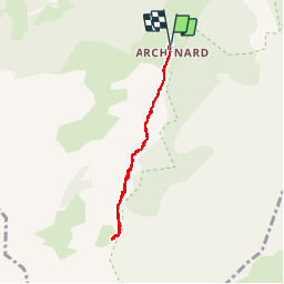
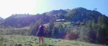
Tour Wandern von 6,1 km verfügbar auf Provence-Alpes-Côte d'Azur, Hochalpen, Orcières. Diese Tour wird von Kilroy06 vorgeschlagen.

Beschreibung

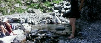
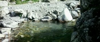
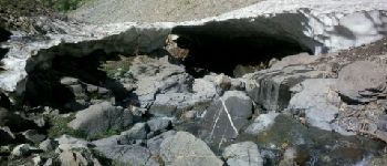
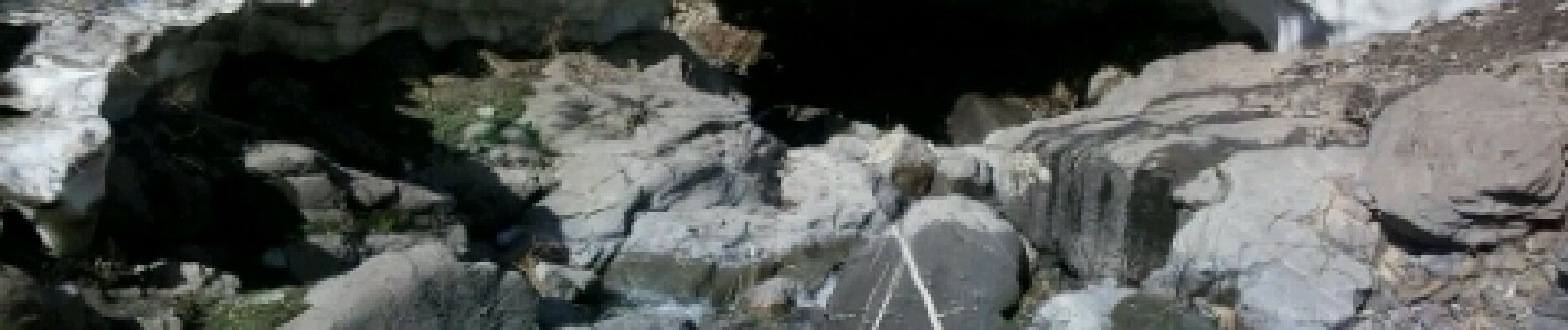
Un sentier au fond d'une très belle vallée. Balade tranquille. Petite montée le long d'un jolie torrent. Au mois d'aout cette année encore des névés le long du torrent.

Höhenprofil

Foto-Galerie

POIs

POI Orcières - Point 1 - Photo
Kilroy06
ORCIÈRES 
POI Orcières - Point 2 - Photo
Kilroy06
ORCIÈRES 
POI Orcières - Point 3 - Photo
Kilroy06
ORCIÈRES 
POI Orcières - Point 4 - Photo
Kilroy06
ORCIÈRES 

Ort

Land:
France
Region :
Provence-Alpes-Côte d'Azur
Abteilung/Provinz :
Hochalpen
Kommune :
Orcières
Standort:
Unknown
Gehen Sie:(Dec)
Gehen Sie:(UTM)
287376 ; 4948977 (32T) N.

Touren in der Umgebung

Tour Wandern Orcières - Le Forest des marches - Photo
Wandern
GUIDE
nadinebondoux

Wandern

Einfach
(2)
Orcières, Provence-Alpes-Côte d'Azur, Hochalpen, France
6,3 km | 9,9 km-effort
1h 42min
Ja
Tour Wandern Orcières - R45   Marmottes a Prapic - Photo
Wandern
GUIDE+

Wandern

Medium
(2)
Orcières, Provence-Alpes-Côte d'Azur, Hochalpen, France
9 km | 14 km-effort
2h 57min
Ja
Tour Wandern Orcières - Orcieres (Hautes Alpes) - Photo
Wandern
ISATR

Wandern

Sehr schwierig
(1)
Orcières, Provence-Alpes-Côte d'Azur, Hochalpen, France
12 km | 19,4 km-effort
4h 24min
Ja
Tour Wandern Ancelle - col de la coupa et tour de la rouanne - Photo
Wandern
chdubois

Wandern

Schwierig
(1)
Ancelle, Provence-Alpes-Côte d'Azur, Hochalpen, France
16,2 km | 28 km-effort
4h 56min
Ja
Tour Wandern Orcières - Roc Diolon par le col de Fressinieres 11/08/23 - Photo
Wandern
GUIDE
R@ph

Wandern

Sehr schwierig
Orcières, Provence-Alpes-Côte d'Azur, Hochalpen, France
16,3 km | 32 km-effort
7h 21min
Ja
Tour Wandern Ancelle - Le Piolt par la Pourrachiere 21/07/23 - Photo
Wandern
GUIDE
R@ph

Wandern

Sehr schwierig
Ancelle, Provence-Alpes-Côte d'Azur, Hochalpen, France
13,7 km | 25 km-effort
5h 41min
Ja
Tour Wandern Ancelle - Le Piolit par Rouanne Haute 27/09/19 - Photo
Wandern
GUIDE
R@ph

Wandern

Sehr schwierig
Ancelle, Provence-Alpes-Côte d'Azur, Hochalpen, France
14,2 km | 26 km-effort
5h 15min
Ja
Tour Wandern Orcières - Col des Tourettes - Croix Lorraine 08/09/18 - Photo
Wandern
GUIDE
R@ph

Wandern

Schwierig
Orcières, Provence-Alpes-Côte d'Azur, Hochalpen, France
21 km | 37 km-effort
5h 30min
Ja
Tour Wandern Orcières - Col de Rouannette 22/07/18 - Photo
Wandern
GUIDE
R@ph

Wandern

Medium
Orcières, Provence-Alpes-Côte d'Azur, Hochalpen, France
9,3 km | 20 km-effort
3h 56min
Ja


Schließen
Meine Abonnements