![](/images/other/stat-length.png)
CC_Velay_AC_03_Grezes_St-Alban-Limagnole_20060823
patrickdanilo
Benutzer
![Länge](/images/other/stat-length.png)
Länge
26 km
![Maximale Höhe](https://static1.geolcdn.com/siteimages/upload/files/1508320355ic_sort_altitude_max_24dp.png)
Maximale Höhe
1336 m
![Positive Höhendifferenz](https://static1.geolcdn.com/siteimages/upload/files/1508320355ic_sort_den_pos_24dp.png)
Positive Höhendifferenz
582 m
![Km-Effort](/images/other/stat-length.png)
Km-Effort
34 km
![Min. Höhe](https://static1.geolcdn.com/siteimages/upload/files/1508320355ic_sort_altitude_min_24dp.png)
Min. Höhe
1005 m
![Negative Höhendifferenz](https://static1.geolcdn.com/siteimages/upload/files/1508320355ic_sort_den_neg_24dp.png)
Negative Höhendifferenz
619 m
![Boucle](https://static1.geolcdn.com/siteimages/upload/files/16400158638029165_repeat_loop_refresh_sync_direction_icon.png)
Boucle
Nein
Erstellungsdatum :
2019-06-14 16:49:41.292
Letzte Änderung :
2022-02-09 10:52:15.16
![Wandern](https://static1.geolcdn.com/sitytour/trail-icons/101.png)
6h15
Schwierigkeit : Medium
![Scannen Sie diesen QR-Code, um die Tour in der SityTrail-Anwendung zu öffnen](https://capi.geolives.com/qq0zvz2zws4bq2lad0pu/sitytour/trails/2114011/qr.png?size=200)
Kostenlosegpshiking-Anwendung
Über SityTrail
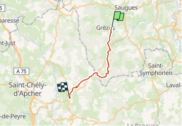
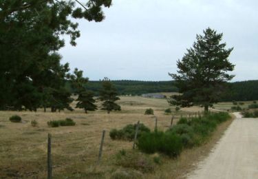
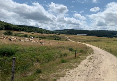
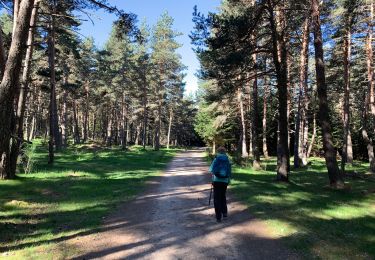
Tour Wandern von 26 km verfügbar auf Auvergne-Rhone-Alpen, Haute-Loire, Grèzes. Diese Tour wird von patrickdanilo vorgeschlagen.
Beschreibung
Randonnée Marche de 26 km à découvrir à Grèzes, Haute-Loire, Auvergne-Rhône-Alpes. Cette randonnée est proposée par patrickdanilo
Ort
Land:
France
Region :
Auvergne-Rhone-Alpen
Abteilung/Provinz :
Haute-Loire
Kommune :
Grèzes
Standort:
Unknown
Gehen Sie:(Dec)
Gehen Sie:(UTM)
539957 ; 4974154 (31T) N.
Kommentare
Touren in der Umgebung
![Tour Wandern Saugues - Saugue La Roche Avril 2018 - Photo](https://media.geolcdn.com/t/375/260/ext.jpg?maxdim=2&url=https%3A%2F%2Fservices.sitytrail.com%2FGeolivesWS%2FDownloadMedia.ashx%3FTrailID%3D954931%26Media%3Dfix__20180418135028.jpg)
![Wandern Wandern](https://static1.geolcdn.com/sitytour/trail-icons/101.png)
Saugue La Roche Avril 2018
Wandern
Schwierig
Saugues,
Auvergne-Rhone-Alpen,
Haute-Loire,
France
![](/images/other/stat-length.png)
26 km | 35 km-effort
7h 26min
![](https://static1.geolcdn.com/siteimages/upload/files/16400158638029165_repeat_loop_refresh_sync_direction_icon.png)
Nein
![Tour Wandern Saugues - Saugues - Le Rouget - Photo](https://media.geolcdn.com/t/375/260/ext.jpg?maxdim=2&url=https%3A%2F%2Fstatic1.geolcdn.com%2Fsiteimages%2Fupload%2Ffiles%2F1553511878bg_sport_marche.png)
![Wandern Wandern](https://static1.geolcdn.com/sitytour/trail-icons/101.png)
Saugues - Le Rouget
Wandern
Schwierig
(1)
Saugues,
Auvergne-Rhone-Alpen,
Haute-Loire,
France
![](/images/other/stat-length.png)
31 km | 41 km-effort
8h 7min
![](https://static1.geolcdn.com/siteimages/upload/files/16400158638029165_repeat_loop_refresh_sync_direction_icon.png)
Nein
![Tour Wandern Grèzes - TOUR DU MONTCHOUVET 43 - circuit pédestre les noisettes sauvages - Photo](https://media.geolcdn.com/t/375/260/ext.jpg?maxdim=2&url=https%3A%2F%2Fservices.sitytrail.com%2FGeolivesWS%2FDownloadMedia.ashx%3FTrailID%3D445970%26Media%3D20150713123106.jpg)
![Wandern Wandern](https://static1.geolcdn.com/sitytour/trail-icons/101.png)
TOUR DU MONTCHOUVET 43 - circuit pédestre les noisettes sauvages
Wandern
Schwierig
Grèzes,
Auvergne-Rhone-Alpen,
Haute-Loire,
France
![](/images/other/stat-length.png)
18,1 km | 25 km-effort
4h 13min
![](https://static1.geolcdn.com/siteimages/upload/files/16400158638029165_repeat_loop_refresh_sync_direction_icon.png)
Ja
![Tour Wandern Saugues - Saugues - Le Sauvage - Chemin de Compostelle - Photo](https://media.geolcdn.com/t/375/260/ext.jpg?maxdim=2&url=https%3A%2F%2Fservices.sitytrail.com%2FGeolivesWS%2FDownloadMedia.ashx%3FTrailID%3D108147%26Media%3D200_6.jpg)
![Wandern Wandern](https://static1.geolcdn.com/sitytour/trail-icons/101.png)
Saugues - Le Sauvage - Chemin de Compostelle
Wandern
Sehr schwierig
Saugues,
Auvergne-Rhone-Alpen,
Haute-Loire,
France
![](/images/other/stat-length.png)
22 km | 29 km-effort
5h 30min
![](https://static1.geolcdn.com/siteimages/upload/files/16400158638029165_repeat_loop_refresh_sync_direction_icon.png)
Nein
![Tour Wandern Saugues - live Saugues - Lajo - Photo](https://media.geolcdn.com/t/375/260/8baf7b88-c287-4e8d-b4d6-e4766513e2df.jpg&format=jpg&maxdim=2)
![Wandern Wandern](https://static1.geolcdn.com/sitytour/trail-icons/101.png)
live Saugues - Lajo
Wandern
Schwierig
Saugues,
Auvergne-Rhone-Alpen,
Haute-Loire,
France
![](/images/other/stat-length.png)
27 km | 36 km-effort
8h 15min
![](https://static1.geolcdn.com/siteimages/upload/files/16400158638029165_repeat_loop_refresh_sync_direction_icon.png)
Nein
![Tour Wandern Saugues - chemin compostelle saugues faux - Photo](https://media.geolcdn.com/t/375/260/e52db260-a752-4d81-a594-77381542ed66.jpg&format=jpg&maxdim=2)
![Wandern Wandern](https://static1.geolcdn.com/sitytour/trail-icons/101.png)
chemin compostelle saugues faux
Wandern
Sehr schwierig
Saugues,
Auvergne-Rhone-Alpen,
Haute-Loire,
France
![](/images/other/stat-length.png)
32 km | 41 km-effort
6h 15min
![](https://static1.geolcdn.com/siteimages/upload/files/16400158638029165_repeat_loop_refresh_sync_direction_icon.png)
Nein
![Tour Wandern Saugues - 2021 AUBRAC Étape 3 - Photo](https://media.geolcdn.com/t/375/260/dd5fefd4-300d-460c-ab95-7eb3010224f5.jpg&format=jpg&maxdim=2)
![Wandern Wandern](https://static1.geolcdn.com/sitytour/trail-icons/101.png)
2021 AUBRAC Étape 3
Wandern
Medium
Saugues,
Auvergne-Rhone-Alpen,
Haute-Loire,
France
![](/images/other/stat-length.png)
18,9 km | 26 km-effort
6h 26min
![](https://static1.geolcdn.com/siteimages/upload/files/16400158638029165_repeat_loop_refresh_sync_direction_icon.png)
Nein
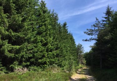
![Tour Wandern Saugues - [03] Compostelle : de Saugues à Saint-Alban-sur-Limagnole (Les Faux) - Photo](https://media.geolcdn.com/t/375/260/4cdf96a3-4480-489b-a106-3d39781190c6.jpg&format=jpg&maxdim=2)
![Wandern Wandern](https://static1.geolcdn.com/sitytour/trail-icons/101.png)
[03] Compostelle : de Saugues à Saint-Alban-sur-Limagnole (Les Faux)
Wandern
Schwierig
Saugues,
Auvergne-Rhone-Alpen,
Haute-Loire,
France
![](/images/other/stat-length.png)
28 km | 37 km-effort
7h 5min
![](https://static1.geolcdn.com/siteimages/upload/files/16400158638029165_repeat_loop_refresh_sync_direction_icon.png)
Nein
![Tour Wandern Saugues - Le Puy Conques 3 - Photo](https://media.geolcdn.com/t/375/260/73fe8a33-b7e1-4cd0-b2ae-3276421ff313.jpg&format=jpg&maxdim=2)
![Wandern Wandern](https://static1.geolcdn.com/sitytour/trail-icons/101.png)
Le Puy Conques 3
Wandern
Medium
Saugues,
Auvergne-Rhone-Alpen,
Haute-Loire,
France
![](/images/other/stat-length.png)
19,3 km | 26 km-effort
7h 7min
![](https://static1.geolcdn.com/siteimages/upload/files/16400158638029165_repeat_loop_refresh_sync_direction_icon.png)
Nein