


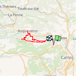

16 km | 29 km-effort


Benutzer


Kostenlosegpshiking-Anwendung
 SityTrail
IGN / Geografische Institute
SityTrail World
Die Welt öffnet sich für Sie
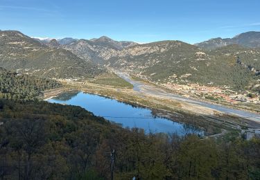
Tour Elektrofahrrad von 50 km verfügbar auf Provence-Alpes-Côte d'Azur, Seealpen, Bouyon. Diese Tour wird von franquen vorgeschlagen.
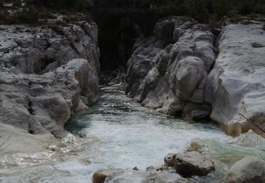
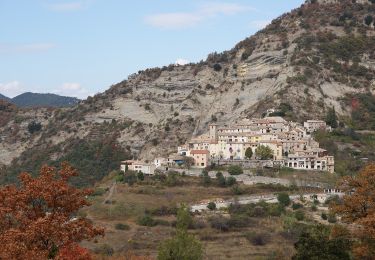
Départ de Bouyon jusqu'aux Ferres puis chemin du Vegay jusque Pous. descente sur Roquesteron et retour par Consegudes. Très beau chemin en encorbellement avec vue plongeante sur l'Esteron.
Zu Fuß

Wandern

Zu Fuß
Zu Fuß

Wandern

Wandern
Wandern
Wandern
Wandern