![](/images/other/stat-length.png)
![Tour Wandern Pont-l'Abbé - La rivière de Pont-l'Abbé - Photo](https://media.geolcdn.com/t/1900/400/ext.pjpeg?maxdim=2&url=https%3A%2F%2Fstatic1.geolcdn.com%2Fsiteimages%2Fupload%2Ffiles%2F1553511878bg_sport_marche.png)
La rivière de Pont-l'Abbé
cron
Benutzer
![Länge](/images/other/stat-length.png)
![Maximale Höhe](https://static1.geolcdn.com/siteimages/upload/files/1508320355ic_sort_altitude_max_24dp.png)
![Positive Höhendifferenz](https://static1.geolcdn.com/siteimages/upload/files/1508320355ic_sort_den_pos_24dp.png)
![Km-Effort](/images/other/stat-length.png)
![Min. Höhe](https://static1.geolcdn.com/siteimages/upload/files/1508320355ic_sort_altitude_min_24dp.png)
![Negative Höhendifferenz](https://static1.geolcdn.com/siteimages/upload/files/1508320355ic_sort_den_neg_24dp.png)
![Boucle](https://static1.geolcdn.com/siteimages/upload/files/16400158638029165_repeat_loop_refresh_sync_direction_icon.png)
![Wandern](https://static1.geolcdn.com/sitytour/trail-icons/101.png)
5h40
Schwierigkeit : Sehr schwierig
![Scannen Sie diesen QR-Code, um die Tour in der SityTrail-Anwendung zu öffnen](https://capi.geolives.com/qq0zvz2zws4bq2lad0pu/sitytour/trails/2076820/qr.png?size=200)
Kostenlosegpshiking-Anwendung
Über SityTrail
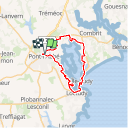
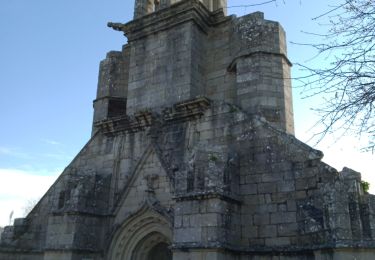
Tour Wandern von 23 km verfügbar auf Bretagne, Finistère, Pont-l'Abbé. Diese Tour wird von cron vorgeschlagen.
Beschreibung
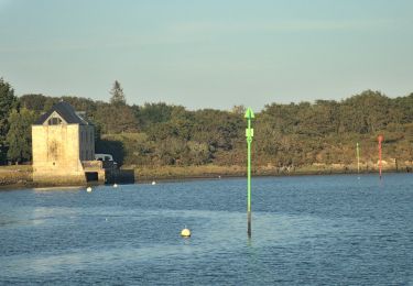
Attention, le bac à Loctudy ne fonctionne que d'Avril à fin septembre (1,50 €/pers.)
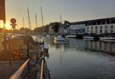
Départ : parking du quai Saint-Laurent à Pont-l'Abbé.
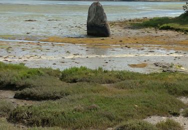
Cette rando figure dans un Topo de la FFrandonnée. Superbe de Pont-l'Abbé à Loctudy, elle ne présente aucun intérêt sur le chemin du retour après l'Ile-Tudy : énormément de goudron et 1 km très dangereux sur le bord d'une voie à grande circulation, sans aucune protection !
Ort
Kommentare
Touren in der Umgebung
![Tour Wandern Plonéour-Lanvern - moulin neuf 2012-06-03 19h21m00 - Photo](https://media.geolcdn.com/t/375/260/ext.jpg?maxdim=2&url=https%3A%2F%2Fstatic1.geolcdn.com%2Fsiteimages%2Fupload%2Ffiles%2F1553511878bg_sport_marche.png)
![Wandern Wandern](https://static1.geolcdn.com/sitytour/trail-icons/101.png)
Wandern
![](/images/other/stat-length.png)
![](https://static1.geolcdn.com/siteimages/upload/files/16400158638029165_repeat_loop_refresh_sync_direction_icon.png)
![Tour Wandern Pont-l'Abbé - GR34 Pont-l'Abbé -- Bénodet - Photo](https://media.geolcdn.com/t/375/260/a2ee19ef-481d-4c4e-92bc-5ffcf174dae8.jpg&format=jpg&maxdim=2)
![Wandern Wandern](https://static1.geolcdn.com/sitytour/trail-icons/101.png)
Wandern
![](/images/other/stat-length.png)
![](https://static1.geolcdn.com/siteimages/upload/files/16400158638029165_repeat_loop_refresh_sync_direction_icon.png)
![Tour Wandern Pont-l'Abbé - Pont l'Abbé à Bénodet - Photo](https://media.geolcdn.com/t/375/260/5b34e465-4bb1-4ce5-8012-1120e5f357da.jpg&format=jpg&maxdim=2)
![Wandern Wandern](https://static1.geolcdn.com/sitytour/trail-icons/101.png)
Wandern
![](/images/other/stat-length.png)
![](https://static1.geolcdn.com/siteimages/upload/files/16400158638029165_repeat_loop_refresh_sync_direction_icon.png)
![Tour Zu Fuß Plomeur - PLOMEUR - Photo](https://media.geolcdn.com/t/375/260/61520ad5-9a28-4010-847f-793b1c68649a.jpg&format=jpg&maxdim=2)
![Zu Fuß Zu Fuß](https://static1.geolcdn.com/sitytour/trail-icons/100.png)
![Tour Wandern Pont-l'Abbé - PONT L'ABBÉ / LOCTUDY - Photo](https://media.geolcdn.com/t/375/260/a8f111bb-1728-4386-924e-5fa280bb0271.jpg&format=jpg&maxdim=2)
![Wandern Wandern](https://static1.geolcdn.com/sitytour/trail-icons/101.png)
Wandern
![](/images/other/stat-length.png)
![](https://static1.geolcdn.com/siteimages/upload/files/16400158638029165_repeat_loop_refresh_sync_direction_icon.png)
![Tour sport Pont-l'Abbé - 2022-11-11_11h00m20_VTT1baseouestcornouaille2021osm - Photo](https://media.geolcdn.com/t/375/260/ext.jpg?maxdim=2&url=https%3A%2F%2Fsecurestorage.geolives.com%2Fsitytour%2Ftrail-bg%2Fdefault.jpg)
sport
![](/images/other/stat-length.png)
![](https://static1.geolcdn.com/siteimages/upload/files/16400158638029165_repeat_loop_refresh_sync_direction_icon.png)
![Tour Zu Fuß Pont-l'Abbé - Le Chemin de Halage - Photo](https://media.geolcdn.com/t/375/260/7e5b068d-bfde-42f2-9d5d-4a5f426b9ab6.jpeg&format=jpg&maxdim=2)
![Zu Fuß Zu Fuß](https://static1.geolcdn.com/sitytour/trail-icons/100.png)
Zu Fuß
![](/images/other/stat-length.png)
![](https://static1.geolcdn.com/siteimages/upload/files/16400158638029165_repeat_loop_refresh_sync_direction_icon.png)
![Tour Wandern Pont-l'Abbé - Pont l'Abbé et l'estuaire de la rivière (fleuve côtier) du même nom - Photo](https://media.geolcdn.com/t/375/260/8391aaed-045d-4321-95a0-025816fd3624.jpg&format=jpg&maxdim=2)
![Wandern Wandern](https://static1.geolcdn.com/sitytour/trail-icons/101.png)
Wandern
![](/images/other/stat-length.png)
![](https://static1.geolcdn.com/siteimages/upload/files/16400158638029165_repeat_loop_refresh_sync_direction_icon.png)
![Tour Wandern Pont-l'Abbé - PONT-L'ABBÉ - Photo](https://media.geolcdn.com/t/375/260/ext.jpg?maxdim=2&url=https%3A%2F%2Fservices.sitytrail.com%2FGeolivesWS%2FDownloadMedia.ashx%3FTrailID%3D1143640%26Media%3Dfix__20190421125638.jpg)
![Wandern Wandern](https://static1.geolcdn.com/sitytour/trail-icons/101.png)
Wandern
![](/images/other/stat-length.png)
![](https://static1.geolcdn.com/siteimages/upload/files/16400158638029165_repeat_loop_refresh_sync_direction_icon.png)