![](/images/other/stat-length.png)
![Tour Wandern Rochefort - Rando 01-05-2019 - Photo](https://media.geolcdn.com/t/1900/400/548ce672-9544-4d6a-88ac-2222affb2c34.jpg&format=pjpeg&maxdim=2)
Rando 01-05-2019
dudu85
Benutzer
![Länge](/images/other/stat-length.png)
Länge
25 km
![Maximale Höhe](https://static1.geolcdn.com/siteimages/upload/files/1508320355ic_sort_altitude_max_24dp.png)
Maximale Höhe
15 m
![Positive Höhendifferenz](https://static1.geolcdn.com/siteimages/upload/files/1508320355ic_sort_den_pos_24dp.png)
Positive Höhendifferenz
101 m
![Km-Effort](/images/other/stat-length.png)
Km-Effort
26 km
![Min. Höhe](https://static1.geolcdn.com/siteimages/upload/files/1508320355ic_sort_altitude_min_24dp.png)
Min. Höhe
-6 m
![Negative Höhendifferenz](https://static1.geolcdn.com/siteimages/upload/files/1508320355ic_sort_den_neg_24dp.png)
Negative Höhendifferenz
100 m
![Boucle](https://static1.geolcdn.com/siteimages/upload/files/16400158638029165_repeat_loop_refresh_sync_direction_icon.png)
Boucle
Nein
Erstellungsdatum :
2019-05-01 09:33:52.0
Letzte Änderung :
2019-05-01 16:44:07.666
![Wandern](https://static1.geolcdn.com/sitytour/trail-icons/101.png)
5h24
Schwierigkeit : Unbekannt
![Scannen Sie diesen QR-Code, um die Tour in der SityTrail-Anwendung zu öffnen](https://capi.geolives.com/qq0zvz2zws4bq2lad0pu/sitytour/trails/2070271/qr.png?size=200)
Kostenlosegpshiking-Anwendung
Über SityTrail
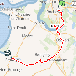
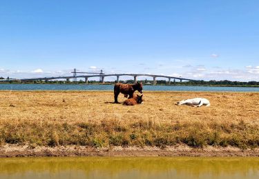
Tour Wandern von 25 km verfügbar auf Neu-Aquitanien, Charente-Maritime, Rochefort. Diese Tour wird von dudu85 vorgeschlagen.
Beschreibung
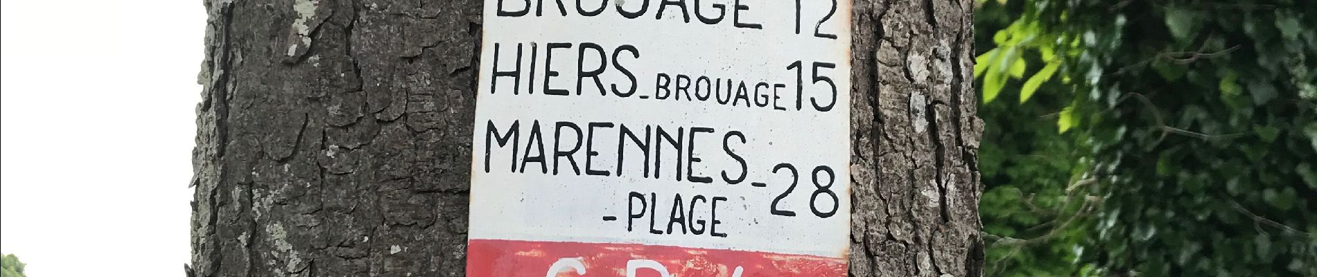
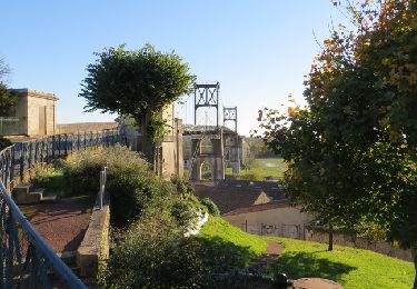
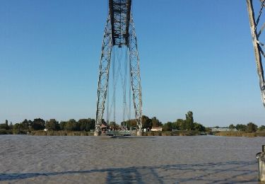
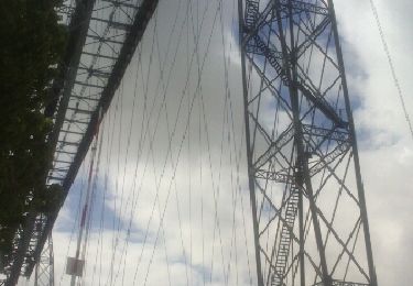
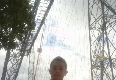
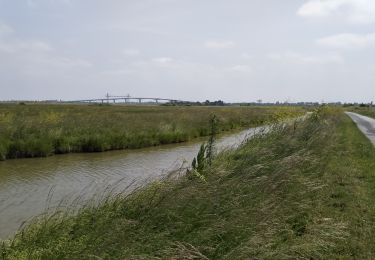
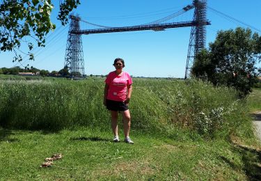
1 jour: gare de Rochefort - Brouage. Problème car le passeur au pont transbordeur en panne !! Donc 21kms au lieu de 26kms. Aïe aïe pas programmé pour donc les 4 derniers kms en stop
Ort
Land:
France
Region :
Neu-Aquitanien
Abteilung/Provinz :
Charente-Maritime
Kommune :
Rochefort
Standort:
Unknown
Gehen Sie:(Dec)
Gehen Sie:(UTM)
657834 ; 5090200 (30T) N.
Kommentare
Touren in der Umgebung
![Tour Wandern Rochefort - décathlon - Photo](https://media.geolcdn.com/t/375/260/ext.jpg?maxdim=2&url=https%3A%2F%2Fservices.sitytrail.com%2FGeolivesWS%2FDownloadMedia.ashx%3FTrailID%3D751971%26Media%3Dfix__20170513102135.jpg)
![Wandern Wandern](https://static1.geolcdn.com/sitytour/trail-icons/101.png)
décathlon
Wandern
Einfach
(1)
Rochefort,
Neu-Aquitanien,
Charente-Maritime,
France
![](/images/other/stat-length.png)
8,6 km | 9,2 km-effort
2h 3min
![](https://static1.geolcdn.com/siteimages/upload/files/16400158638029165_repeat_loop_refresh_sync_direction_icon.png)
Ja
![Tour Fahrrad Rochefort - Les ponts rochefortais - Rochefort - Photo](https://media.geolcdn.com/t/375/260/ext.jpg?maxdim=2&url=https%3A%2F%2Fservices.sitytrail.com%2FGeolivesWS%2FDownloadMedia.ashx%3FTrailID%3D172941%26Media%3D14418_2.jpg)
![Fahrrad Fahrrad](https://static1.geolcdn.com/sitytour/trail-icons/200.png)
Les ponts rochefortais - Rochefort
Fahrrad
Medium
(1)
Rochefort,
Neu-Aquitanien,
Charente-Maritime,
France
![](/images/other/stat-length.png)
28 km | 30 km-effort
3h 0min
![](https://static1.geolcdn.com/siteimages/upload/files/16400158638029165_repeat_loop_refresh_sync_direction_icon.png)
Ja
![Tour Hybrid-Bike Rochefort - Cyclo autour de Rochefort - Photo](https://media.geolcdn.com/t/375/260/2f277ad3-8f0a-493a-a624-0ba3c521f126.jpg&format=jpg&maxdim=2)
![Hybrid-Bike Hybrid-Bike](https://static1.geolcdn.com/sitytour/trail-icons/203.png)
Cyclo autour de Rochefort
Hybrid-Bike
Sehr leicht
Rochefort,
Neu-Aquitanien,
Charente-Maritime,
France
![](/images/other/stat-length.png)
66 km | 71 km-effort
4h 59min
![](https://static1.geolcdn.com/siteimages/upload/files/16400158638029165_repeat_loop_refresh_sync_direction_icon.png)
Ja
![Tour Hybrid-Bike Rochefort - Rochefort_ Breuil-Magné_Les Marais - Photo](https://media.geolcdn.com/t/375/260/ext.jpg?maxdim=2&url=https%3A%2F%2Fstatic1.geolcdn.com%2Fsiteimages%2Fupload%2Ffiles%2F1524743154velo.jpg)
![Hybrid-Bike Hybrid-Bike](https://static1.geolcdn.com/sitytour/trail-icons/203.png)
Rochefort_ Breuil-Magné_Les Marais
Hybrid-Bike
Einfach
(1)
Rochefort,
Neu-Aquitanien,
Charente-Maritime,
France
![](/images/other/stat-length.png)
38 km | 40 km-effort
3h 20min
![](https://static1.geolcdn.com/siteimages/upload/files/16400158638029165_repeat_loop_refresh_sync_direction_icon.png)
Ja
![Tour Wandern Rochefort - Rochefort - Photo](https://media.geolcdn.com/t/375/260/ext.jpg?maxdim=2&url=https%3A%2F%2Fservices.sitytrail.com%2FGeolivesWS%2FDownloadMedia.ashx%3FTrailID%3D476372%26Media%3Dfix__20150927173006.jpg)
![Wandern Wandern](https://static1.geolcdn.com/sitytour/trail-icons/101.png)
Rochefort
Wandern
Einfach
(1)
Rochefort,
Neu-Aquitanien,
Charente-Maritime,
France
![](/images/other/stat-length.png)
10,7 km | 11,7 km-effort
2h 53min
![](https://static1.geolcdn.com/siteimages/upload/files/16400158638029165_repeat_loop_refresh_sync_direction_icon.png)
Ja
![Tour Andere Aktivitäten Rochefort - Rochefort - pont transbordeur - Photo](https://media.geolcdn.com/t/375/260/ext.jpg?maxdim=2&url=https%3A%2F%2Fservices.sitytrail.com%2FGeolivesWS%2FDownloadMedia.ashx%3FTrailID%3D448908%26Media%3Dfix__20140428121407.jpg)
![Andere Aktivitäten Andere Aktivitäten](https://static1.geolcdn.com/sitytour/trail-icons/900.png)
Rochefort - pont transbordeur
Andere Aktivitäten
Sehr leicht
Rochefort,
Neu-Aquitanien,
Charente-Maritime,
France
![](/images/other/stat-length.png)
3,9 km | 4,2 km-effort
25min
![](https://static1.geolcdn.com/siteimages/upload/files/16400158638029165_repeat_loop_refresh_sync_direction_icon.png)
Nein
![Tour Wandern Rochefort - Rochefort - pont transbordeur - Photo](https://media.geolcdn.com/t/375/260/ext.jpg?maxdim=2&url=https%3A%2F%2Fservices.sitytrail.com%2FGeolivesWS%2FDownloadMedia.ashx%3FTrailID%3D271334%26Media%3Dfix__20140428121318.jpg)
![Wandern Wandern](https://static1.geolcdn.com/sitytour/trail-icons/101.png)
Rochefort - pont transbordeur
Wandern
Sehr leicht
Rochefort,
Neu-Aquitanien,
Charente-Maritime,
France
![](/images/other/stat-length.png)
3,9 km | 4,2 km-effort
25min
![](https://static1.geolcdn.com/siteimages/upload/files/16400158638029165_repeat_loop_refresh_sync_direction_icon.png)
Nein
![Tour Mountainbike Rochefort - 17-vtt-rochefort-tour-17km - Photo](https://media.geolcdn.com/t/375/260/a39986a4-605f-4c19-8e55-29dae387c299.jpg&format=jpg&maxdim=2)
![Mountainbike Mountainbike](https://static1.geolcdn.com/sitytour/trail-icons/202.png)
17-vtt-rochefort-tour-17km
Mountainbike
Einfach
Rochefort,
Neu-Aquitanien,
Charente-Maritime,
France
![](/images/other/stat-length.png)
16,8 km | 18 km-effort
2h 5min
![](https://static1.geolcdn.com/siteimages/upload/files/16400158638029165_repeat_loop_refresh_sync_direction_icon.png)
Ja
![Tour Mountainbike Rochefort - rochefort - st trojan - Photo](https://media.geolcdn.com/t/375/260/8230a513-be5b-45d2-bdc9-e111400f149e.jpg&format=jpg&maxdim=2)
![Mountainbike Mountainbike](https://static1.geolcdn.com/sitytour/trail-icons/202.png)
rochefort - st trojan
Mountainbike
Sehr leicht
Rochefort,
Neu-Aquitanien,
Charente-Maritime,
France
![](/images/other/stat-length.png)
51 km | 54 km-effort
4h 21min
![](https://static1.geolcdn.com/siteimages/upload/files/16400158638029165_repeat_loop_refresh_sync_direction_icon.png)
Nein