![](/images/other/stat-length.png)
![Tour Zu Fuß Perpignan - Boucle dans PERPIGNAN - Photo](https://media.geolcdn.com/t/1900/400/137c38c9-6a66-4734-b8cf-d808cac9439e.jpg&format=pjpeg&maxdim=2)
Boucle dans PERPIGNAN
marcheur75
Benutzer
![Länge](/images/other/stat-length.png)
Länge
11,8 km
![Maximale Höhe](https://static1.geolcdn.com/siteimages/upload/files/1508320355ic_sort_altitude_max_24dp.png)
Maximale Höhe
63 m
![Positive Höhendifferenz](https://static1.geolcdn.com/siteimages/upload/files/1508320355ic_sort_den_pos_24dp.png)
Positive Höhendifferenz
93 m
![Km-Effort](/images/other/stat-length.png)
Km-Effort
13 km
![Min. Höhe](https://static1.geolcdn.com/siteimages/upload/files/1508320355ic_sort_altitude_min_24dp.png)
Min. Höhe
30 m
![Negative Höhendifferenz](https://static1.geolcdn.com/siteimages/upload/files/1508320355ic_sort_den_neg_24dp.png)
Negative Höhendifferenz
91 m
![Boucle](https://static1.geolcdn.com/siteimages/upload/files/16400158638029165_repeat_loop_refresh_sync_direction_icon.png)
Boucle
Ja
Erstellungsdatum :
2019-03-25 07:51:16.325
Letzte Änderung :
2019-03-25 15:40:54.797
![Zu Fuß](https://static1.geolcdn.com/sitytour/trail-icons/100.png)
--
Schwierigkeit : Sehr leicht
![Scannen Sie diesen QR-Code, um die Tour in der SityTrail-Anwendung zu öffnen](https://capi.geolives.com/qq0zvz2zws4bq2lad0pu/sitytour/trails/2052053/qr.png?size=200)
Kostenlosegpshiking-Anwendung
Über SityTrail
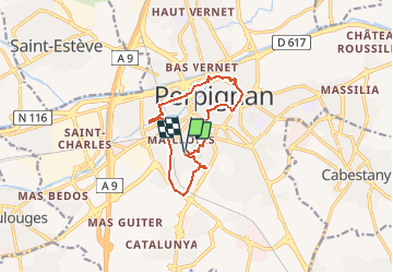
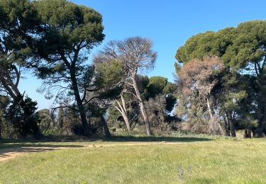
Tour Zu Fuß von 11,8 km verfügbar auf Okzitanien, Ostpyrenäen, Perpignan. Diese Tour wird von marcheur75 vorgeschlagen.
Beschreibung
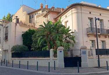
Boucle PERPIGNAN ,Las Canal , Gare de Perpignan,Le castillet,Palais des Congres, Square Bir Hakein,et Palais de rois de majorque
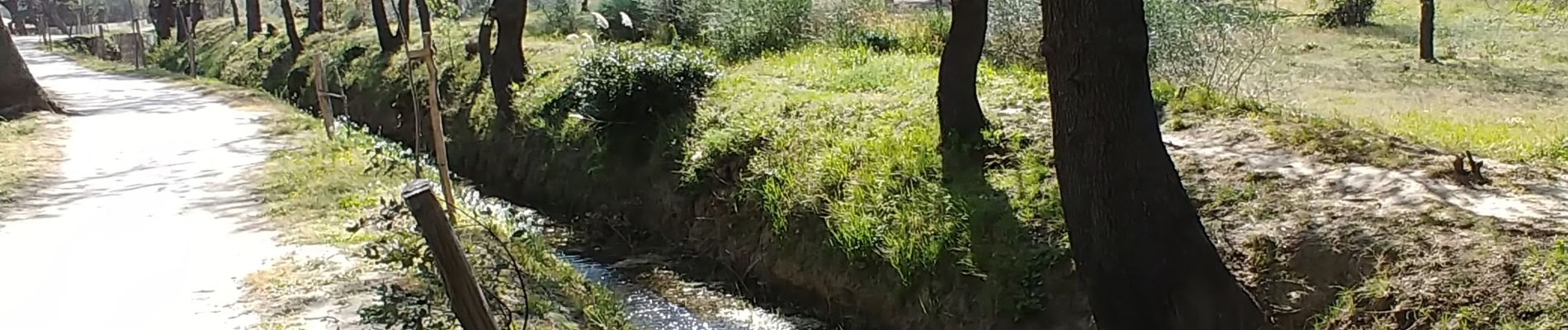
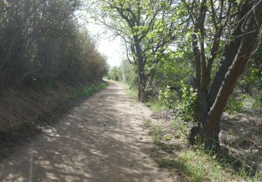
Bonne Ballade
Ort
Land:
France
Region :
Okzitanien
Abteilung/Provinz :
Ostpyrenäen
Kommune :
Perpignan
Standort:
Unknown
Gehen Sie:(Dec)
Gehen Sie:(UTM)
490690 ; 4725819 (31T) N.
Kommentare
Touren in der Umgebung
![Tour Wandern Saint-Estève - SAINT-ESTEVE 66 - ballade dans le Vignoble de Rivesaltes - Photo](https://media.geolcdn.com/t/375/260/ext.jpg?maxdim=2&url=https%3A%2F%2Fservices.sitytrail.com%2FGeolivesWS%2FDownloadMedia.ashx%3FTrailID%3D449054%26Media%3D20150723191454.jpg)
![Wandern Wandern](https://static1.geolcdn.com/sitytour/trail-icons/101.png)
SAINT-ESTEVE 66 - ballade dans le Vignoble de Rivesaltes
Wandern
Medium
(1)
Saint-Estève,
Okzitanien,
Ostpyrenäen,
France
![](/images/other/stat-length.png)
8 km | 8,8 km-effort
1h 23min
![](https://static1.geolcdn.com/siteimages/upload/files/16400158638029165_repeat_loop_refresh_sync_direction_icon.png)
Ja
![Tour Wandern Cabestany - Chemins autour de Cabestany - Photo](https://media.geolcdn.com/t/375/260/ext.jpg?maxdim=2&url=https%3A%2F%2Fservices.sitytrail.com%2FGeolivesWS%2FDownloadMedia.ashx%3FTrailID%3D105901%26Media%3D9899_2.jpg)
![Wandern Wandern](https://static1.geolcdn.com/sitytour/trail-icons/101.png)
Chemins autour de Cabestany
Wandern
Medium
(2)
Cabestany,
Okzitanien,
Ostpyrenäen,
France
![](/images/other/stat-length.png)
11,8 km | 12,7 km-effort
3h 0min
![](https://static1.geolcdn.com/siteimages/upload/files/16400158638029165_repeat_loop_refresh_sync_direction_icon.png)
Ja
![Tour Wandern Perpignan - Perpignan 01.10.2017 - Photo](https://media.geolcdn.com/t/375/260/ext.jpg?maxdim=2&url=https%3A%2F%2Fstatic1.geolcdn.com%2Fsiteimages%2Fupload%2Ffiles%2F1553511878bg_sport_marche.png)
![Wandern Wandern](https://static1.geolcdn.com/sitytour/trail-icons/101.png)
Perpignan 01.10.2017
Wandern
Einfach
(1)
Perpignan,
Okzitanien,
Ostpyrenäen,
France
![](/images/other/stat-length.png)
6,7 km | 7,5 km-effort
1h 39min
![](https://static1.geolcdn.com/siteimages/upload/files/16400158638029165_repeat_loop_refresh_sync_direction_icon.png)
Nein
![Tour Wandern Villeneuve-de-la-Raho - 66 VILLENEUVE-DE-LA-RAHO - grand tour périphérique du lac par les lignes de crêtes - Photo](https://media.geolcdn.com/t/375/260/ext.jpg?maxdim=2&url=https%3A%2F%2Fstatic1.geolcdn.com%2Fsiteimages%2Fupload%2Ffiles%2F1553511878bg_sport_marche.png)
![Wandern Wandern](https://static1.geolcdn.com/sitytour/trail-icons/101.png)
66 VILLENEUVE-DE-LA-RAHO - grand tour périphérique du lac par les lignes de c...
Wandern
Einfach
(2)
Villeneuve-de-la-Raho,
Okzitanien,
Ostpyrenäen,
France
![](/images/other/stat-length.png)
10 km | 11,5 km-effort
1h 44min
![](https://static1.geolcdn.com/siteimages/upload/files/16400158638029165_repeat_loop_refresh_sync_direction_icon.png)
Ja
![Tour Mountainbike Canohès - canohes - Photo](https://media.geolcdn.com/t/375/260/ext.jpg?maxdim=2&url=https%3A%2F%2Fstatic1.geolcdn.com%2Fsiteimages%2Fupload%2Ffiles%2F1524743154velo.jpg)
![Mountainbike Mountainbike](https://static1.geolcdn.com/sitytour/trail-icons/202.png)
canohes
Mountainbike
Medium
(2)
Canohès,
Okzitanien,
Ostpyrenäen,
France
![](/images/other/stat-length.png)
37 km | 44 km-effort
2h 12min
![](https://static1.geolcdn.com/siteimages/upload/files/16400158638029165_repeat_loop_refresh_sync_direction_icon.png)
Ja
![Tour Quad Villeneuve-de-la-Raho - Villeneuve-de-la-Raho-Collioure(Juillet-Aout) - Photo](https://media.geolcdn.com/t/375/260/94b9111a-30bb-4d36-9ee6-84d7d83dae26.jpg&format=jpg&maxdim=2)
![Quad Quad](https://static1.geolcdn.com/sitytour/trail-icons/404.png)
Villeneuve-de-la-Raho-Collioure(Juillet-Aout)
Quad
Sehr leicht
(1)
Villeneuve-de-la-Raho,
Okzitanien,
Ostpyrenäen,
France
![](/images/other/stat-length.png)
39 km | 44 km-effort
1h 40min
![](https://static1.geolcdn.com/siteimages/upload/files/16400158638029165_repeat_loop_refresh_sync_direction_icon.png)
Nein
![Wandern Wandern](https://static1.geolcdn.com/sitytour/trail-icons/101.png)
cabestany
Wandern
Medium
Cabestany,
Okzitanien,
Ostpyrenäen,
France
![](/images/other/stat-length.png)
7,5 km | 8,2 km-effort
2h 35min
![](https://static1.geolcdn.com/siteimages/upload/files/16400158638029165_repeat_loop_refresh_sync_direction_icon.png)
Ja
![Tour Wandern Perpignan - petit tour à Perpignan - Photo](https://media.geolcdn.com/t/375/260/cf8ad957-f56e-48d4-8573-e9a6b69866e7.jpg&format=jpg&maxdim=2)
![Wandern Wandern](https://static1.geolcdn.com/sitytour/trail-icons/101.png)
petit tour à Perpignan
Wandern
Sehr leicht
Perpignan,
Okzitanien,
Ostpyrenäen,
France
![](/images/other/stat-length.png)
3,9 km | 4,2 km-effort
1h 53min
![](https://static1.geolcdn.com/siteimages/upload/files/16400158638029165_repeat_loop_refresh_sync_direction_icon.png)
Ja
![Tour Wandern Perpignan - Perpignan - Photo](https://media.geolcdn.com/t/375/260/904ff4bb-4f73-47d8-906f-dc7922d74f80.jpg&format=jpg&maxdim=2)
![Wandern Wandern](https://static1.geolcdn.com/sitytour/trail-icons/101.png)
Perpignan
Wandern
Sehr leicht
Perpignan,
Okzitanien,
Ostpyrenäen,
France
![](/images/other/stat-length.png)
18 km | 19,9 km-effort
2h 23min
![](https://static1.geolcdn.com/siteimages/upload/files/16400158638029165_repeat_loop_refresh_sync_direction_icon.png)
Nein