![](/images/other/stat-length.png)
![Tour Dauphin - 04 - Dauphin - Les fours et la mine de gypse - Photo](https://media.geolcdn.com/t/1900/400/ext.pjpeg?maxdim=2&url=https%3A%2F%2Fsecurestorage.geolives.com%2Fsitytour%2Ftrail-bg%2Fdefault.jpg)
04 - Dauphin - Les fours et la mine de gypse
patrice.marckt
Benutzer
![Länge](/images/other/stat-length.png)
![Maximale Höhe](https://static1.geolcdn.com/siteimages/upload/files/1508320355ic_sort_altitude_max_24dp.png)
![Positive Höhendifferenz](https://static1.geolcdn.com/siteimages/upload/files/1508320355ic_sort_den_pos_24dp.png)
![Km-Effort](/images/other/stat-length.png)
![Min. Höhe](https://static1.geolcdn.com/siteimages/upload/files/1508320355ic_sort_altitude_min_24dp.png)
![Negative Höhendifferenz](https://static1.geolcdn.com/siteimages/upload/files/1508320355ic_sort_den_neg_24dp.png)
![Boucle](https://static1.geolcdn.com/siteimages/upload/files/16400158638029165_repeat_loop_refresh_sync_direction_icon.png)
![Scannen Sie diesen QR-Code, um die Tour in der SityTrail-Anwendung zu öffnen](https://capi.geolives.com/qq0zvz2zws4bq2lad0pu/sitytour/trails/2036612/qr.png?size=200)
Kostenlosegpshiking-Anwendung
Über SityTrail
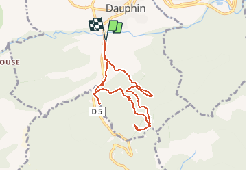
Tour von 8 km verfügbar auf Provence-Alpes-Côte d'Azur, Alpes-de-Haute-Provence, Dauphin. Diese Tour wird von patrice.marckt vorgeschlagen.
Beschreibung
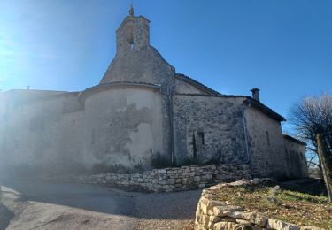
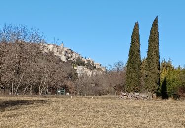
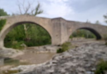
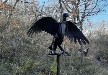
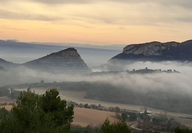
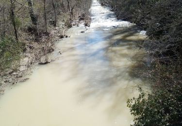
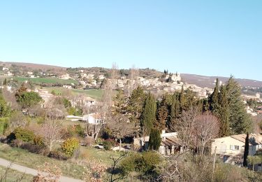
Les participants à cette sortie se regroupent dans quelques voitures, à Dauphin, pour gagner le petit pont, près du moulin de l'Ausselet d'où nous démmarrons la randonnée. Pour une fois, si c'est bien moi qui la propose, c'est Eric qui va mener cette sortie ... et ce n'est pas à la vitesse habituelle car Eric marche vite et les randonneurs devront lui demander plusieurs fois de ralentir. Nous sommes rapidement dans la forêt domaniale de Pelissane et commençons par monter, monter par une large piste que nous quittons bientôt pour un petit détour vers une source. Nous regagnons notre itinéraire prévu pour gagner la mine de gypse de l'Escourteja. L'entrée est étroite mais c'est une très grande pièce qui s'offre à nous au-delà d'un tunnel d'une dizaine de mètres. En sortant de la mine nous revenons une centaine de mètres sur nos pas pour prendre un chemin qui nous permet de contourner la colline et nous amène à la route entre Dauphin et Manosque (via le Col de la Mort d'Imbert). Encore un petit détour pour une source, celle du Comtard(mais Contard sur la carte de Cassini). Nous revenons vers la route et passons devant les reste d'un ancien moulin puis nous gagnons un site où plusieurs fours à gypse ont été reconstitués. Une pause près d'une nouvelle source et d'un pont fait l'unanimité. Nous repartons et gagnons rapidement les voitures toutes proches.
Ort
Kommentare
Touren in der Umgebung
![Tour Wandern Mane - MANE. Prieuré de Salagon , Pont romain , petit Sauvan , carrières, tour de Pourchere chapelles , ol l s - Photo](https://media.geolcdn.com/t/375/260/d1588e6f-dded-4027-aaae-990874136ea9.jpg&format=jpg&maxdim=2)
![Wandern Wandern](https://static1.geolcdn.com/sitytour/trail-icons/101.png)
Wandern
![](/images/other/stat-length.png)
![](https://static1.geolcdn.com/siteimages/upload/files/16400158638029165_repeat_loop_refresh_sync_direction_icon.png)
![Tour Wandern Dauphin - DAUPHIN La forêt de Pelissier o - Photo](https://media.geolcdn.com/t/375/260/38031732-1577-4607-ab9b-103e2562d975.jpg&format=jpg&maxdim=2)
![Wandern Wandern](https://static1.geolcdn.com/sitytour/trail-icons/101.png)
Wandern
![](/images/other/stat-length.png)
![](https://static1.geolcdn.com/siteimages/upload/files/16400158638029165_repeat_loop_refresh_sync_direction_icon.png)
![Tour Wandern Manosque - Le Val des Chats, avant le col de la Mort d'Imbert. - Photo](https://media.geolcdn.com/t/375/260/ext.jpg?maxdim=2&url=https%3A%2F%2Fservices.sitytrail.com%2FGeolivesWS%2FDownloadMedia.ashx%3FTrailID%3D897794%26Media%3Dfix__20180202095306.jpg)
![Wandern Wandern](https://static1.geolcdn.com/sitytour/trail-icons/101.png)
Wandern
![](/images/other/stat-length.png)
![](https://static1.geolcdn.com/siteimages/upload/files/16400158638029165_repeat_loop_refresh_sync_direction_icon.png)
![Tour Wandern Mane - MANE , pont romain , chapelle S Jean et chapelle Châteauneuf o l s - Photo](https://media.geolcdn.com/t/375/260/f11acae6-d29d-4a56-adfa-70f020f219fb.jpg&format=jpg&maxdim=2)
![Wandern Wandern](https://static1.geolcdn.com/sitytour/trail-icons/101.png)
Wandern
![](/images/other/stat-length.png)
![](https://static1.geolcdn.com/siteimages/upload/files/16400158638029165_repeat_loop_refresh_sync_direction_icon.png)
![Tour Wandern Mane - MANE Saint Michel Observatoire o - Photo](https://media.geolcdn.com/t/375/260/39e7d3b3-522e-416b-a76a-f14dbd0f25fb.jpg&format=jpg&maxdim=2)
![Wandern Wandern](https://static1.geolcdn.com/sitytour/trail-icons/101.png)
Wandern
![](/images/other/stat-length.png)
![](https://static1.geolcdn.com/siteimages/upload/files/16400158638029165_repeat_loop_refresh_sync_direction_icon.png)
![Tour Zu Fuß Saint-Maime - SAINT MAIME . Brives , le Pin Blanc o - Photo](https://media.geolcdn.com/t/375/260/11607803-5104-4dd0-9a83-c2f0b288f355.jpg&format=jpg&maxdim=2)
![Zu Fuß Zu Fuß](https://static1.geolcdn.com/sitytour/trail-icons/100.png)
Zu Fuß
![](/images/other/stat-length.png)
![](https://static1.geolcdn.com/siteimages/upload/files/16400158638029165_repeat_loop_refresh_sync_direction_icon.png)
![Tour Mountainbike Volx - Volx/Montaigu/Bellevue/La Garde - Photo](https://media.geolcdn.com/t/375/260/ext.jpg?maxdim=2&url=https%3A%2F%2Fstatic1.geolcdn.com%2Fsiteimages%2Fupload%2Ffiles%2F1524743154velo.jpg)
![Mountainbike Mountainbike](https://static1.geolcdn.com/sitytour/trail-icons/202.png)
Mountainbike
![](/images/other/stat-length.png)
![](https://static1.geolcdn.com/siteimages/upload/files/16400158638029165_repeat_loop_refresh_sync_direction_icon.png)
![Tour Wandern Mane - mane le barrage - Photo](https://media.geolcdn.com/t/375/260/098f335b-b3f2-4d71-9b06-371a5f1d7f65.jpg&format=jpg&maxdim=2)
![Wandern Wandern](https://static1.geolcdn.com/sitytour/trail-icons/101.png)
Wandern
![](/images/other/stat-length.png)
![](https://static1.geolcdn.com/siteimages/upload/files/16400158638029165_repeat_loop_refresh_sync_direction_icon.png)
![Tour Wandern Saint-Michel-l'Observatoire - st.michel l observatoire. les deux chapelles. - Photo](https://media.geolcdn.com/t/375/260/54e692cc-e8b3-43fd-82d3-a37f7db75ecb.jpg&format=jpg&maxdim=2)
![Wandern Wandern](https://static1.geolcdn.com/sitytour/trail-icons/101.png)
Wandern
![](/images/other/stat-length.png)
![](https://static1.geolcdn.com/siteimages/upload/files/16400158638029165_repeat_loop_refresh_sync_direction_icon.png)