![](/images/other/stat-length.png)
![Tour Zu Fuß Chaumes-en-Retz - jcyol44 arthon en retz via chéméré - Photo](https://media.geolcdn.com/t/1900/400/ext.pjpeg?maxdim=2&url=https%3A%2F%2Fstatic1.geolcdn.com%2Fsiteimages%2Fupload%2Ffiles%2F1545311037marcheuse_200dpi.jpg)
jcyol44 arthon en retz via chéméré
JCYOL44
Benutzer
![Länge](/images/other/stat-length.png)
![Maximale Höhe](https://static1.geolcdn.com/siteimages/upload/files/1508320355ic_sort_altitude_max_24dp.png)
![Positive Höhendifferenz](https://static1.geolcdn.com/siteimages/upload/files/1508320355ic_sort_den_pos_24dp.png)
![Km-Effort](/images/other/stat-length.png)
![Min. Höhe](https://static1.geolcdn.com/siteimages/upload/files/1508320355ic_sort_altitude_min_24dp.png)
![Negative Höhendifferenz](https://static1.geolcdn.com/siteimages/upload/files/1508320355ic_sort_den_neg_24dp.png)
![Boucle](https://static1.geolcdn.com/siteimages/upload/files/16400158638029165_repeat_loop_refresh_sync_direction_icon.png)
![Zu Fuß](https://static1.geolcdn.com/sitytour/trail-icons/100.png)
2h20
Schwierigkeit : Sehr leicht
![Scannen Sie diesen QR-Code, um die Tour in der SityTrail-Anwendung zu öffnen](https://capi.geolives.com/qq0zvz2zws4bq2lad0pu/sitytour/trails/2035446/qr.png?size=200)
Kostenlosegpshiking-Anwendung
Über SityTrail
Tour Zu Fuß von 9,6 km verfügbar auf Pays de la Loire, Loire-Atlantique, Chaumes-en-Retz. Diese Tour wird von JCYOL44 vorgeschlagen.
Beschreibung
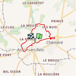
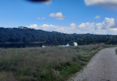
Petite boucle d'environ 10km sans difficulté..
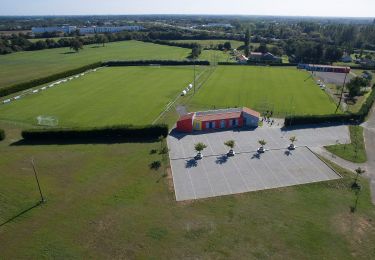
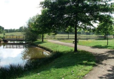
Départ / arrivée du parking de la salle de sports. Partir en longeant la D751 puis passer le pont sur votre droite .Sur la D5. Traverser la D5 en direction de La Meule. Sur votre gauche prendre un chemin qui vous emmène vers La Danjollerie. Arrivé au Plessis, tourner à droite jusqu'au parc de Chéméré; en faire le tour puis longer à nouveau la D751 jusqu'au parking.
Ort
Kommentare
Touren in der Umgebung
![Tour Zu Fuß Chaumes-en-Retz - Sentier pédestre des Iles Enchantées - Photo](https://media.geolcdn.com/t/375/260/8d9b3652-bedc-4903-8d23-e450b9c65d96.jpeg&format=jpg&maxdim=2)
![Zu Fuß Zu Fuß](https://static1.geolcdn.com/sitytour/trail-icons/100.png)
Zu Fuß
![](/images/other/stat-length.png)
![](https://static1.geolcdn.com/siteimages/upload/files/16400158638029165_repeat_loop_refresh_sync_direction_icon.png)
![Tour Zu Fuß Chaumes-en-Retz - Circuit des Chênes - Photo](https://media.geolcdn.com/t/375/260/7606bf5a-2198-4218-abf5-a4d4ae02cf42.jpeg&format=jpg&maxdim=2)
![Zu Fuß Zu Fuß](https://static1.geolcdn.com/sitytour/trail-icons/100.png)
Zu Fuß
![](/images/other/stat-length.png)
![](https://static1.geolcdn.com/siteimages/upload/files/16400158638029165_repeat_loop_refresh_sync_direction_icon.png)
![Tour Wandern Chaumes-en-Retz - Arthon Chemere - Photo](https://media.geolcdn.com/t/375/260/5c2166da-4a74-4ba7-a499-c7af068420f8.jpg&format=jpg&maxdim=2)
![Wandern Wandern](https://static1.geolcdn.com/sitytour/trail-icons/101.png)
Wandern
![](/images/other/stat-length.png)
![](https://static1.geolcdn.com/siteimages/upload/files/16400158638029165_repeat_loop_refresh_sync_direction_icon.png)
![Tour Mountainbike Chaumes-en-Retz - de Arthon en Retz par le Prépaud - Photo](https://media.geolcdn.com/t/375/260/ext.jpg?maxdim=2&url=https%3A%2F%2Fstatic1.geolcdn.com%2Fsiteimages%2Fupload%2Ffiles%2F1524743154velo.jpg)
![Mountainbike Mountainbike](https://static1.geolcdn.com/sitytour/trail-icons/202.png)
Mountainbike
![](/images/other/stat-length.png)
![](https://static1.geolcdn.com/siteimages/upload/files/16400158638029165_repeat_loop_refresh_sync_direction_icon.png)
![Tour Hybrid-Bike Chaumes-en-Retz - Belle Épine lac de Pornic - Photo](https://media.geolcdn.com/t/375/260/4196bce5-8058-43cf-9aa2-712e6b61de2a.jpg&format=jpg&maxdim=2)
![Hybrid-Bike Hybrid-Bike](https://static1.geolcdn.com/sitytour/trail-icons/203.png)
Hybrid-Bike
![](/images/other/stat-length.png)
![](https://static1.geolcdn.com/siteimages/upload/files/16400158638029165_repeat_loop_refresh_sync_direction_icon.png)
![Tour Zu Fuß Chaumes-en-Retz - D'Arthon à La Sicaudais - Photo](https://media.geolcdn.com/t/375/260/39754271-52c4-4067-8a63-e67370b7bbbe.jpeg&format=jpg&maxdim=2)
![Zu Fuß Zu Fuß](https://static1.geolcdn.com/sitytour/trail-icons/100.png)
Zu Fuß
![](/images/other/stat-length.png)
![](https://static1.geolcdn.com/siteimages/upload/files/16400158638029165_repeat_loop_refresh_sync_direction_icon.png)
![Tour Zu Fuß Chaumes-en-Retz - Circuit de Haute-Perche - Photo](https://media.geolcdn.com/t/375/260/39754271-52c4-4067-8a63-e67370b7bbbe.jpeg&format=jpg&maxdim=2)
![Zu Fuß Zu Fuß](https://static1.geolcdn.com/sitytour/trail-icons/100.png)
Zu Fuß
![](/images/other/stat-length.png)
![](https://static1.geolcdn.com/siteimages/upload/files/16400158638029165_repeat_loop_refresh_sync_direction_icon.png)
![Tour Mountainbike Chaumes-en-Retz - Belle épine/Ste Pazane - Photo](https://media.geolcdn.com/t/375/260/91857525-f683-4e66-91a0-3b82395a892f.jpg&format=jpg&maxdim=2)
![Mountainbike Mountainbike](https://static1.geolcdn.com/sitytour/trail-icons/202.png)
Mountainbike
![](/images/other/stat-length.png)
![](https://static1.geolcdn.com/siteimages/upload/files/16400158638029165_repeat_loop_refresh_sync_direction_icon.png)
![Tour Wandern Chaumes-en-Retz - Les Chênes - Photo](https://media.geolcdn.com/t/375/260/ac7d3175-0270-486b-af63-acac79c92b63.jpg&format=jpg&maxdim=2)
![Wandern Wandern](https://static1.geolcdn.com/sitytour/trail-icons/101.png)
Wandern
![](/images/other/stat-length.png)
![](https://static1.geolcdn.com/siteimages/upload/files/16400158638029165_repeat_loop_refresh_sync_direction_icon.png)