![](/images/other/stat-length.png)
![Tour Wandern Parfondeval - Le chemin de la brique et du torchis - Photo](https://media.geolcdn.com/t/1900/400/ext.pjpeg?maxdim=2&url=https%3A%2F%2Fservices.sitytrail.com%2FGeolivesWS%2FDownloadMedia.ashx%3FTrailID%3D202835%26Media%3D1d68a018-702f-40a0-b6e7-da045377dae5.jpg)
Le chemin de la brique et du torchis
Rando Famili
Randonnées de RandoFamili
![Länge](/images/other/stat-length.png)
Länge
1,4 km
![Maximale Höhe](https://static1.geolcdn.com/siteimages/upload/files/1508320355ic_sort_altitude_max_24dp.png)
Maximale Höhe
222 m
![Positive Höhendifferenz](https://static1.geolcdn.com/siteimages/upload/files/1508320355ic_sort_den_pos_24dp.png)
Positive Höhendifferenz
22 m
![Km-Effort](/images/other/stat-length.png)
Km-Effort
1,7 km
![Min. Höhe](https://static1.geolcdn.com/siteimages/upload/files/1508320355ic_sort_altitude_min_24dp.png)
Min. Höhe
196 m
![Negative Höhendifferenz](https://static1.geolcdn.com/siteimages/upload/files/1508320355ic_sort_den_neg_24dp.png)
Negative Höhendifferenz
22 m
![Boucle](https://static1.geolcdn.com/siteimages/upload/files/16400158638029165_repeat_loop_refresh_sync_direction_icon.png)
Boucle
Ja
Erstellungsdatum :
2014-12-10 00:00:00.0
Letzte Änderung :
2014-12-10 00:00:00.0
![Wandern](https://static1.geolcdn.com/sitytour/trail-icons/101.png)
--
Schwierigkeit : Unbekannt
![Scannen Sie diesen QR-Code, um die Tour in der SityTrail-Anwendung zu öffnen](https://capi.geolives.com/qq0zvz2zws4bq2lad0pu/sitytour/trails/202835/qr.png?size=200)
Kostenlosegpshiking-Anwendung
Über SityTrail
Tour Wandern von 1,4 km verfügbar auf Nordfrankreich, Aisne, Parfondeval. Diese Tour wird von Rando Famili vorgeschlagen.
Beschreibung
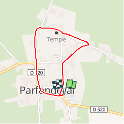
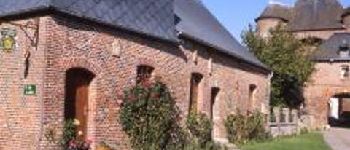
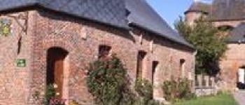
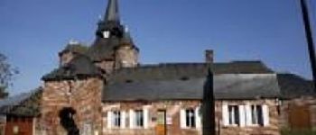
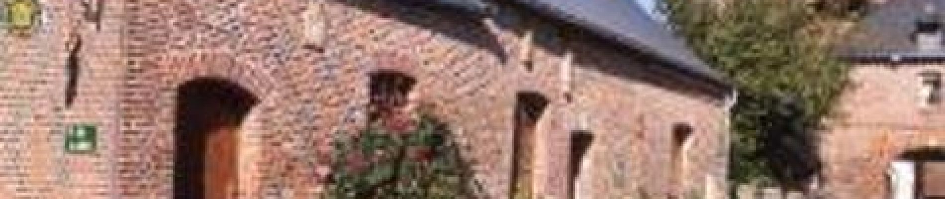
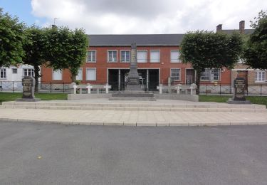
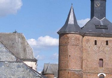
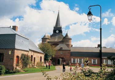
La découverte de Parfondeval ressemble à un inventaire : une église de brique rouge, un lavoir,un temple, des maisons et des fermes bâties ici en brique, là utilisant le torchis…
POIs
Ort
Land:
France
Region :
Nordfrankreich
Abteilung/Provinz :
Aisne
Kommune :
Parfondeval
Standort:
Unknown
Gehen Sie:(Dec)
Gehen Sie:(UTM)
583593 ; 5510268 (31U) N.
Kommentare
Touren in der Umgebung
![Tour Zu Fuß Brunehamel - Par le fond du val - Photo](https://media.geolcdn.com/t/375/260/8e3a953d-955c-4c62-a89d-391f5e526a72.jpeg&format=jpg&maxdim=2)
![Zu Fuß Zu Fuß](https://static1.geolcdn.com/sitytour/trail-icons/100.png)
Par le fond du val
Zu Fuß
Einfach
Brunehamel,
Nordfrankreich,
Aisne,
France
![](/images/other/stat-length.png)
12,5 km | 14,2 km-effort
3h 14min
![](https://static1.geolcdn.com/siteimages/upload/files/16400158638029165_repeat_loop_refresh_sync_direction_icon.png)
Ja
![Tour Wandern Brunehamel - 2023_04_23 PARFONDEVAL - Photo](https://media.geolcdn.com/t/375/260/376aed58-e901-440d-acd2-8ccf990f5b65.jpg&format=jpg&maxdim=2)
![Wandern Wandern](https://static1.geolcdn.com/sitytour/trail-icons/101.png)
2023_04_23 PARFONDEVAL
Wandern
Schwierig
Brunehamel,
Nordfrankreich,
Aisne,
France
![](/images/other/stat-length.png)
10,5 km | 12,4 km-effort
2h 49min
![](https://static1.geolcdn.com/siteimages/upload/files/16400158638029165_repeat_loop_refresh_sync_direction_icon.png)
Nein
![Tour Wandern Parfondeval - Par le fond du val - Photo](https://media.geolcdn.com/t/375/260/ext.jpg?maxdim=2&url=https%3A%2F%2Fservices.sitytrail.com%2FGeolivesWS%2FDownloadMedia.ashx%3FTrailID%3D108375%26Media%3D1059_2.jpg)
![Wandern Wandern](https://static1.geolcdn.com/sitytour/trail-icons/101.png)
Par le fond du val
Wandern
Sehr schwierig
Parfondeval,
Nordfrankreich,
Aisne,
France
![](/images/other/stat-length.png)
13 km | 14,9 km-effort
3h 30min
![](https://static1.geolcdn.com/siteimages/upload/files/16400158638029165_repeat_loop_refresh_sync_direction_icon.png)
Ja
![Tour Wandern Parfondeval - Le chemin de la brique et du torchis - Photo](https://media.geolcdn.com/t/375/260/ext.jpg?maxdim=2&url=https%3A%2F%2Fservices.sitytrail.com%2FGeolivesWS%2FDownloadMedia.ashx%3FTrailID%3D108963%26Media%3D2852_1.jpg)
![Wandern Wandern](https://static1.geolcdn.com/sitytour/trail-icons/101.png)
Le chemin de la brique et du torchis
Wandern
Einfach
Parfondeval,
Nordfrankreich,
Aisne,
France
![](/images/other/stat-length.png)
1,4 km | 1,7 km-effort
45min
![](https://static1.geolcdn.com/siteimages/upload/files/16400158638029165_repeat_loop_refresh_sync_direction_icon.png)
Ja
![Tour Wandern Résigny - Du chemin de fer au chemin vert - Photo](https://media.geolcdn.com/t/375/260/ext.jpg?maxdim=2&url=https%3A%2F%2Fstatic1.geolcdn.com%2Fsiteimages%2Fupload%2Ffiles%2F1553511878bg_sport_marche.png)
![Wandern Wandern](https://static1.geolcdn.com/sitytour/trail-icons/101.png)
Du chemin de fer au chemin vert
Wandern
Medium
Résigny,
Nordfrankreich,
Aisne,
France
![](/images/other/stat-length.png)
7,6 km | 9,2 km-effort
2h 30min
![](https://static1.geolcdn.com/siteimages/upload/files/16400158638029165_repeat_loop_refresh_sync_direction_icon.png)
Ja