![](/images/other/stat-length.png)
![Tour Andere Aktivitäten Glarus Süd - Elm- Àmpächli-Chüebodenalpsee-Àmpächli - Photo](https://media.geolcdn.com/t/1900/400/ext.pjpeg?maxdim=2&url=https%3A%2F%2Fstatic1.geolcdn.com%2Fsiteimages%2Fupload%2Ffiles%2F1545311037marcheuse_200dpi.jpg)
Elm- Àmpächli-Chüebodenalpsee-Àmpächli
jschna
Benutzer
![Länge](/images/other/stat-length.png)
Länge
7,3 km
![Maximale Höhe](https://static1.geolcdn.com/siteimages/upload/files/1508320355ic_sort_altitude_max_24dp.png)
Maximale Höhe
2114 m
![Positive Höhendifferenz](https://static1.geolcdn.com/siteimages/upload/files/1508320355ic_sort_den_pos_24dp.png)
Positive Höhendifferenz
643 m
![Km-Effort](/images/other/stat-length.png)
Km-Effort
15,9 km
![Min. Höhe](https://static1.geolcdn.com/siteimages/upload/files/1508320355ic_sort_altitude_min_24dp.png)
Min. Höhe
1472 m
![Negative Höhendifferenz](https://static1.geolcdn.com/siteimages/upload/files/1508320355ic_sort_den_neg_24dp.png)
Negative Höhendifferenz
634 m
![Boucle](https://static1.geolcdn.com/siteimages/upload/files/16400158638029165_repeat_loop_refresh_sync_direction_icon.png)
Boucle
Ja
Erstellungsdatum :
2014-12-11 00:00:00.0
Letzte Änderung :
2014-12-11 00:00:00.0
![Andere Aktivitäten](https://static1.geolcdn.com/sitytour/trail-icons/900.png)
--
Schwierigkeit : Unbekannt
![Scannen Sie diesen QR-Code, um die Tour in der SityTrail-Anwendung zu öffnen](https://capi.geolives.com/qq0zvz2zws4bq2lad0pu/sitytour/trails/20250/qr.png?size=200)
Kostenlosegpshiking-Anwendung
Über SityTrail
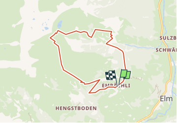
Tour Andere Aktivitäten von 7,3 km verfügbar auf Glarus, Unbekannt, Glarus Süd. Diese Tour wird von jschna vorgeschlagen.
Beschreibung
Der Aufstieg rechts herum ist sehr steil. Die Landschaft sehr schön und interessant. Auf dem höchsten Punkt ein Pic-Nic (eine halbe Stunde)und dann der Abstieg über das Oberämpachli ist dann nicht mehr so steil, sogar sehr angenehm.
Ort
Land:
Switzerland
Region :
Glarus
Abteilung/Provinz :
Unbekannt
Kommune :
Glarus Süd
Standort:
Unknown
Gehen Sie:(Dec)
Gehen Sie:(UTM)
511813 ; 5196509 (32T) N.
Kommentare
Touren in der Umgebung
![Tour Zu Fuß Glarus Süd - Jetzloch - Pass Pigniu / Pass Vepta - Photo](https://media.geolcdn.com/t/375/260/be4ad3f7-0d57-4e2e-a946-b394947a686d.jpeg&format=jpg&maxdim=2)
![Zu Fuß Zu Fuß](https://static1.geolcdn.com/sitytour/trail-icons/100.png)
Jetzloch - Pass Pigniu / Pass Vepta
Zu Fuß
Einfach
Glarus Süd,
Glarus,
Unbekannt,
Switzerland
![](/images/other/stat-length.png)
5,6 km | 15,9 km-effort
3h 36min
![](https://static1.geolcdn.com/siteimages/upload/files/16400158638029165_repeat_loop_refresh_sync_direction_icon.png)
Nein
![Tour Zu Fuß Glarus Süd - Skihütte Erbs - Leglerhütte SAC - Photo](https://media.geolcdn.com/t/375/260/d039e266-2fae-4323-85e2-7bcb014ef4f0.jpeg&format=jpg&maxdim=2)
![Zu Fuß Zu Fuß](https://static1.geolcdn.com/sitytour/trail-icons/100.png)
Skihütte Erbs - Leglerhütte SAC
Zu Fuß
Einfach
Glarus Süd,
Glarus,
Unbekannt,
Switzerland
![](/images/other/stat-length.png)
5,3 km | 16 km-effort
3h 38min
![](https://static1.geolcdn.com/siteimages/upload/files/16400158638029165_repeat_loop_refresh_sync_direction_icon.png)
Nein
![Tour Zu Fuß Glarus Süd - Chärpfbrugg Rundweg - Photo](https://media.geolcdn.com/t/375/260/b977a8ca-a0db-47ae-bd1e-286d5679c384.jpeg&format=jpg&maxdim=2)
![Zu Fuß Zu Fuß](https://static1.geolcdn.com/sitytour/trail-icons/100.png)
Chärpfbrugg Rundweg
Zu Fuß
Einfach
Glarus Süd,
Glarus,
Unbekannt,
Switzerland
![](/images/other/stat-length.png)
6,7 km | 11,7 km-effort
2h 40min
![](https://static1.geolcdn.com/siteimages/upload/files/16400158638029165_repeat_loop_refresh_sync_direction_icon.png)
Ja
![Tour Zu Fuß Glarus Süd - Schwändi - Matt Station - Photo](https://media.geolcdn.com/t/375/260/5a2d3e2e-f585-40dd-b109-4a5e794e4a8c.jpeg&format=jpg&maxdim=2)
![Zu Fuß Zu Fuß](https://static1.geolcdn.com/sitytour/trail-icons/100.png)
Schwändi - Matt Station
Zu Fuß
Einfach
Glarus Süd,
Glarus,
Unbekannt,
Switzerland
![](/images/other/stat-length.png)
3,4 km | 3,9 km-effort
53min
![](https://static1.geolcdn.com/siteimages/upload/files/16400158638029165_repeat_loop_refresh_sync_direction_icon.png)
Nein
![Tour Wandern Glarus Süd - Auf den Spuren des russischen Feldmarschalls - Photo](https://media.geolcdn.com/t/375/260/ext.jpg?maxdim=2&url=https%3A%2F%2Fstatic1.geolcdn.com%2Fsiteimages%2Fupload%2Ffiles%2F1553511878bg_sport_marche.png)
![Wandern Wandern](https://static1.geolcdn.com/sitytour/trail-icons/101.png)
Auf den Spuren des russischen Feldmarschalls
Wandern
Sehr leicht
Glarus Süd,
Glarus,
Unbekannt,
Switzerland
![](/images/other/stat-length.png)
15,1 km | 19,5 km-effort
5h 56min
![](https://static1.geolcdn.com/siteimages/upload/files/16400158638029165_repeat_loop_refresh_sync_direction_icon.png)
Nein
![Tour Mountainbike Glarus Süd - Bike32871 - Photo](https://media.geolcdn.com/t/375/260/ext.jpg?maxdim=2&url=https%3A%2F%2Fstatic1.geolcdn.com%2Fsiteimages%2Fupload%2Ffiles%2F1524743154velo.jpg)
![Mountainbike Mountainbike](https://static1.geolcdn.com/sitytour/trail-icons/202.png)
Bike32871
Mountainbike
Sehr leicht
Glarus Süd,
Glarus,
Unbekannt,
Switzerland
![](/images/other/stat-length.png)
18,3 km | 30 km-effort
Unbekannt
![](https://static1.geolcdn.com/siteimages/upload/files/16400158638029165_repeat_loop_refresh_sync_direction_icon.png)
Ja
![Tour Wandern Glarus Süd - sf09_e7c - Photo](https://media.geolcdn.com/t/375/260/ext.jpg?maxdim=2&url=https%3A%2F%2Fstatic1.geolcdn.com%2Fsiteimages%2Fupload%2Ffiles%2F1553511878bg_sport_marche.png)
![Wandern Wandern](https://static1.geolcdn.com/sitytour/trail-icons/101.png)
sf09_e7c
Wandern
Sehr leicht
Glarus Süd,
Glarus,
Unbekannt,
Switzerland
![](/images/other/stat-length.png)
9,8 km | 25 km-effort
4h 7min
![](https://static1.geolcdn.com/siteimages/upload/files/16400158638029165_repeat_loop_refresh_sync_direction_icon.png)
Nein
![Tour Wandern Glarus Süd - st_ronald - Photo](https://media.geolcdn.com/t/375/260/ext.jpg?maxdim=2&url=https%3A%2F%2Fstatic1.geolcdn.com%2Fsiteimages%2Fupload%2Ffiles%2F1553511878bg_sport_marche.png)
![Wandern Wandern](https://static1.geolcdn.com/sitytour/trail-icons/101.png)
st_ronald
Wandern
Sehr leicht
Glarus Süd,
Glarus,
Unbekannt,
Switzerland
![](/images/other/stat-length.png)
9,6 km | 25 km-effort
4h 8min
![](https://static1.geolcdn.com/siteimages/upload/files/16400158638029165_repeat_loop_refresh_sync_direction_icon.png)
Nein
![Tour Andere Aktivitäten Glarus Süd - Richetlipass - Photo](https://media.geolcdn.com/t/375/260/ext.jpg?maxdim=2&url=https%3A%2F%2Fstatic1.geolcdn.com%2Fsiteimages%2Fupload%2Ffiles%2F1545311037marcheuse_200dpi.jpg)
![Andere Aktivitäten Andere Aktivitäten](https://static1.geolcdn.com/sitytour/trail-icons/900.png)
Richetlipass
Andere Aktivitäten
Sehr leicht
Glarus Süd,
Glarus,
Unbekannt,
Switzerland
![](/images/other/stat-length.png)
18,2 km | 35 km-effort
Unbekannt
![](https://static1.geolcdn.com/siteimages/upload/files/16400158638029165_repeat_loop_refresh_sync_direction_icon.png)
Nein